Quick Stats
Dates: September 15-22, 2007
Starting Point: Reno, Nevada
Ending Point: Denver, Colorado
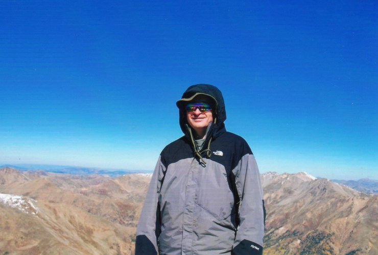
Peaks Ascended: Boundary Peak, Nevada – 13,140’; Humphreys Peak, Arizona – 12,633’; Mount Elbert, Colorado – 14,433’
Miles Driven: 1,744
Travel Partners: None
Hiking Partner: Kathy on Boundary; other peaks solo
Simply put, it turned out to be one of the most enjoyable weeks of hiking I’ve ever had. In fact, since I’ve returned from my week of western highpointing, I’ve characterized it in exactly those terms – “best ever” – to anyone who has been willing to listen. Three outstanding western state highpoints, splendid weather, and a whole lot of time wandering with time for introspection in between. By the time the week ended, I’d significantly increased my experience at altitude, added Boundary (NV), Humphreys (AZ) and Elbert (CO) to my highpointing tally and gotten in some much-needed solitude in the mountains.
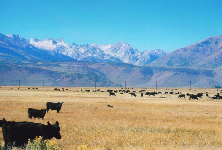
Since I’m guessing most readers don’t give a hoot about my enjoyable drive in the eastern Sierra, the Hot Springs I visited in Benton, California or the fact that I saw the Hoover Dam for the first time in my life, I’ll just stick to the mountain facts. Three days, three mountains, three great hikes/scrambles. And for any of my fellow highpointers who may happen to read this, there will simply be the knowledge of the enjoyment of the wanderings experienced along the way.
Boundary Peak, Nevada – September 17, 2007
This hike came together largely as a result of a Summit Post “Plans and Partners” posting I’d made back in March stating my intentions for this trip. From the start, there seemed to be the most interest in Boundary Peak, Nevada – an officially trailless peak on the California/Nevada border. In the end, Kathy (originally from New York but transplanted to California) became my partner for this hike. Though I’m accustomed to hiking solo, I was pleased to have such a competent partner for what I suspected would be the most difficult of the three state highpoints.
On Sunday, September 16th, Kathy and I arrived at the Queen Canyon Mine within about 15 minutes of each other during the early afternoon. I had come to get in a brief acclimatization hike and scout things out while Kathy had come to camp overnight near the trailhead. We talked about the next day’s hike and finalized our plans to get a 6 AM start. We were also pleasantly surprised to catch a glimpse of some wild horses grazing on the low slopes of Boundary.

Upon starting out the next morning, the weather couldn’t have been better. Crisp but not cold, cloudless skies and virtually no wind. We fell into a steady pace from the unofficial Queen Canyon Mine trailhead with me hiking a couple of minutes ahead of Kathy but trying to keep my pace in check. My experience at altitude was minimal and I was taking Diamox to help with my ascent from sea level to over 13,000 feet in the span of about 40 hours. Overall, I felt good and – as it turned out – I would experience no signs of AMS (acute mountain sickness) all week long. We reached the main saddle, where the route merges with the Trail Canyon Route, in good time and scouted out the “trail” and route above.
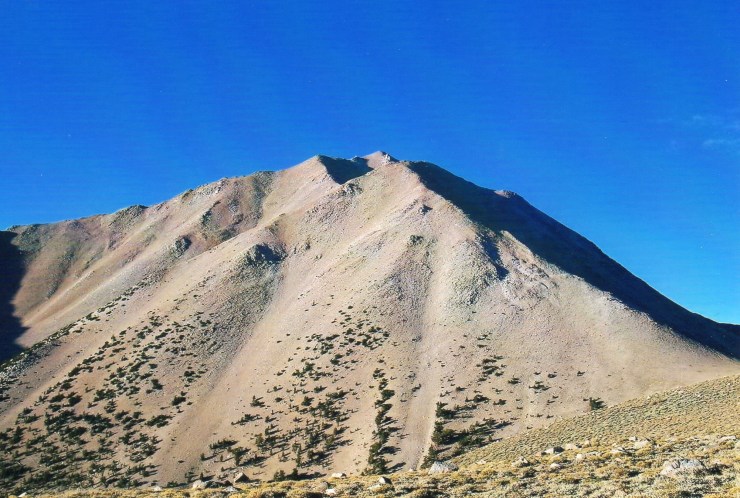
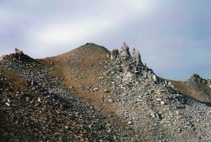
The main use path seemed to head straight for the heart of the scree for which Boundary is so well-known. I’d read and been sent private messages about this so I suggested skipping the path and heading “off-trail” straight for the ridge since the route was basically just rocky and a little sandy at this point. Kathy, however, had prior experience on Boundary and assured me that there would be a couple of feint paths that break off the main path to the left and up to the ridge. Within 10 minutes of leaving the saddle, I spotted one such path and headed up the sandy slope. This turned out to be the key to the hike. Within a half an hour, we were hiking just below the top of the ridge on an outstanding use path. We never really got off-route and steadily worked up the mountain, taking turns in the lead.
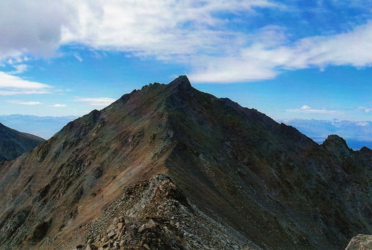
Kathy really set a great, steady pace and I was hesitant to leapfrog past her since I knew it wouldn’t take long to get hiking too fast for my own good. At any rate, we were happily on the summit by about 10:15 AM. We had discussed continuing to the summit of Montgomery (the highpoint of the massif that lies just across the border in California) but in the end called it a day atop Boundary. The descent went quickly and we were back at Kathy’s truck by about 1:15 PM, making it a seven-hour roundtrip. A great day, a great mountain and a great partner. State highpoint #39. On to Arizona.
Blown Away on Humphreys – September 19, 2007
After staying a second night in Benton, California, I spent the day on Tuesday driving uneventfully from Benton to Flagstaff, Arizona, arriving in the late afternoon. Once again, I checked out the main trailhead at the Arizona Snowbowl and had time to get everything in order for another early start the next day.

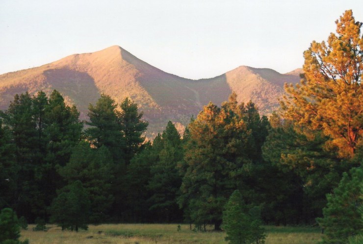
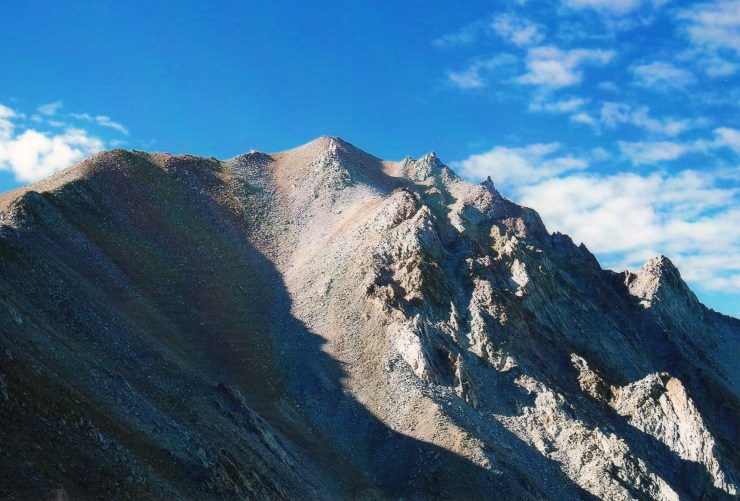
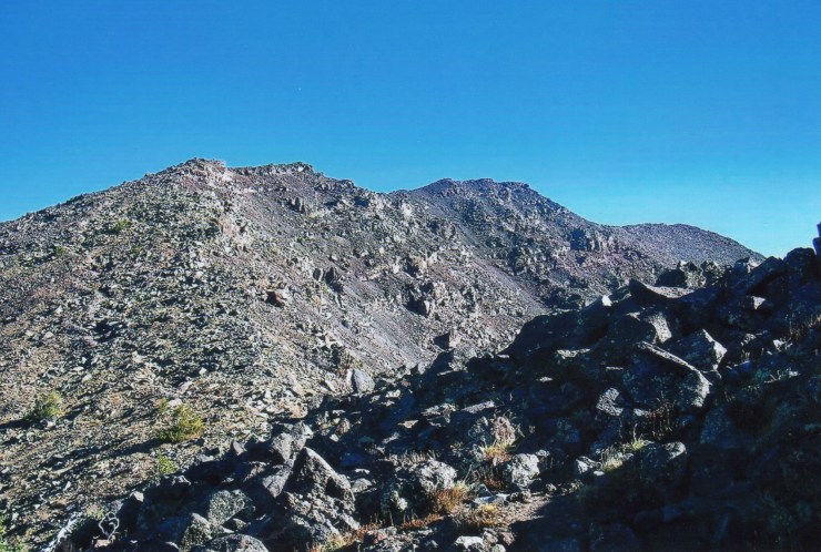
On my way to the trailhead just before dawn on the 19th, I noticed just a few low clouds that seemed to be moving along at quite a fast clip. It didn’t take long for the clouds to clear but the wind that had carried them away turned out to be the story of the day. As I parked at the snowbowl, I watched another solo hiker head into the woods, meaning that I’d probably have to settle for claiming the second summit of the day. Initially, I was amazed at how easy the hike seemed to be. It almost felt like I was home in the Adirondacks … rocks, roots, spruce and a well-groomed trail marked the first couple of thousand feet of gain as the trail worked its way gently through a series of switchbacks.
As I approached the Humphreys/Agassiz saddle, however, the wind started to pick up and by the time I hit the ridge, it was blowing full force. I’m not great at estimating these things, but I’d guess it was at least in the 40-50 MPH range. In any event, the wind was strong enough to turn around the gentleman that I’d seen start on the trail before me. I continued along an awesome ridge hike that steadily gained elevation as I fought off the wind. At times, the ridge itself blocked me from the worst of the wind while at other times, I was exposed to its full blast. Overall, the footing on the trail was good and the wind was manageable as I worked my way over a series of humps. The only real concern I had was that I was occasionally getting pelted in the face by small, loose stones picked up by the strong gusts (Note to self: Keep glasses on. It’s all fun and games until someone loses an eye.)

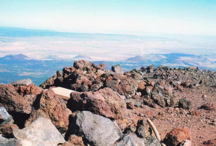
At last, the summit came into sight and I’m here to tell you that never in my life have I experienced such fierce winds as I did along the final 100 or so yards to the summit pyramid. It was like something out of Hurricane Central as I was blown around like a rag-doll. Upon reaching the three-sided stone summit shelter, I literally dove into it head-first, arms out in front of me (Superman style). Going down was even worse as the wind blew straight into my face. I couldn’t even stand up at times and made forward progress in four or five step bursts. Like I said, the wind was only this bad for 100 or so yards but it left me with some seriously chapped lips and quite an adrenaline rush. A memorable summit experience, for sure! The rest of the hike out was uneventful. Highpoint #40. On to Colorado.

To the Top of Colorado – September 21, 2007
Being a highpointer, the goal of the game is to simply get to the top. Prior to this hike, I thought about attempting a more difficult route to the summit of Elbert than the standard Northeast Ridge Route, but in the end decided to maximize my chances of reaching the peak. After all, Elbert stands some 1,300 feet higher than I’d ever been and my attempt would be at the end of a long week of hiking and traveling. Why press my luck?
As luck would have it, this was the right decision. As I started down the trail just after 6:30 AM on September 21st, it was obvious that I just didn’t have “it” on this morning. From the first steepish pitch just minutes from the trailhead, my sluggishness was apparent. After dismissing the idea of just turning around to try it the following day, I fell into a slooooow pace. I decided if it took me six hours to cover 4.5 miles, then that’s just how long it would take. I had all day and the forecast was for bright sun. No point in rushing. Besides, I reasoned the slow pace would probably help minimize any chances of AMS. So onward I pressed.

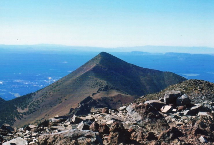
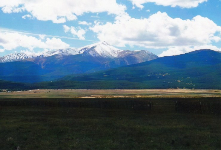
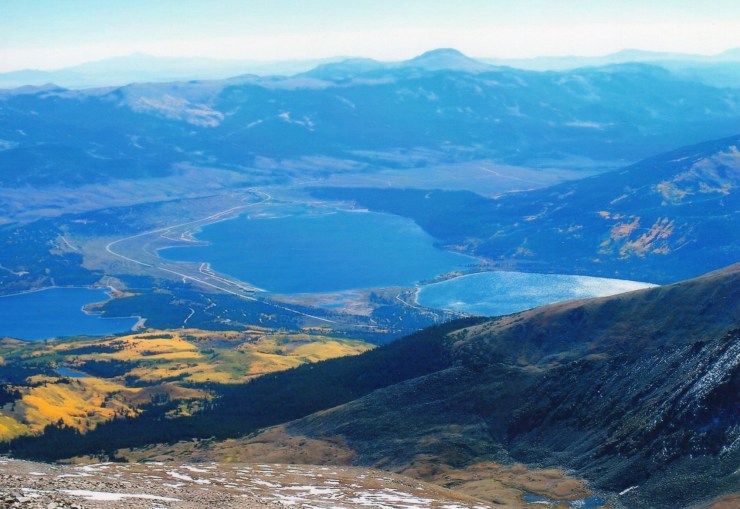
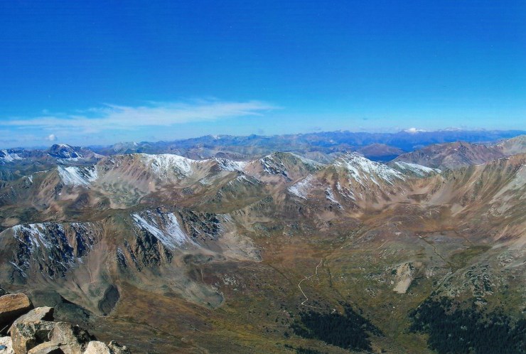
Some incredible scenery opened up as I broke out above tree-line. Mount Massive to the northwest, Twin Lakes far below to the east and just a whole sea of great Colorado mountains that felt close enough to touch but yet were just out of reach.


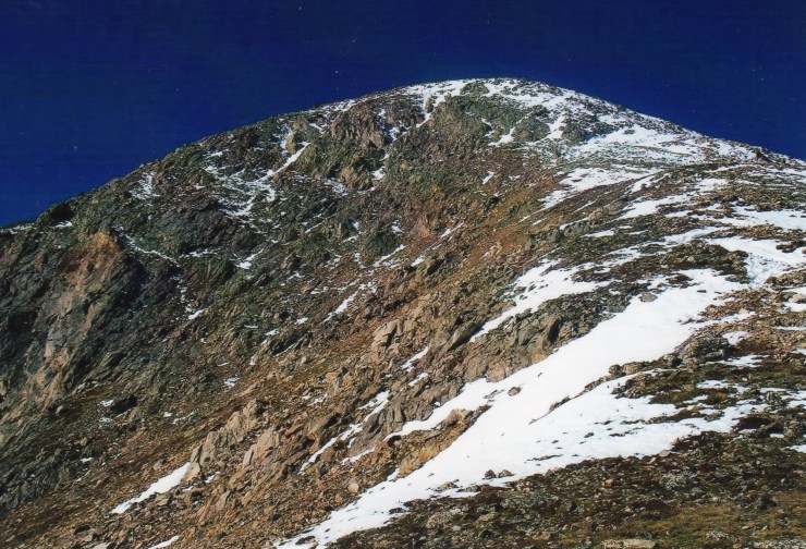
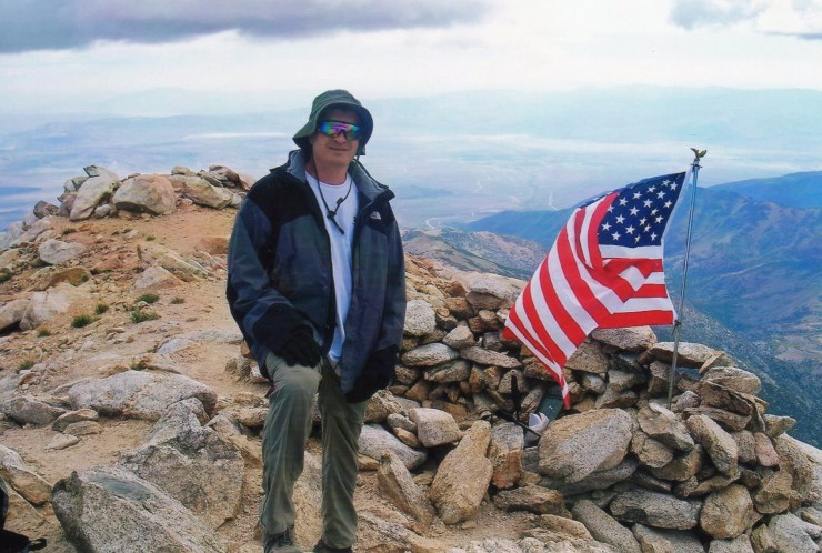
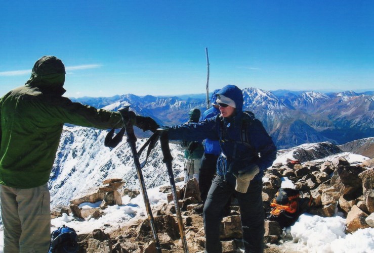
Upwards I moved towards the snow-line on the first of several false summits. Oddly, the higher I went, the better I seemed to feel. My pace didn’t exactly pick up, but I fell into a nice rhythm. The more elevation that I put below me, the more certain I became in my chances of summiting. The false summits fell away one by one and before long I had set a new personal elevation record. And finally, at just about 11 AM – 4.5 hours after starting my hike – I joined a small group of other hikers atop Colorado. We enjoyed some good conversation on the peak and I met another state highpointer who was also standing on his 41st highpoint. What are the chances? A great day all-in-all. Descent went quickly as my hiking poles were very helpful on the hard pack of snow in the upper contours of Elbert. Round trip time was about seven hours.
Conclusion
41 down, 9 to go. Too early to start seriously planning for my 2008 trip. But I am kind of leaning towards Mauna Kea, Hawaii and Mount Whitney, California at this point. My Dad missed this year’s trip and out of my remaining nine highpoints, these are probably the two he’d have the best chance of actually enjoying. I’ll probably start seriously planning in the spring. Until then, back to the Northeast hills …