For many years, one of my favorite sayings has been “the adventure you plan is never the adventure you have.”
Sometimes the reality is close to what you envision and sometimes it is far afield.
As my wife and I found ourselves dashing through Dulles Airport in Washington DC on the morning of April 3rd, 2026 while trying to make a tight connection, this old adage of mine played once again in my mind. If we were to miss our flight to Honolulu, we were probably looking at a full day before we could catch the next plane on our way to our eventual destination … Guam.
Fortunately, our hustle paid off and we arrived at the gate as our next flight was just about halfway through boarding. Bullet successfully dodged. Two long flights and 20 hours later, we arrived uneventfully on the other side of the International Date Line at Guam’s A.B. Won Pat International Airport in the early evening hours of April 4th as we looked forward to spending the next six days on this beautiful United States Territory.
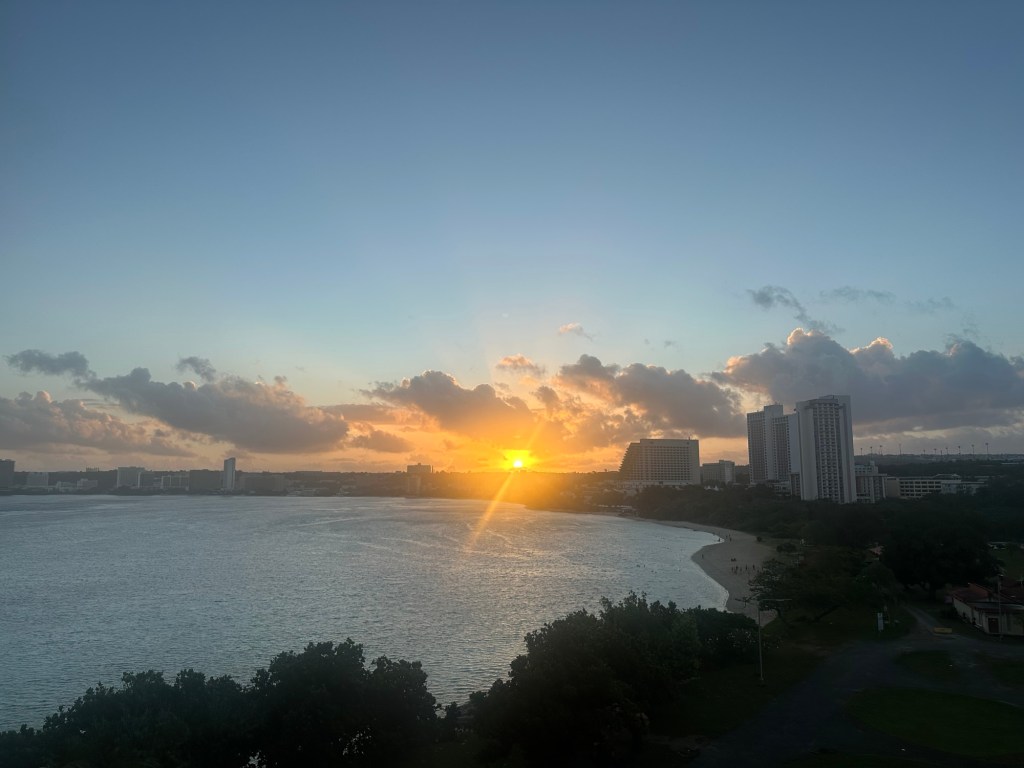
Thoroughly jet-lagged, Laura and I awoke unusually early the next day – Easter Morning – and enjoyed a gorgeous sunrise over Tumon Bay from our perch on the 7th floor of the HIlton Guam Resort and Spa before savoring a hearty “executive” breakfast and heading to Easter Mass at a small nearby Catholic church.
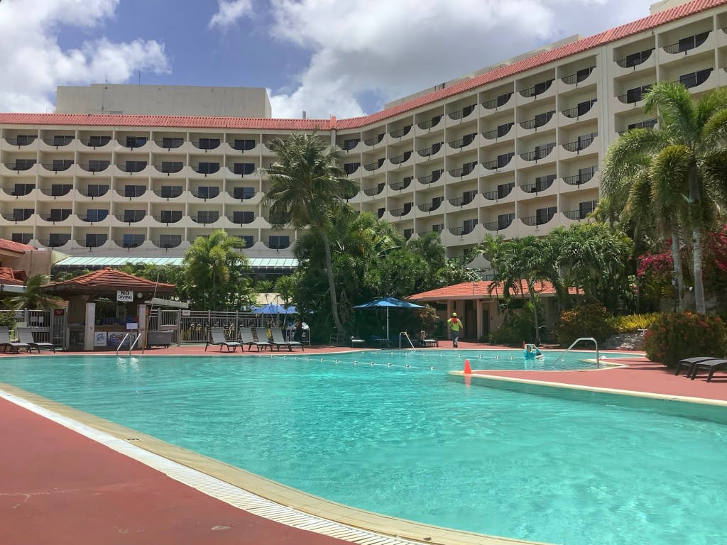
By noon, we had staked out a spot on Hilton’s private beach and soaked in abundant sunshine for the rest of the afternoon as temperatures topped out in the high 80s, a much needed escape at the end of yet another way-too-long Northeast winter. A perfect Day 1.
And now for Round 2 of “the adventure you plan is never the adventure you have.”
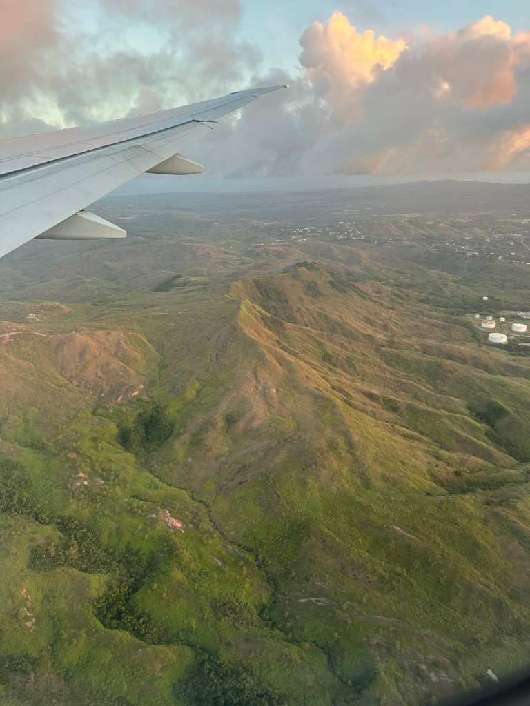
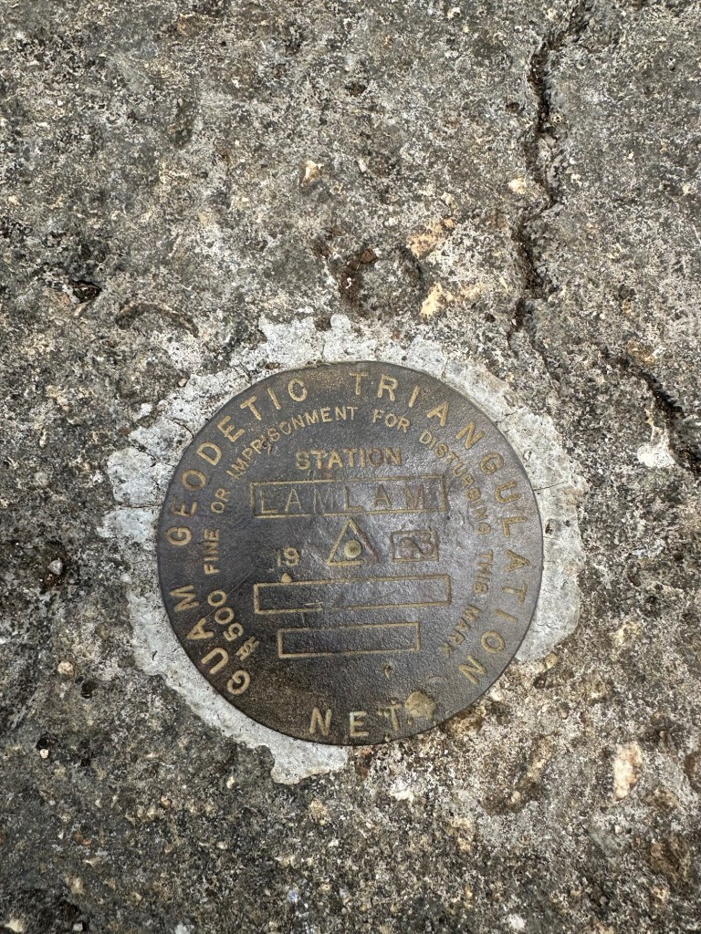
I had done my research. At an elevation of 1,332 feet, Mount Lamlam is the highest point on the US Territory of Guam. In fact, reaching this highpoint was the entire reason for this trip nearly halfway around the globe. If successful, it would be my fourth of six US District and Territorial highpoints to go along with my previous ascents of Point Reno (Washington DC), Cerro de Punta (Puerto Rico) and Crown Mountain (US Virgin Islands).
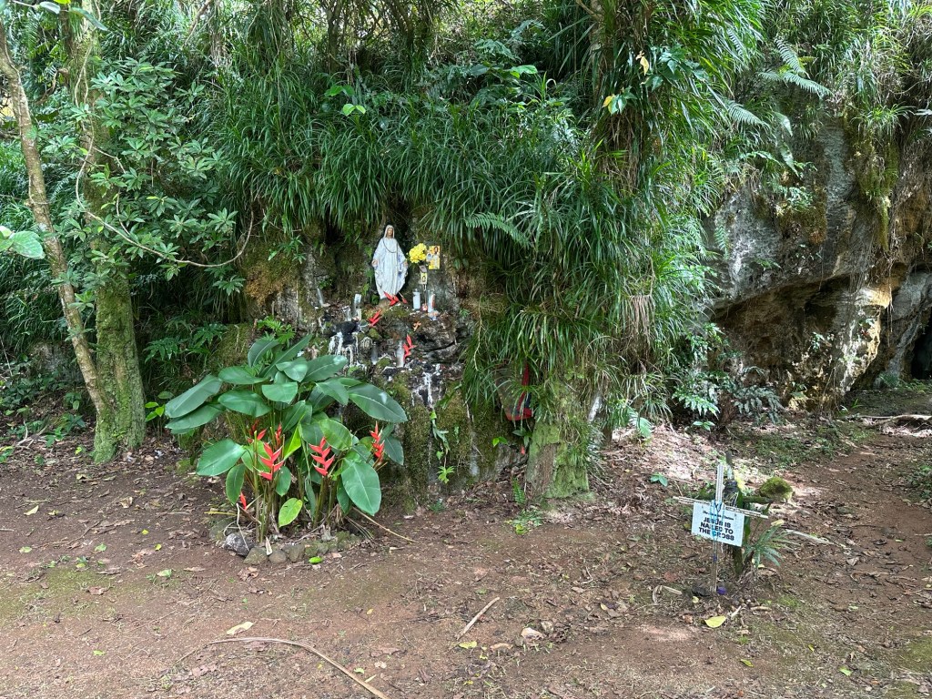
I was expecting about a four hour round-trip hike. From what I had read, the route to the top of Lamlam begins on a wide trail that leads eventually to the summit of Mount Jumulong (Guam’s second highest peak) and is known for its Stations of the Cross and Shrine to Mary. My literature indicated that an unmaintained path branches off the left side of the Jumulong Trail after about a mile and leads to what’s informally known as the flagpole summit of Mount Lamlam, elevation 1,311 feet. From there, I was expecting a tough bushwhack to two higher bumps to the north, the second of which normally gets credit as the true summit of Lamlam.
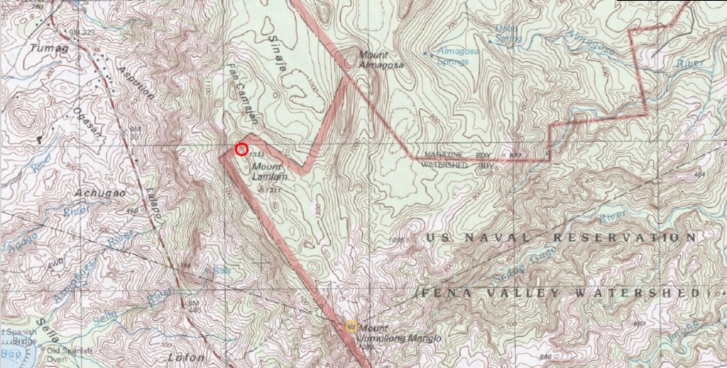
My starting point was to be the Cetti Bay Overlook along Route 2 on the southern part of the island. My wife planned to stay back at the resort in favor of poolside warmth and relaxation. Solid choice.
And this is where it all went wrong for me on the morning of April 6th.
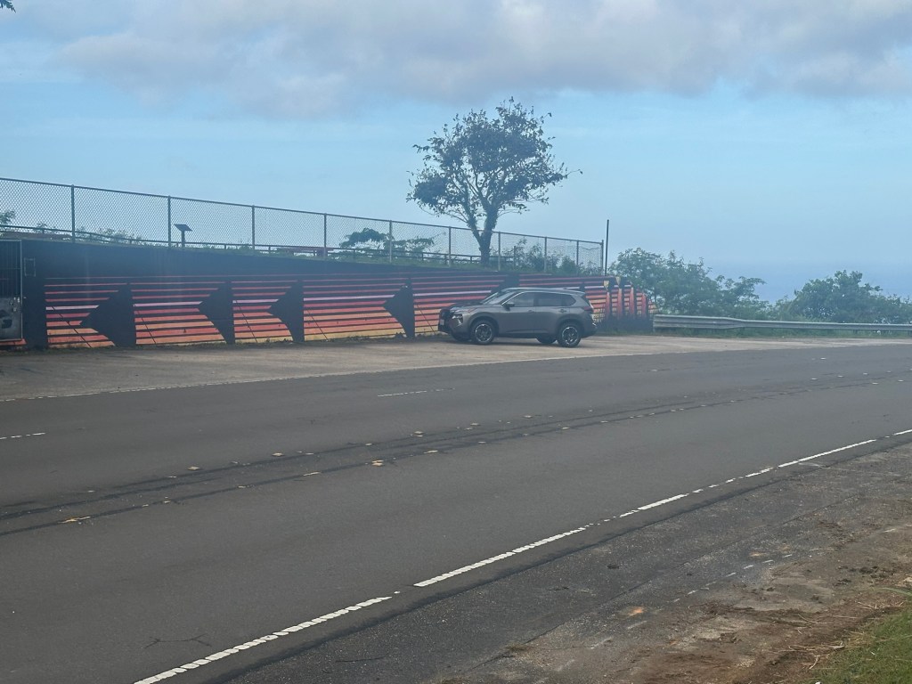
It was the simplest of dumb mistakes. Rather than entering “Cetti Bay Overlook” into my Apple Maps, I entered “Mount Lamlam” and got a result on Route 2 with a note indicating that I would have to park and walk from here. Yup, that’s what I want. I happily pulled into the parking area on the right side of the road at just about 7:30 AM and excitedly gazed at the mountains rising steeply just across the street.
I donned my backpack and crossed Route 2 to find the start of the unmarked trail. Hmmm. Nothing jumped out at me as the obvious start of the trail. I walked the road back and forth a bit and began to question everything I thought I knew. Maybe the trail had fallen into disuse and become quickly overgrown. My main source of information was an 11-year-old trip report. I’d read it about 12 times and carried a printout in my backpack. Did I screw this whole thing up?
The only real suspect I observed was a Jeep trail that quickly petered out into an overgrown field of sawgrass. I tried to push through, thinking maybe the trail would pick up again. No such luck. After 20-30 minutes of futility, I spied a ridge with short grass to my left and worked my way over to it. The ridge was steeper than anything I’d read about but the summit it was leading towards rose higher than everything else in my field of vision. I climbed the ridge probably 40 percent of the way up to the obvious peak, expending no small amount of energy, but it felt all wrong. The terrain started to steepen from class 2 to class 3 and led towards a precipitous 200 foot cliff that left no room for error. No, I deduced, this can’t be the way. It doesn’t make sense. And back to the road I returned.
One more try, I decided, before I would throw up my hands in defeat. I spied an area of slash on the far side of a roadside trench. Perhaps a storm or roadwork had somehow obscured the start of the trail. There appeared to be a sunny clearing on the other side of the slash so I worked over to it and found a bit of a height of land and scanned slowly from left to right and right to left for anything that could be a trail. Nothing.
Sweaty and thoroughly beaten, I sat down and grabbed my phone. There was just enough of a signal to pull up the internet and do some trailside research. My confusion only deepened as I found multiple reports within the last two years of folks heading up the wide Jumulong Trail.
And then I saw a link to a youtube video. What the heck, I thought, I have nothing to lose. So I started to watch the 15 minute video where a bearded man very calmly showed himself starting down an obvious trail wide enough for a car before swinging the camera back around to the parking area.
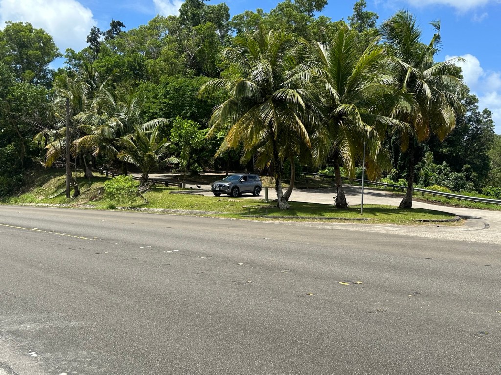
Well, damn, that’s not where I’m parked and I instantly knew exactly how I’d screwed it up. I quickly confirmed that the Cetti Bay Overlook is located exactly 9/10 of a mile further south along Route 2 than where I had parked two full hours ago … the Bakanan Senya Overlook. Wrong overlook. Whoops! The irony of having traveled 8,000 miles from home only to start my hike less than a mile too soon was not lost on me.
A few quick minutes later, I parked once again, this time at the correct parking area and immediately spotted the trail across the street. 9:38 AM. No biggie, I reasoned, I still have plenty of time.
By now, it was hot and the sun was getting higher. In addition to the Eskimo effect of having just emerged from six months of Northeast chill, I was within 1,000 miles of the equator and had grabbed my favorite black hiking jersey without even really thinking about the consequences of such a choice.
I started down the trail and soon exchanged pleasantries with a young military-looking family on their way back down from Jumulong. A five year-old-boy asked about my hiking poles.
“What are those for, Mister?”
“Oh, ya know, they help with balance and stuff.”
“Thanks!”
My face felt red and my hair was mop-wet after the effort of my earlier two hours of futility. I’d packed four 32 ounce bottles of orange Gatorade but was already about one and a half bottles deep into my stash.
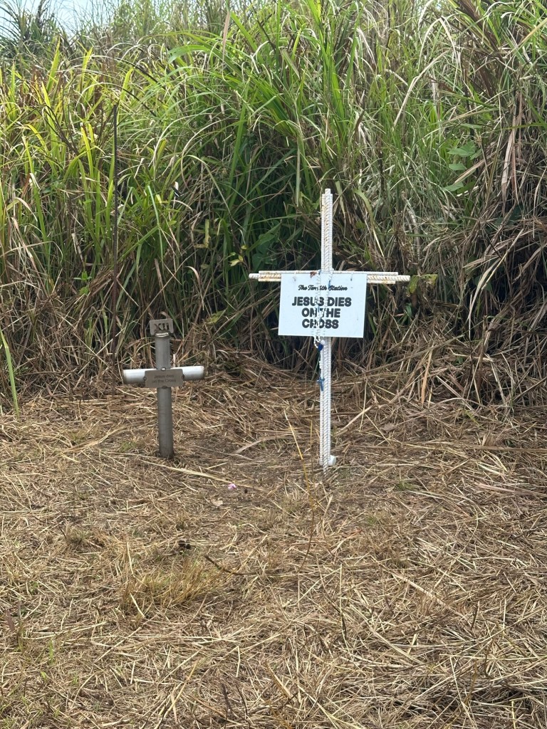
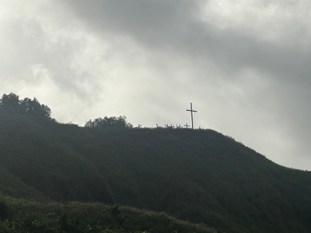
Soon enough, I reached the last of the Christian Stations … “Jesus Dies on the Cross” … and knew this is where my route broke to the left while the Jumulong Trail continued to the right, just a short hike to the very visible crosses atop the Mount Lamlam sub-peak.
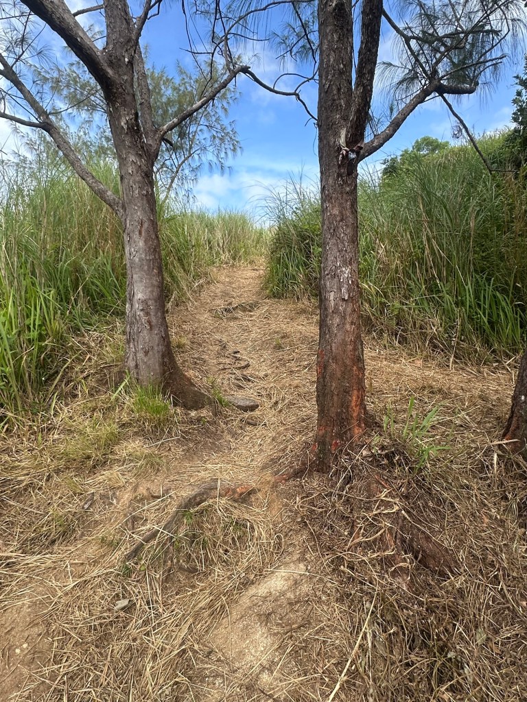
The herd path I followed instantly felt different than the wide trail up to this point and reminded me in some ways of the herd paths of New York’s Adirondack 46 High Peaks from once upon a time as I chased my first list of mountains back in the early-to-mid 90s.
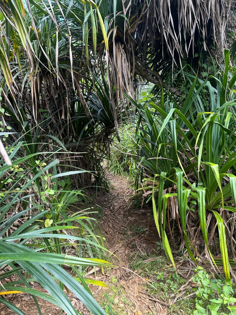
The unofficial narrow path went down a bit, regained the lost elevation and then flattened out with pink and white ribbon flagging letting me know that I was still going the right way. At one point, I veered off on a false path to the right (east) but soon realized and corrected my error.
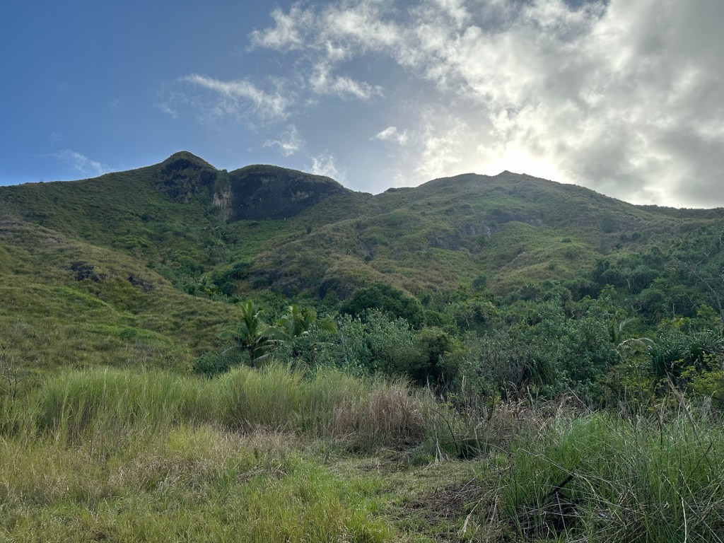
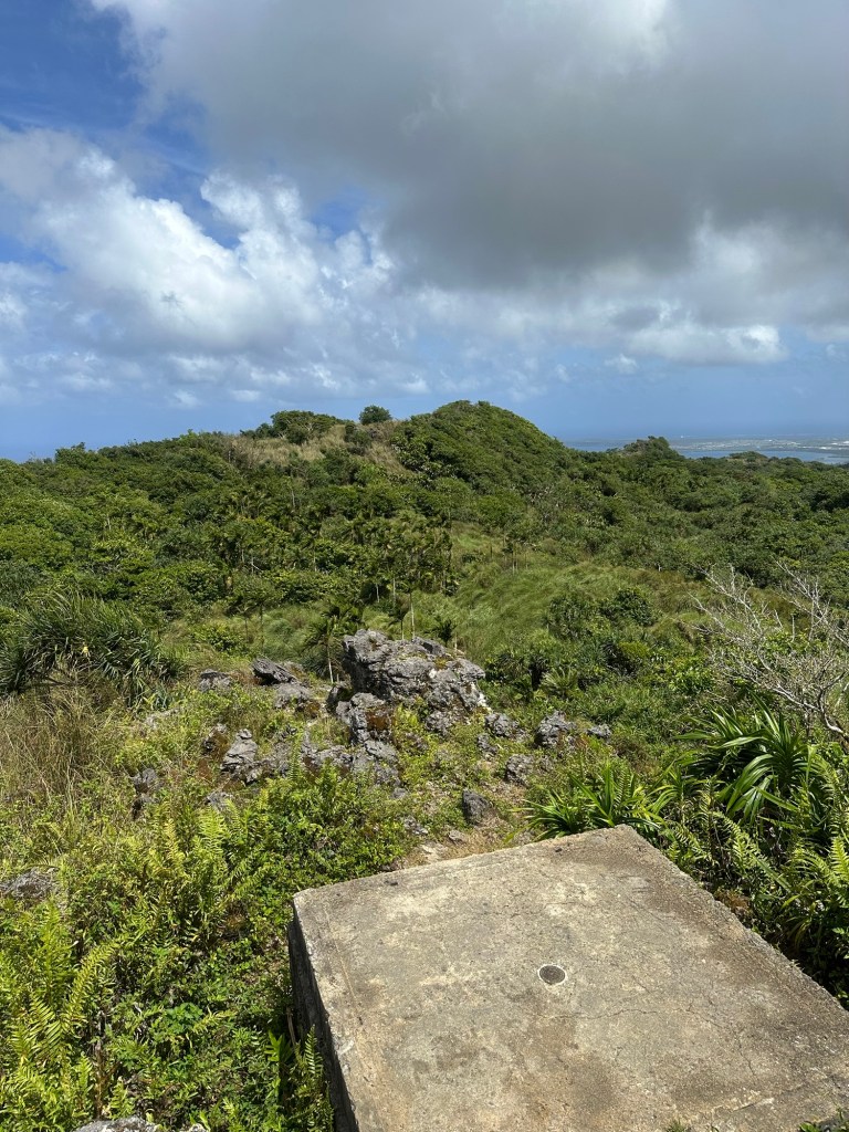
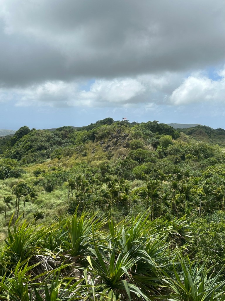
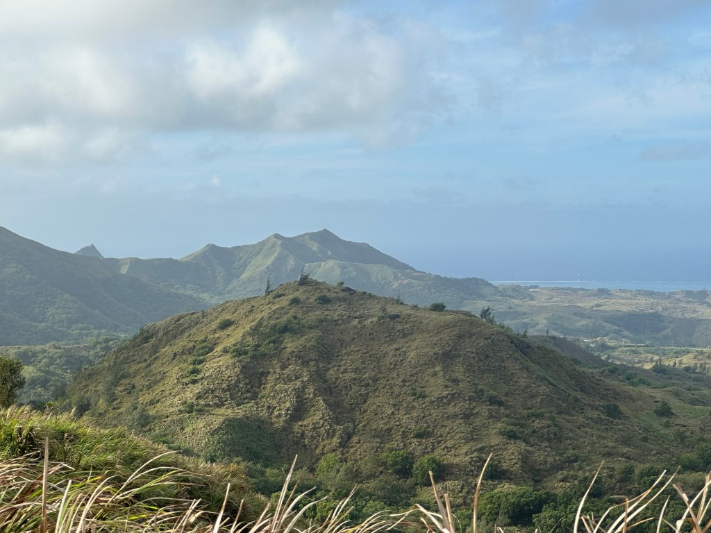
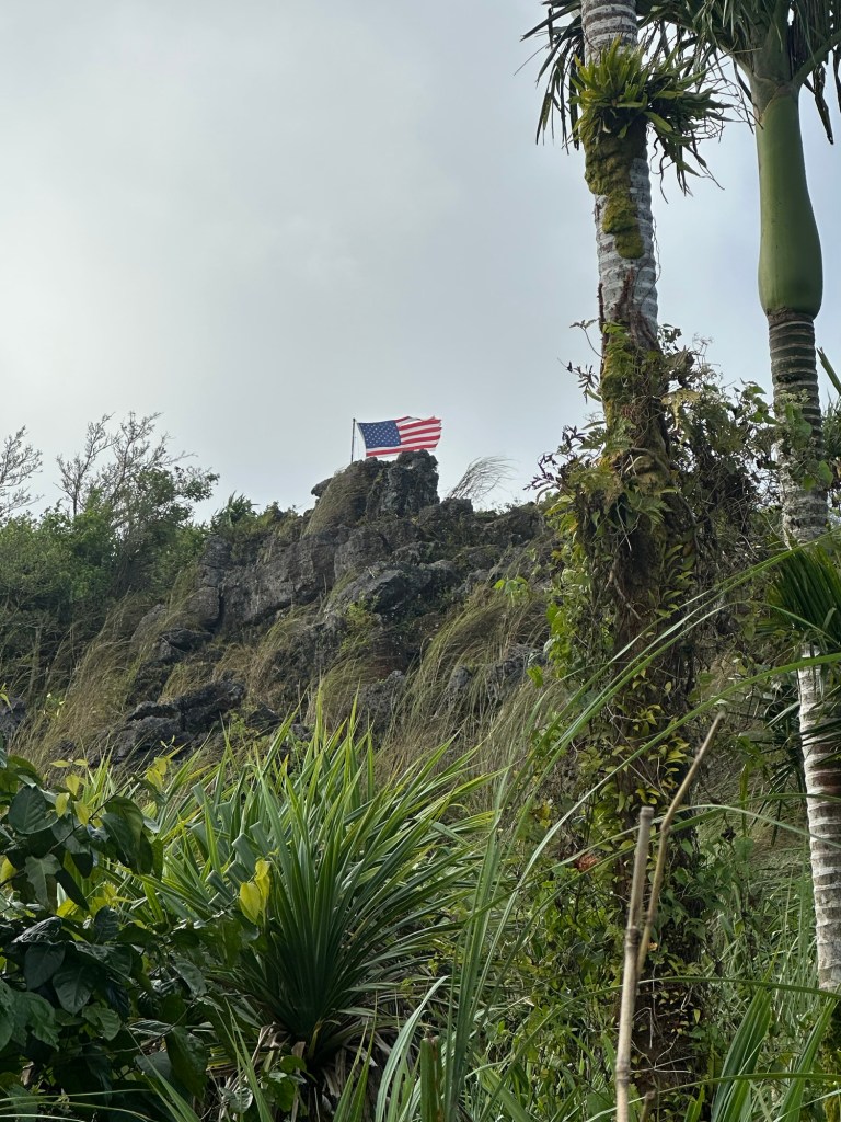
I caught my first glance of the flagpole summit right around 10:20 AM and locked in on the task at hand. Much to my surprise, a tattered and torn Stars and Stripes flew proudly atop the locally-accepted summit of the mountain. Cool to see though it was, I knew the flagpole summit marked just the beginning of the real work involved in reaching the true highpoint of Guam.
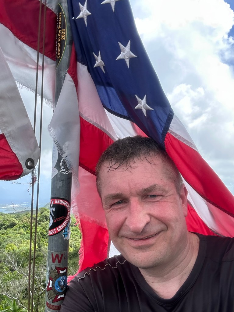
I soon arrived at a point where the class 2 scramble to the flagpole became very apparent. I covered the short distance with little difficulty and started snapping “summit” photos right around 10:40 AM, barely an hour after I’d finally set off down the correct route.
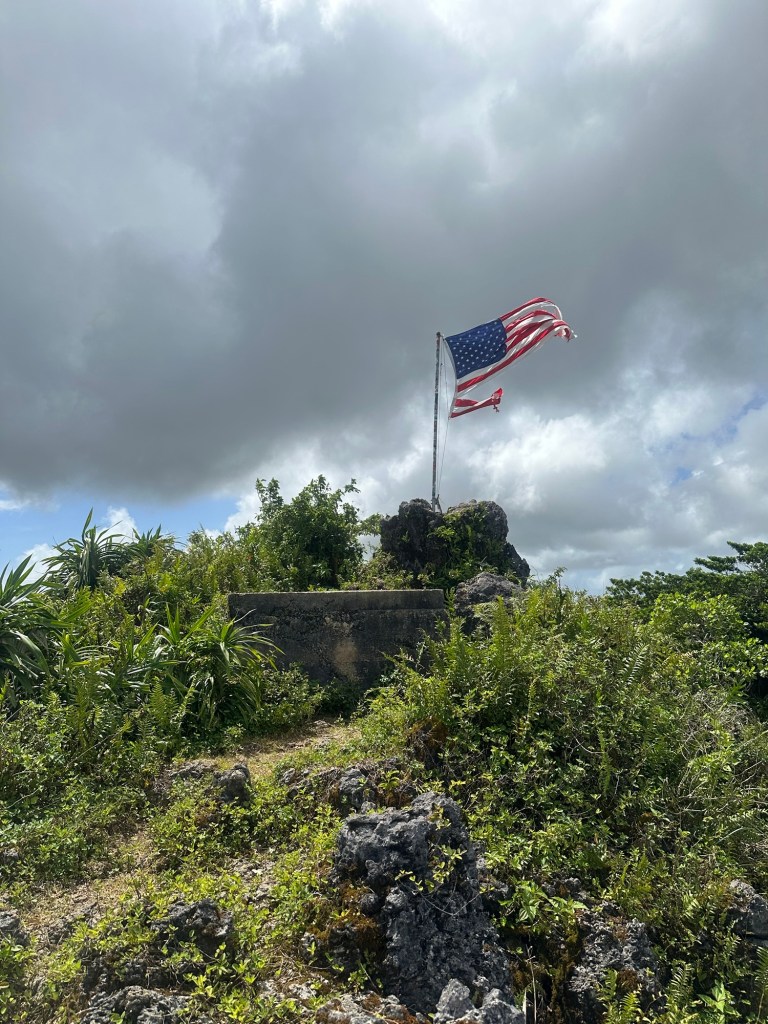
I’m not gonna lie. After a year of planning and then traveling half way around the world, the moment felt real good as the wind blew across my face and this ultimately false summit adorned by both a USGS marker and a whipping American flag.
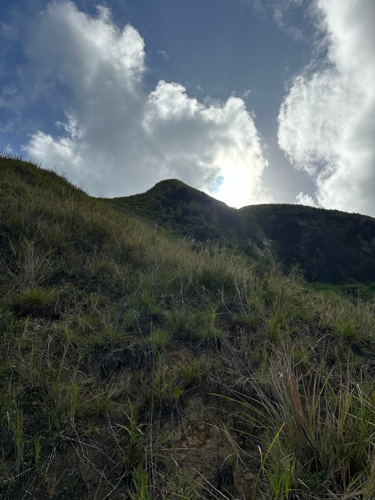
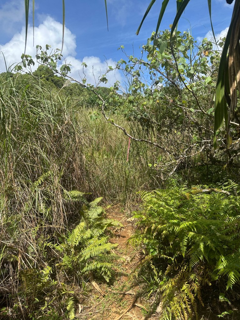
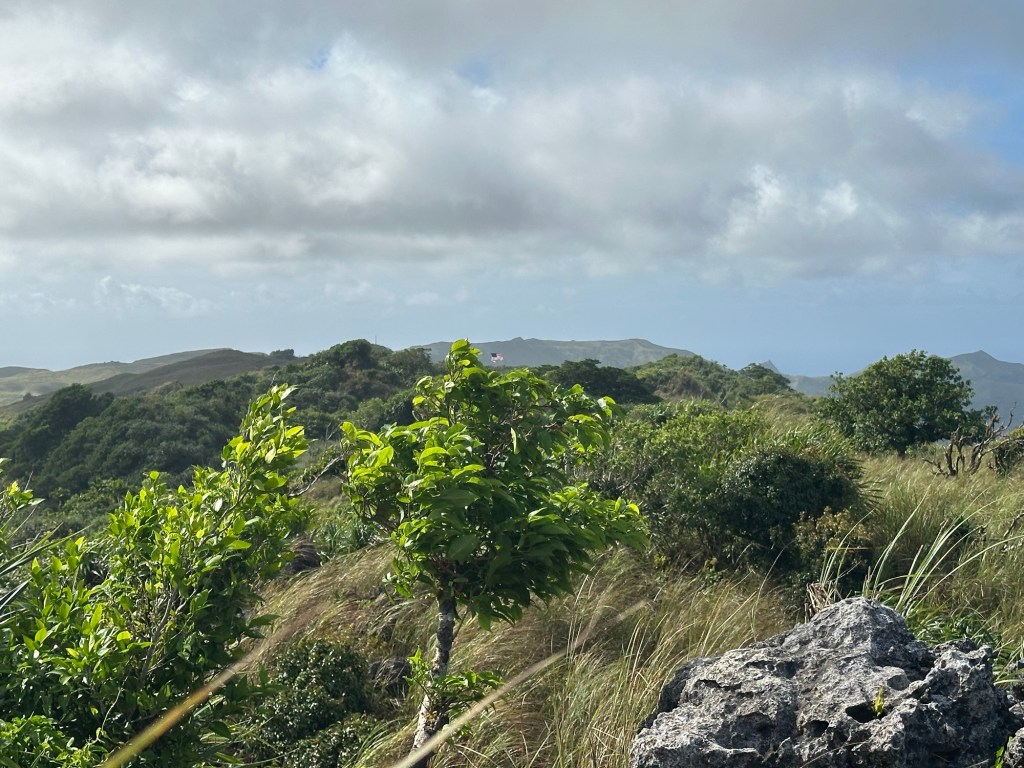
But, of course, I knew. I knew that the true summit of Lamlam layed one gnarly bushwhack and two small bumps to the north (NNW to be exact). I spent a good bit of time visually identifying the next higher bump and studying the terrain for the path of least resistance. I saw a mix of jungle and sawgrass.
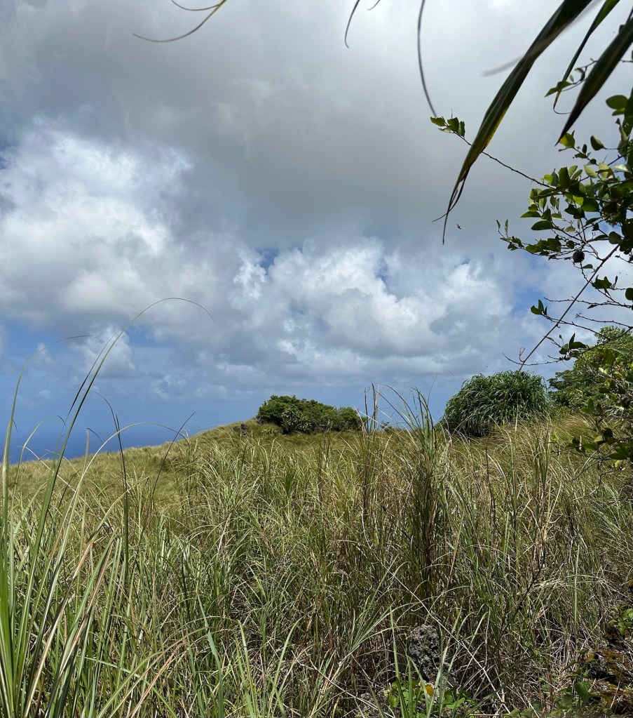
My next decision proved to the killer blow in a series of errors on this 6th day of April, 2026. I made the choice to avoid the uncertainty of the forest in favor of pushing through the sawgrass, which I reasoned would offer better forward visibility. Although rooted in solid logic for Northeastern US peaks, it proved to be the wrong option in this circumstance on this day.
I dropped off the concrete block at the flagpole and hiked back down to the herd path. I then worked my way to the left (west) en route to the first higher bump to the north. The still rising sun heated up my black hiking jersey under the mostly open sky as I consciously avoided the shady cover and potential confusion of the forest. Sensing higher terrain, I then moved back to my right (east) and soon topped out on the first higher bump to the north just 20-25 minutes after leaving the flagpole summit. Cool.
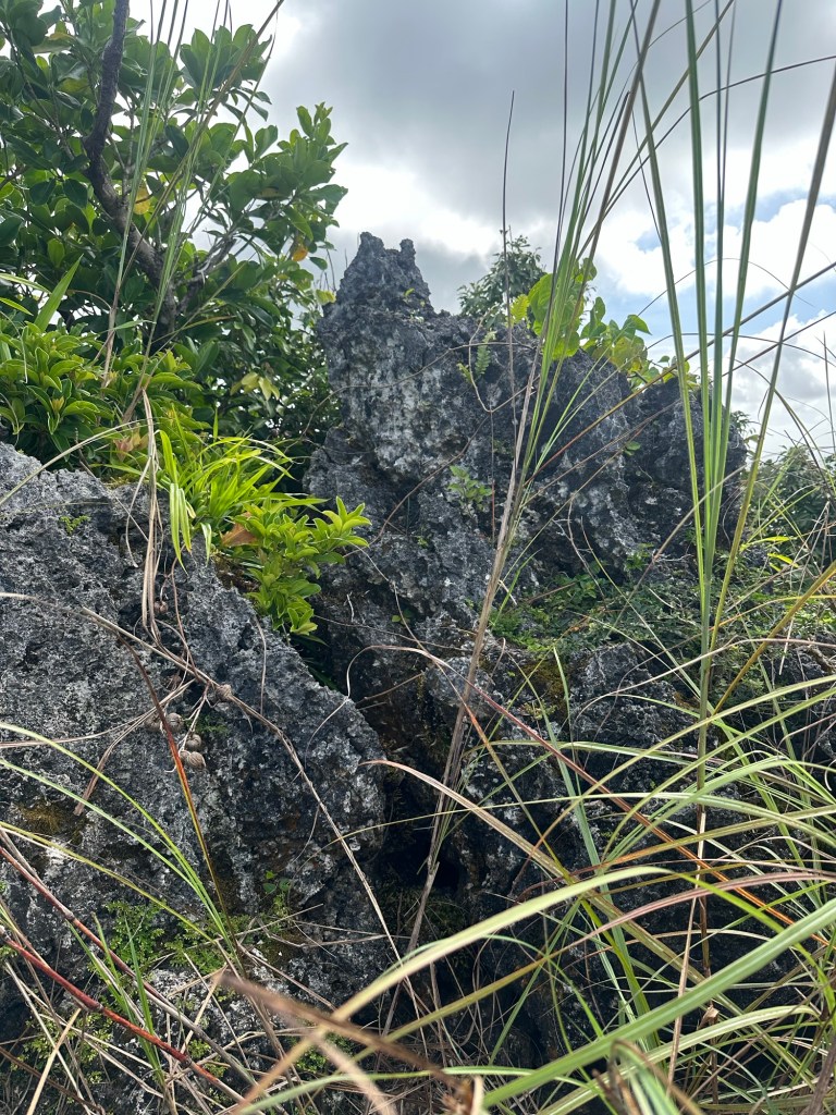
After snapping a few photos, I sensed victory and down-climbed back to the west of the summit ridge. It was here that everything opened up into a massive field of eight foot high sawgrass. In addition, the ground was uneven and I was forced to make careful foot placements as I tiptoed my way through the limestone field. At some point, I managed to make missteps with both feet, bloodying each of my shins. The heat and my building exhaustion became unmanageable and I sought out a rock face for shade and protection from the sun as I reassessed my situation.
I knew I was within 100 yards of my target … the second northern bump and generally accepted true highpoint of Lamlam. But I was knackered … in no small measure due to the wasted two hours at the wrong parking area. My tank was nearly empty and heat exhaustion was becoming a real concern. I really had no emotion as I made the only reasonable choice and turned back.
Getting back to my rental car became a big effort. In my semi-delirium, I lost the herd path badly once, finding myself yet again in a field of impossibly high sawgrass and soon collapsing for a 10 minute break. Once finally back on the trail, I read the words of the Stations of the Cross somewhat differently. “Jesus Falls the Third Time” hit a little harder than it had just a few hours earlier.
Guzzling my last Gatorade as I drove back to our resort, my left thigh seized suddenly into a painful cramp and nearly caused me to drive off the road. Turning back when I did had certainly been the correct call.
By the time I got back to the resort, my brain was back in high gear as I excitedly recalled the day’s misadventure to my wife. I then hit the internet for any helpful hints on navigating to the true highpoint. Multiple accounts mentioned staying to the right of the ridge rather than the left, arguing that the forest on the east side is wide open (although full of spider webs) and much easier to work through than the western sawgrass side. Some also made the point that the first northern bump may actually be higher than the second, meaning that I had potentially already tagged the true highpoint.
Decisions.
I consulted a trusted friend and expert in these matters but he offered no strong opinion on the location of the true summit, only noting that he had hit both bumps during his hike many years ago. After some thought, I reaffirmed my initial instinct to make a second try at the second northern bump. After all, I’d intentionally scheduled enough time on Guam to facilitate multiple attempts if needed.
I joined my wife the following day for a full day of R&R at our resort’s luxurious seaside swimming pools. Or maybe that should be R&R&R … Rehydration, Rest and Relaxation. We explored a bit during the evening, grabbing dinner at a nearby food court and then doing a little light shopping. My key acquisitions were a white long sleeve hiking jersey and a white sun hat.
I was back on the Jumulong Trail by about 7:30 AM on the morning of April 8th and noticed that it seemed just a bit wetter and muddier than two days prior. April 7th had produced some periodic moderate to heavy rainfall events that combined with many bouts of abundant sunshine in somewhat typical tropical fashion.
On this second hike of Lamlam, I was all business and determined not to repeat any of the mistakes from just 48 hours ago. I snapped a photo near the base of the flagpole summit at 8:26 AM, not even an hour since starting my hike. Intermittent clouds and substantially cooler temperatures at this earlier hour kept my internal thermometer at a much more manageable level.
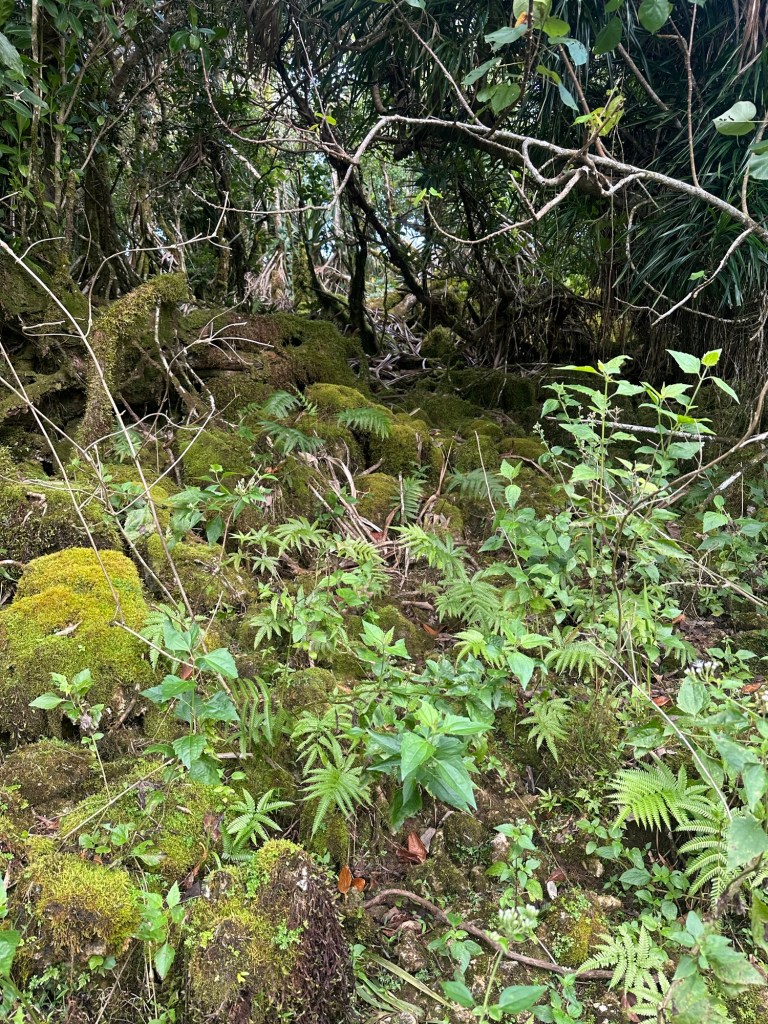
There was no reason for me to re-ascend the flagpole summit so I broke right when I spied a split in the herd path. The left fork led in the direction of the scramble to the Stars and Stripes while the right fork passed through a rock cut and then broke towards the forested left (eastern) side of the summit ridge. One trip report on the hiker -famous “peakbagger” website from the spring of 2024 referred to this area as the “Mossy Rock Spider Forest” and I found this description to be spot on. Although the jungle was mostly wide open, massive spider webs blocked the way in multiple spots. The spiders I saw clinging to these webs were correspondingly gigantic. Check your heeby-jeebys at the door, please.
It took only 11 minutes from the time I took the photo of the flagpole summit for me to reach the first bump to the north at 8:37 AM. I methodically explored this hillock with its true highest point being an obvious bit of limestone just north of center.
And then back into the jungle I went, this time making speedy progress on the eastern side of the ridge. I slowly worked my way back to the left as I moved north and arrived at the base of the summit block at 8:53 AM. My spirits soared as I knew that only a fun rock scramble now separated me from the zenith of Guam.
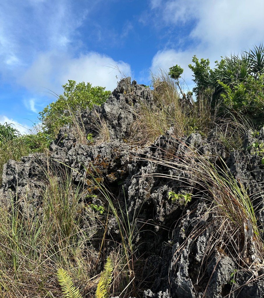
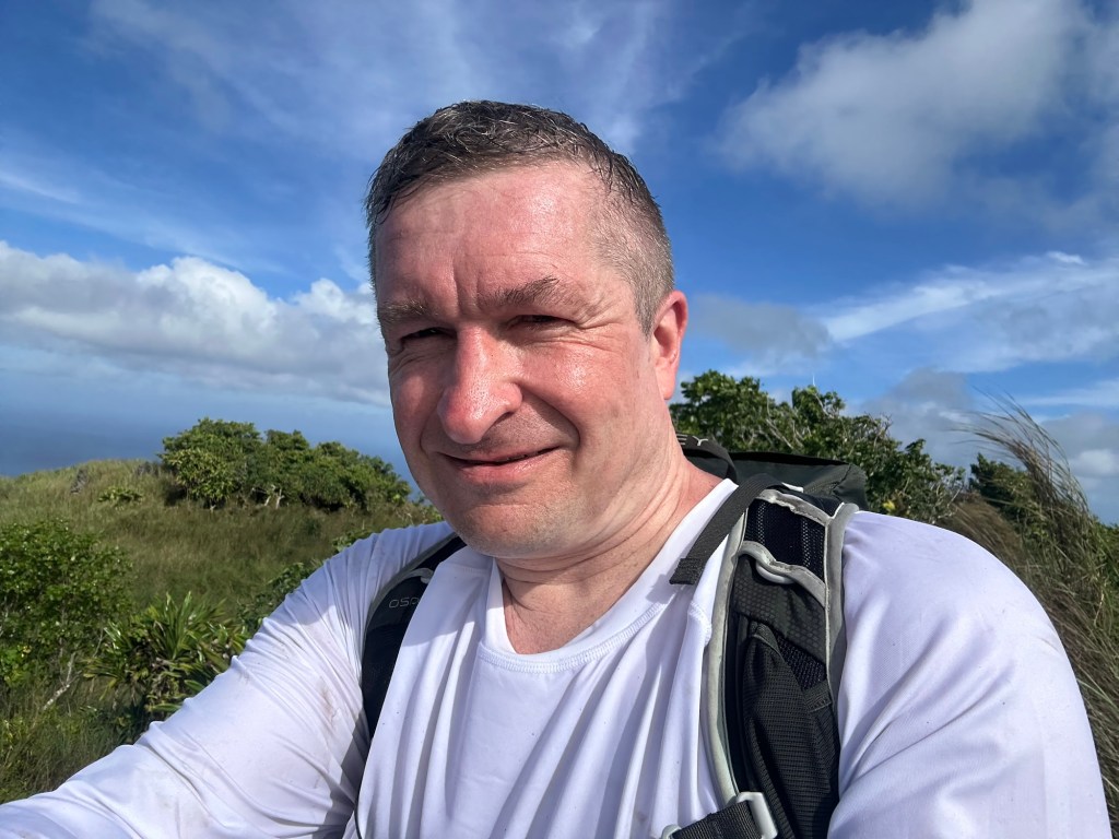
Just a few minutes later, I emerged atop the second bump to the north and snapped a summit selfie … the sawgrass hell of just a couple of days ago partially visible over my right shoulder. While I was certain that my head was now the highest thing in Guam, I carefully inched my way along the 10-15 yards of summit ridge to make sure I touched every last bit of limestone that could qualify as the true tippy top. I saw no summit canister and expended exactly zero energy looking for one. I’m not saying there wasn’t one there but if such a canister exists, it was obscured on this day by the vegetation popping up in every direction through the limestone. I reached the far northern end of the ridge and there was simply no more mountain left to explore.
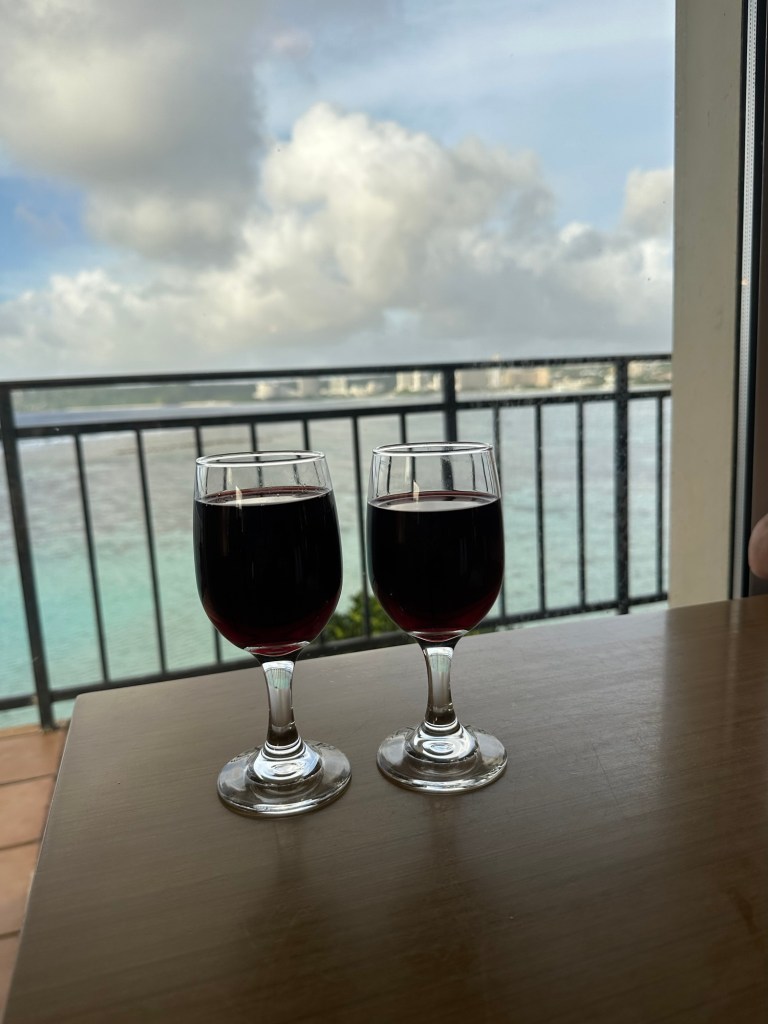
The hike out was largely uneventful. I got a little bit off course between the first northern bump and the flagpole summit but methodically and logically worked it out in about 30 minutes or so. I was back to my rental car by 11:30 AM and returned to the Hilton Guam Resort and Spa with plenty of time left in the day to enjoy a relaxing poolside afternoon with Laura.
Kind of an odd mix of luxury vacation and hardcore hiking, to be sure. But definitely one of my favorite vacations of all-time.
Next up: Lata Mountain, America Samoa. 2027. Stay tuned.

Fantastic adventure. I can picture myself being there as you described it to a tee.
You made the right call, on your first experience. If you continue for that extra 100m, you might off made it,but their again you might not of. If you did would you have made it back to your car ?!
You did the right thing, pushed your limit for that day and lived to return another day.
You gained a vast amount from the first hike and mad you a better man for it. I would call that a win win, situation and by the right call you actually achieved your goal and gained a greater experience from it too.
Well done for the right call, when you could’ve pushed yourself to far.
Thank you, for your adventure and inviting me along with you.
Joe:-)
LikeLiked by 1 person