I had an awareness that I had begun to close to within striking distance of my 400th unique US summit but never really set it as a goal.
I finished 2024 with 393 total peaks including just a pair of new ones for the year. During the first half of 2024, most of my mountain energy had been focused on hosting the State Highpointers Konvention in Rapid City, South Dakota and then later in the year on a Jerimoth Hill, Rhode Island project for the Highpointers Foundation.
And when 2025 started, I was more interested in skiing and yoga than in climbing new Northeast mountains. Killington, Vail, and Warrior 2. That was my vibe.

That changed in April when I visited the US Virgin Islands and claimed five new summits, watching my “Lists of John” US peaks tally jump from 393 to 398 in the process. OK, this is a thing now. Two measly peaks. No problem.
Having been a Northeast peakbagger for 32 years now, it has grown increasingly difficult to find new terrain that captures my imagination. I didn’t want to just pick two random mountains for no other reason than to bump my number to 400.
So what to do?

My most recent list completions were the Northeast 2000 foot prominence peaks (or P2Ks as the cool kids say) and the similar New England Fifty Finest (NEFF). During the years I was working on the NEFF list, I couldn’t help but notice the prominence peaks that just missed the cut. Notably, of the top five that DON’T make the list, three are in nearby Vermont, which quite frankly has become my favored hiking spot over the last 10 years or so. Maine is pretty awesome too, but the mountainous areas are seven hours by car and simply not day trip material.
So to Vermont I decided to go. The 802.

I started the month of May in style with an attempt of Adams Mountain just south of Warren, Vermont. With 1,816 feet of prominence, this 3,214 foot tall mountain is the 51st most prominent peak in New England, missing the NEFF cutoff by just 11 feet. Not only this, but Adams is geographically the closest of the Vermont “near misses” to my home. I arrived at the Plunkton Road starting point right around 8 AM on May 1st and puttered around for 15 or 20 minutes before beginning my hike.
Adams has no trail to the summit but is pretty easy as bushwhack peaks go. I joked with my wife the day before that this was going to be about as adventurous as running out to the convenience store for milk. But still, any day in the mountains is a good day.
I started up an old logging road that still seems to get some use for whatever reason and quickly reached a large clearing with all sorts of metallic junk strewn about. I could clearly see the mass of my target peak directly in front of me with the lower/less prominent Rice Mountain to the left and Adams Mountain to the right. As per my research, I aimed for the col between Rice and Adams, knowing that I would have to work my way right as I gained elevation. So straightforward that my compass would never leave my backpack.
From the clearing, there were a couple of different choices for logging roads to follow and I initially picked the wrong one. After less than 1/10th of a mile, I deduced that this path was pulling me too far left. I returned to the clearing and chose differently. Bingo.
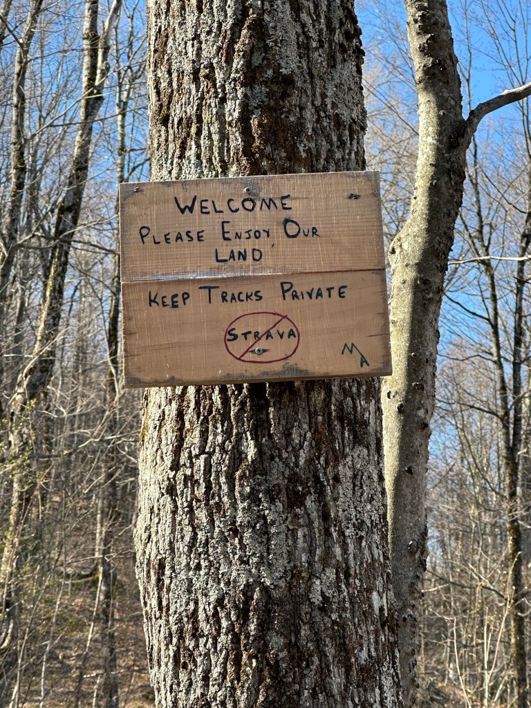
The old logging road continued upwards for several hundred feet in elevation and then crossed onto private property with a sign that welcomed hikers. Although a relatively short hike of less than four miles round trip, I knew this would be a bit of a lung buster from here as there is more than 1,800 feet of elevation gain from the road to the summit. The woods path hooked hard right upon crossing the private property line, meaning that the bushwhack portion of the outing was about to begin.
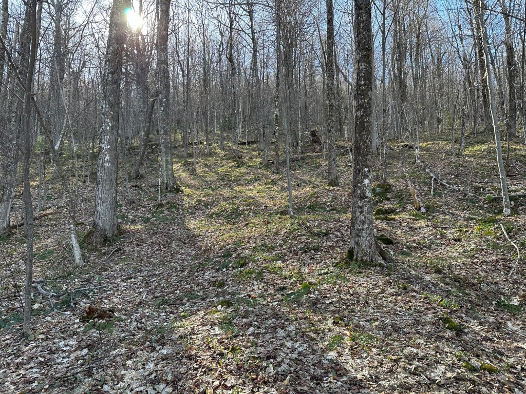
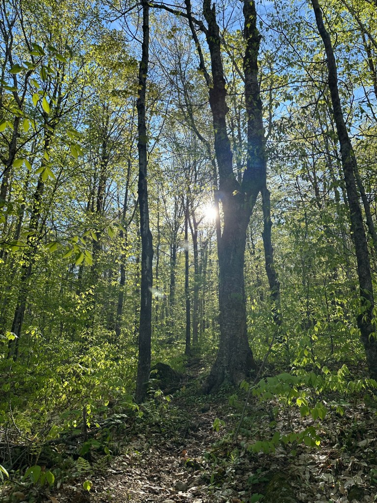
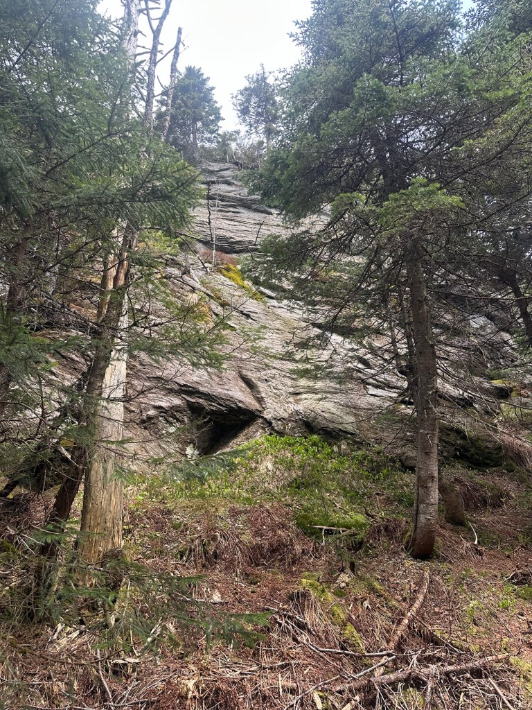
At a point where the logging road begins to level off, I snapped a photo into the woods as 9:08 AM and started the ‘whack part of the hike. I call it a bushwhack but there were in fact no bushes to whack. Being so early in the growing season, the ground cover had not yet filled in and the deciduous forest was wide open. Not a leafy tree to be found. Easy peasy. Now go get that milk.
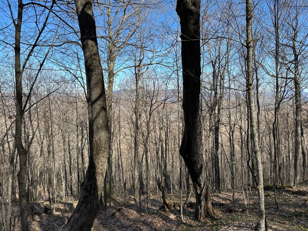
Oddly, as I worked my way uphill, I could see sporadic fresh signs of a cut as if someone had tried to create a wildcat trail to the summit of Adams Mountain. After returning home, I found information indicating that some folks will ski tour Adams in the winter and I had followed the general route of the skin track. Interesting.
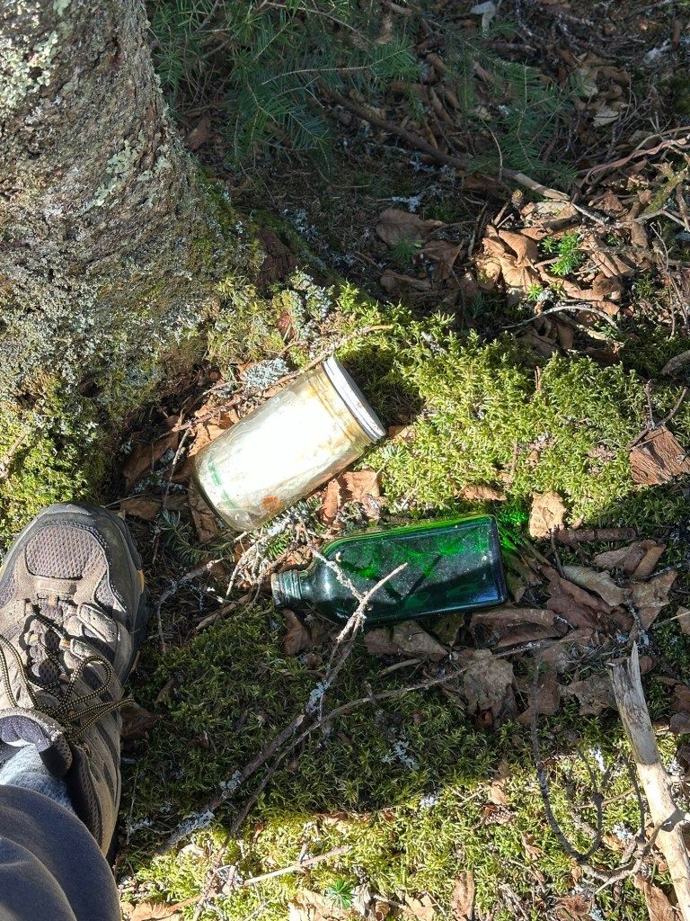
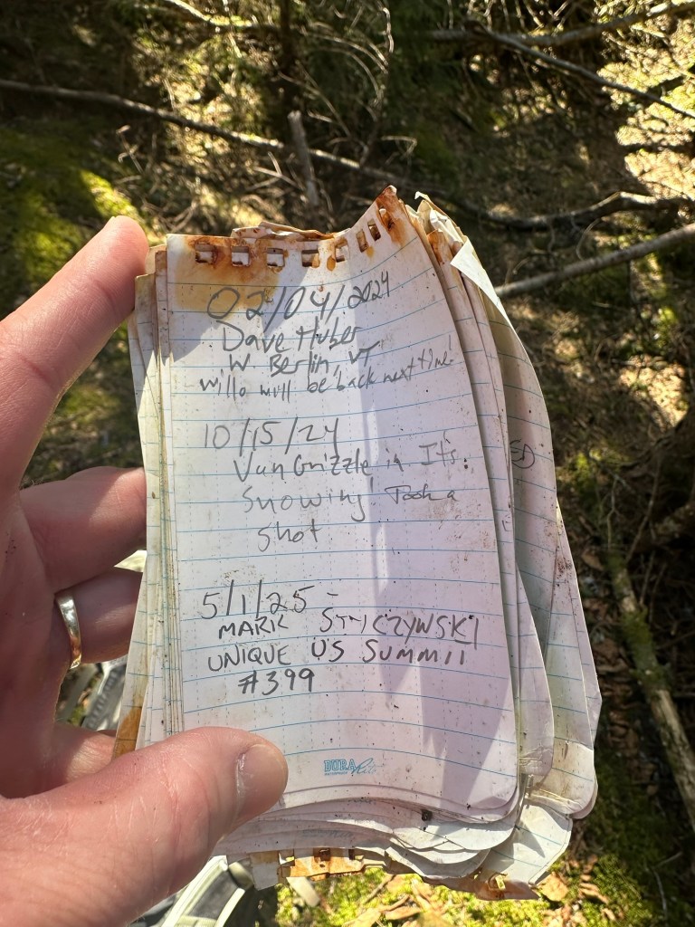
In any event, I reached the summit at 9:45 AM but found no milk. Just a water-logged summit canister and an empty bottle of Jägermeister. Fortunately, the pages of the small notebook are waterproof so I was able to sign through with my #399. Next!
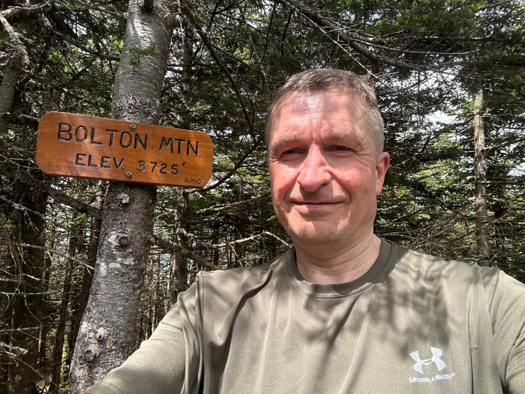
By this point, the 400 peaks thing had become a regular talking point of mine and I was anxious to get it done. I had pre-selected Bolton Mountain near Stowe, Vermont as my target peak. With 1,814 feet of prominence, Bolton rises to 3,725 feet in elevation and is tied with Maine’s East Kennebago (which I summited in 2017) as the 52nd most prominent peak in New England. A very worthy #400.
Although the weather in the Northeast was completely dreadful for most of May, the forecast on the 16th was absolutely stellar and it was a regular day off of work for me. Perfect!
There are multiple ways to ascend Bolton Mountain. While browsing through trip reports on peakbagger.com, I saw that most folks tag Bolton either as part of a Long Trail thru-hike or as a day trip via a network of trails beginning at the Bolton Valley Ski Resort. One report on the internet, however, caught my attention. A 14 mile round trip, 12 of which are on a rugged section of the Long Trail, starting at a connector trail on Notch Road. I always enjoy hiking personally unexplored sections of the Long Trail, so this was a very easy decision for me.
I turned onto Notch Road just a little before 8 AM on May 16th and began looking for the trailhead. The information I had indicated the existence of a small parking lot but no such lot existed and I soon found myself at the “Preston Pond Loop” trailhead with plenty of parking. I knew I had driven about 1/2 of a mile too far north and correctly deduced that the area I wanted was probably back at the signs on each side of the dirt road cautioning hikers not to park in the traveled portion of the road. Even at that, it was still not easy to see the trail as I needed to walk about 50-100 feet up a private driveway before spying the sign indicating the start of the “Duck Brook Trail.”
A friendly and fit young adult male jogger passed by my car as I was getting my pack ready and we exchanged nods. He would prove to be the only person I would see all day.
The Duck Brook Trail definitely fits into the lightly-used category and it’s entirely plausible that I was the first to use it for the spring season. Nonetheless, I covered the aggressive uphill hike to the intersection of the heavily-used Long Trail in less than 30 minutes. The sun hit me from the east and continued to filter through the thin, early-season canopy for much of my hike.
There were many PUDs (“pointless ups and downs” in hiker speak) along this section of the Long Trail just to the south of state highpoint Mount Mansfield. By day’s end, I would log about 3,700 feet of elevation gain and loss, which is a vigorous outing by almost any standard.
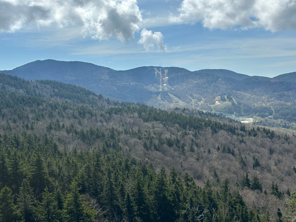
I fell into a zen-like groove for the next 2.5 hours and just soaked in the day, stopping briefly at the Harrington’s View outlook, which provided an outstanding glimpse of the Bolton Valley Ski Resort. A little after 11 AM, I reached the crux of the hike as the moderate but consistent ascent took a turn for the steep. At 11:36 AM, I reached the summit of my 400th unique US peak and made a quick video on my iPhone that I later decided was stupid and decided to delete. A single summit selfie, however, survives.
The hike back to my car was equally pleasant but I was pretty knackered by the time I finished up around 3 PM. My playful text to my wife at 3:18 PM summed up the day perfectly: “I am dead. 😨 Prolly home like 6:30. I hope you have as much fun with your friends as I did not seeing a single person on a 14 mile hike. 🏔️🥾😁”
So I soon decided that just because I had reached my milestone peak #400 was no reason to slow the train down. I had thoroughly enjoyed my two day trips to Vermont and had also decided to take a hiatus from yoga during the outdoors months of the year. Looking again at the just-missed-the-cut peaks from the New England Fifty Finest list, I saw that Blue Mountain, NH (54th) and Bald Mountain, Vermont (55th) are only about an hour from each other and might make for a good two-day excursion.
But I reconsidered. “Almost-made-it” peaks aren’t really a thing for list-baggers like myself and while an interesting curiosity, I didn’t want to marry myself to a sublist of my own creation.
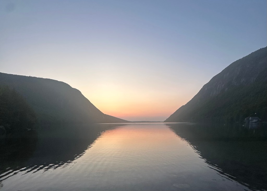
Back in early September 2012, I had stopped through the spectacular Lake Willoughby in the Northeast Kingdom of Vermont on my way back from a New England Hundred Highest peak-bagging trip to Maine. The lake consists of essentially long-since-replaced melted glacial water with steep mountains rising on each side. At the time, I promised myself to one day return to hike to the summits of these cool peaks. Thirteen years later, as I realized I would have to literally drive along the eastern shore of Lake Willoughby to reach the trailhead for the almost-NEFF-prominent Bald Mountain, now seemed like the perfect opportunity to finish old business. Blue Mountain, New Hampshire could wait for another time. Keeping it in the 802.
The wet, cool and dreary March-like weather continued unabated in both New York and New England over the next few weeks until finally an opening. Two perfect weather days – even a tad dry and hot – were forecast for June 4th and 5th before Noah’s Ark type conditions were predicted to roll back in. It was decided. I needed to take a day off from work to make this happen, but it was on.
My alarm clock rang at 3:30 AM on June 4th and within an hour, I was on the road and off to the far-flung Northeast Kingdom of Vermont, a full four-hour drive from my home.
The destination proved equal to the journey as I first took in the full early day beauty and general awesomeness of Lake Willoughby before arriving at the trailhead for my Bald Mountain hike sometime around 8:15 AM, my preferred starting time for a Northeast hike of reasonable length. My “beta” suggested a short four-mile round-trip hike, but I think it was probably closer to five miles by the time it was all said and done.
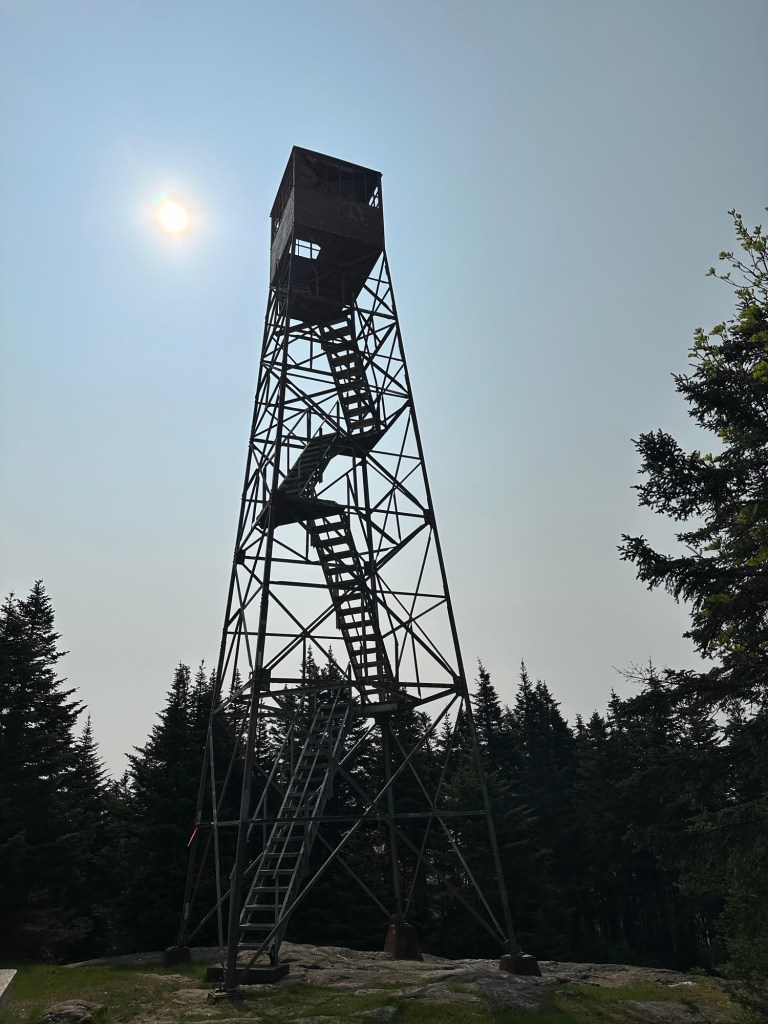
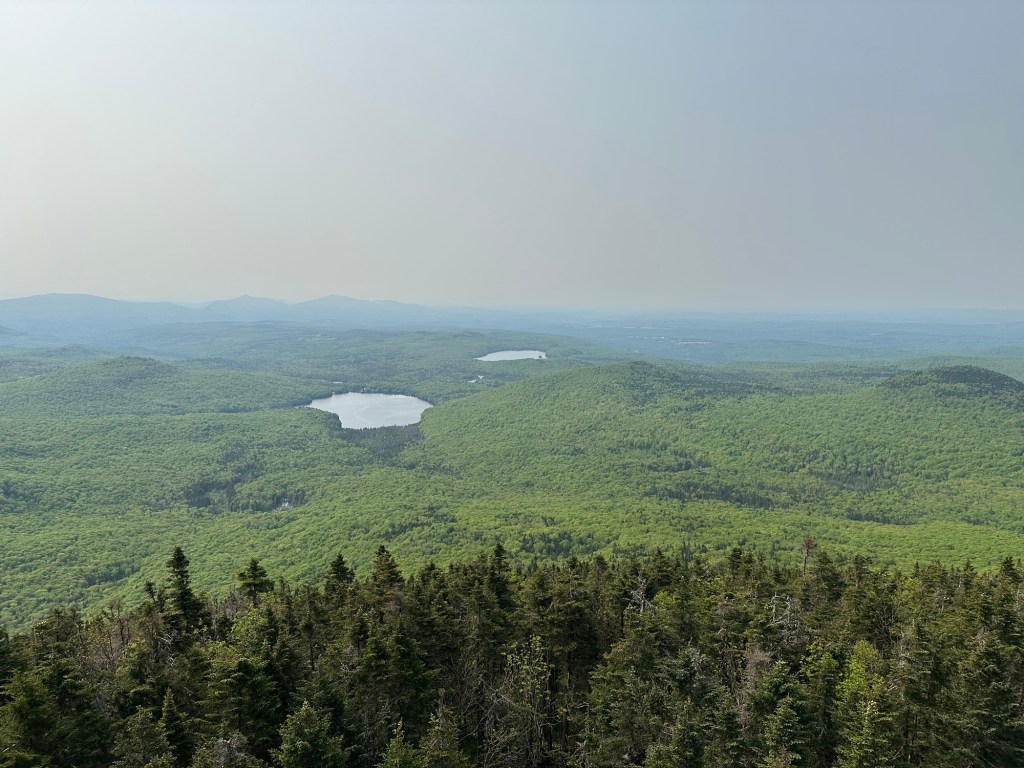
The trail hike remained pleasant and easy on the 3,315-foot tall Bald Mountain, which claims 1,793 feet of clean prominence. Sunny and warm conditions dominated the morning as I worked my way through the contours. I reached the summit at 9:30 AM before then climbing the fire tower, which offers expansive 360-degree views.
My lack of human interaction to this point in the 2025 hiking season continued for a bit after I tagged the summit and was about 15 minutes into my descent before FINALLY … other human beings. I exchanged pleasantries with two retirement-aged men and then completed my descent before heading to the southern shore of Lake Willoughby for what I hoped would be a lazy beach kind of afternoon.
But my trip to the south shore in 2025 proved equally disappointing as my 2012 visit. While I had been endlessly harassed by some dude’s dog 13 years earlier, this time I arrived to a postage-stamp-sized patch of beach with a strange combination of old men and young families competing for towel space. OK, this beach just sucks, I concluded. I set up my camp chair well away from everyone, ate my lunch and got the hell out of there within 30 minutes.
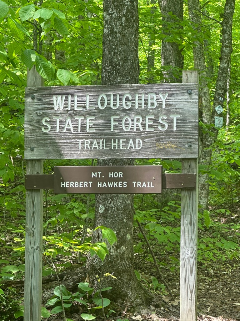
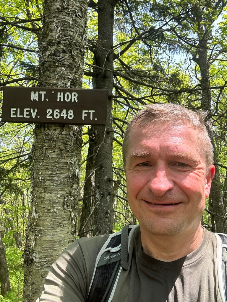
Fortunately, both my planned campground and the trailheads for Mount Hor and Mount Pisgah were just a hop, skip and jump away from my current location. It was too early to check in at the across-the-street campground so I decided to head for the Herbert Hawkes trailhead to Mount Hor, snapping a photo of the trailhead sign on the CCC Road at precisely noon-o-clock.
This would be the easiest of my three hikes, covering the trailhead to summit distance in just a single mile with only about 600 feet elevation gain. A solid choice for a nearly 90 degree afternoon with the effort of the morning hike still paramount in my mind. I encountered some road work on the dirt CCC road and pulled into the small lot, where one other parked car indicated some activity on the trail.
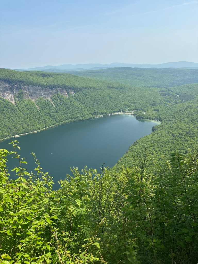
The summit itself was viewless but short excursions in different directions provided fabulous vistas. Three to be exact.
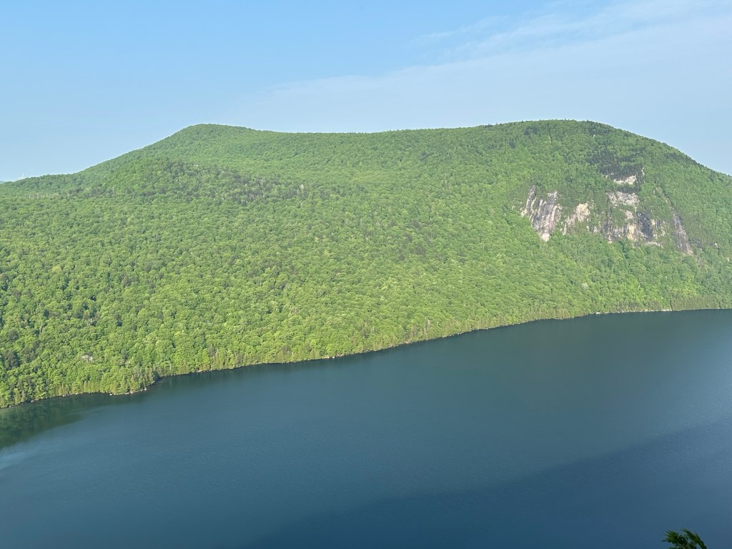
I first scouted out an overlook to a viewpoint of a ridge wind farm to the west before backtracking to fabulous panoramas of Lake Willoughby far below and the stunning cliffs of Mount Pisgah to the east.
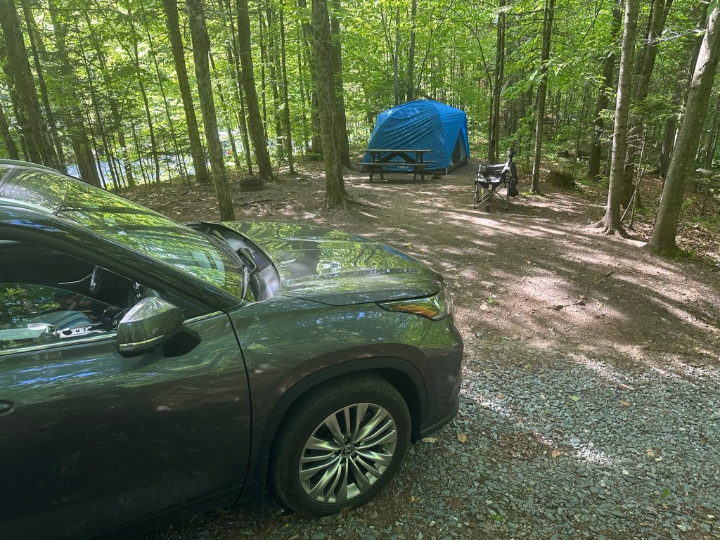
Back at my car by 2:30 PM, it was now late enough to check in at the White Caps Campground, directly across the street from the southern shore of Lake Willoughby. I spent the rest of the afternoon preparing my tent-site, relaxing and enjoying an adult beverage or six. Although I had not rated the beach itself to be much of a worthwhile destination, I found myself repeatedly stretching my legs to check out the magnificent viewpoint that can only be fully appreciated from the southern tip of the lake. By day’s end, my iPhone health tracker had logged 13.6 miles of walking.
After possibly the greatest night’s sleep of my life, my eyes popped open at 6 AM and I felt fully refreshed and ready to hit the trail once again. I took my time in breaking camp before starting the very short drive of less than one mile along Vermont Route 5A to the Mount Pisgah trailhead. Arriving around 7:20 AM, I was the first car in the large lot for the day. Easily the most popular and well-maintained trail I’ve been on thus far in 2025, I at least knew I would be completely by myself during the ascent.
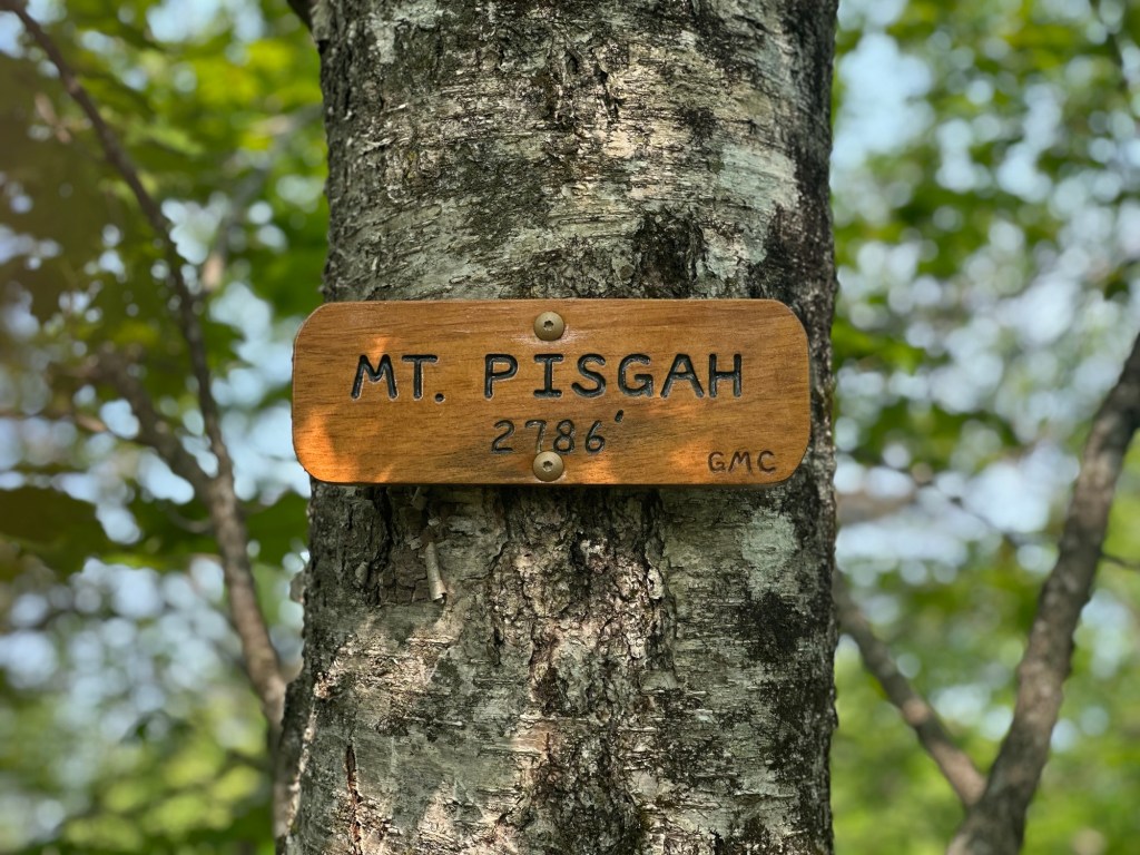
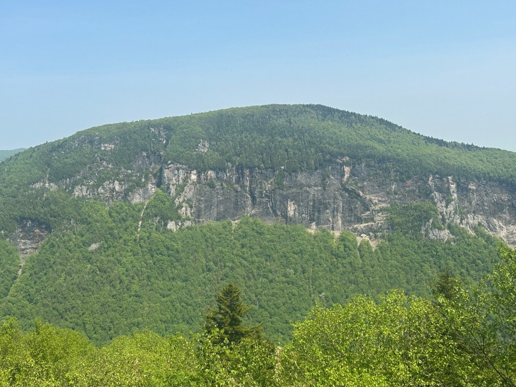
The sign at the main trailhead indicated a hike of just 1.9 miles to the top but like Bald Mountain the day before, it felt just a tiny bit longer. I found the trail construction and maintenance to be absolutely marvelous as I worked my way through about 1,400 feet in elevation gain towards the 2,786 foot summit of Mount Pisgah. Fantastic views that filtered through the early season thin canopy proved to be a wonderful companion as I regularly looked to the west at Lake Willoughby and Mount Hor on the far side of the water.
I snapped a few summit photos at 8:29 AM and spent a good bit of time lingering before starting the descent and long drive home. It had been a very satisfying short getaway with three new peaks added to my Lists of John tally sheet.