It was a little after 4 AM and I had just awoken at the start of our second full day in Hawaii. Waikiki, Honolulu to be exact.
The plan had been to spend six days exploring the island of O’ahu and then fly to Maui for the last three days of our dream family vacation that had been five years in the making.

That was about to change as I received an incredibly alarming text from my wife as I brushed my teeth.
It came in the form of a link to a story from the Weather Channel.
“People Jump Into Sea to Escape Raging Maui Wildfires.”
“Holy shit!” I replied not so artfully.
The entire nation would soon be talking about the terrible loss of life on Maui and the complete destruction of the town of Lahaina, once the proud capital of the kingdom of Hawaii.
By mid-afternoon, we had altered the back end of our vacation and would be staying on O’ahu for the entire trip.
Nobody needed to tell us to stay away from Maui. The decision was easy and obvious.
So with three extra days of O’ahu adventure now on the agenda, my mind turned to where it always does.
The mountains.
Prior to leaving for the trip, I had done some research on Mount Ka’ala, which at 4,026 feet is the highest point on the island of O’ahu as well as the county of Honolulu. But the numbers seemed a little too big for family vacation material. An eight mile round trip with anywhere between 3,500 and 5,000 total feet in elevation gain depending on what source you wanted to believe. And kind of remote.
I had put it out of my mind. Left my hiking boots at home.
But now. Hmmmmmm.
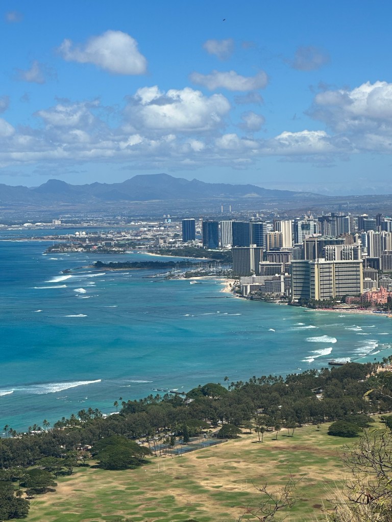
The day after learning of the wildfires on Maui, we enjoyed a fun family hike to the summit of Diamond Head with its spectacular views.
The mountain juices started flowing. Back in 2009, I had hiked to the summit of Mauna Kea, which at 13,803 feet is the highest mountaintop in all of Hawaii. Now was an opportunity to tag another Hawaiian highpoint.
Mount Ka’ala was on. It would be a solo attempt.
A couple of days prior to the hike, I stopped through a Foot Locker and spent $60 on a new pair of New Balance sneakers, knowing that they would get caked in Hawaiian red mud and probably be a total loss.
And on Monday, August 14th, I left the hotel at 5 AM and pointed our rental neon blue Jeep in the direction of the Wai’anae Valley on the west side of the island.

I started snapping photos as I approached the mountain range and pulled into the remote and unmarked parking lot at about 6:15 AM.
I would not be alone on my trek as a group of four fit-looking twenty somethings started their hike just minutes ahead of me. It’s always reassuring to know you’re not completely alone when pushing the limits of what is comfortable. As it would turn out, we all kept about the same pace and would leap-frog each other throughout the morning.
Like the parking lot, the trail was completely unmarked. Nothing to tell you “Mount Ka’ala is this way” and I was happy to have taken screenshots of some very specific directions I had found online. Plenty of places to take a wrong turn back here.

For the first mile and change, the route followed a barricaded paved road, gaining about 900 feet in elevation.
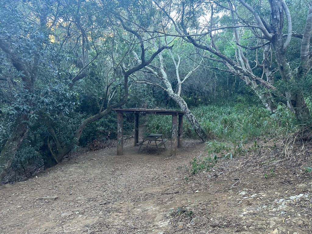
After passing a sheltered picnic table, the trail part of the hike began and I was sure to stay left at a brown and yellow arrowed marker (no other context) at the first key intersection.
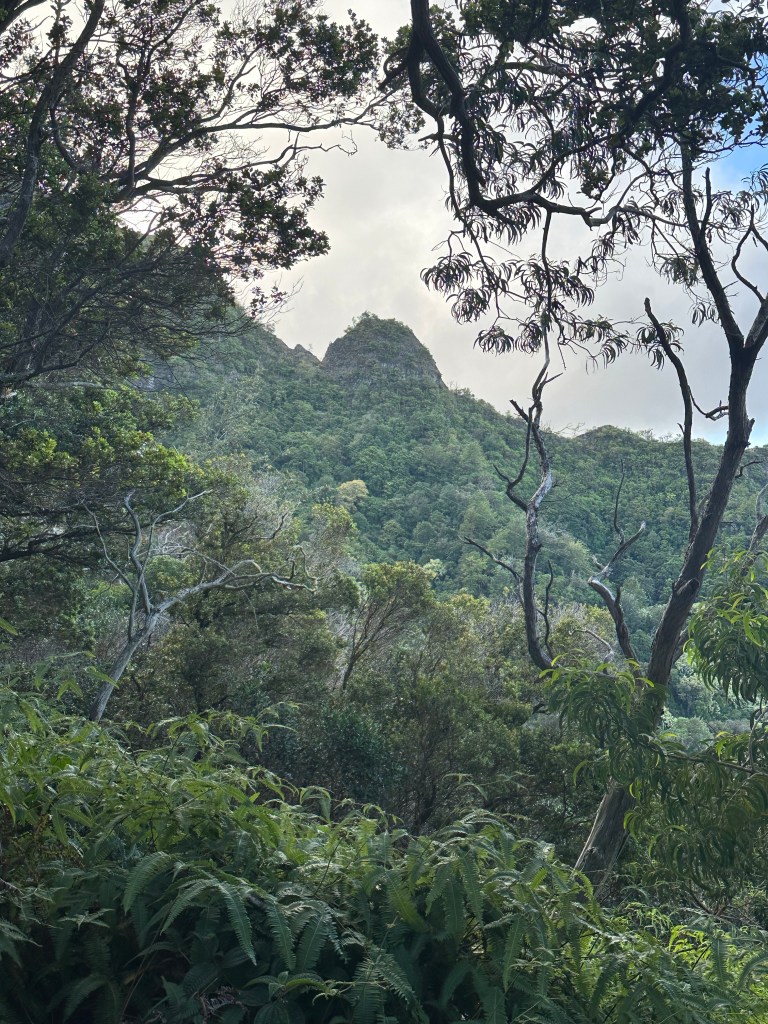
The route got progressively steeper and ropes were available for use in a couple of spots as the trail approached the main ridge and heart of the climb.

Music and voices were within earshot at this point and I knew I was just behind the foursome I had exchanged greetings with back at the trailhead. I decided that if I passed them, I was going to joke that I thought the music was coming from the snack bar.
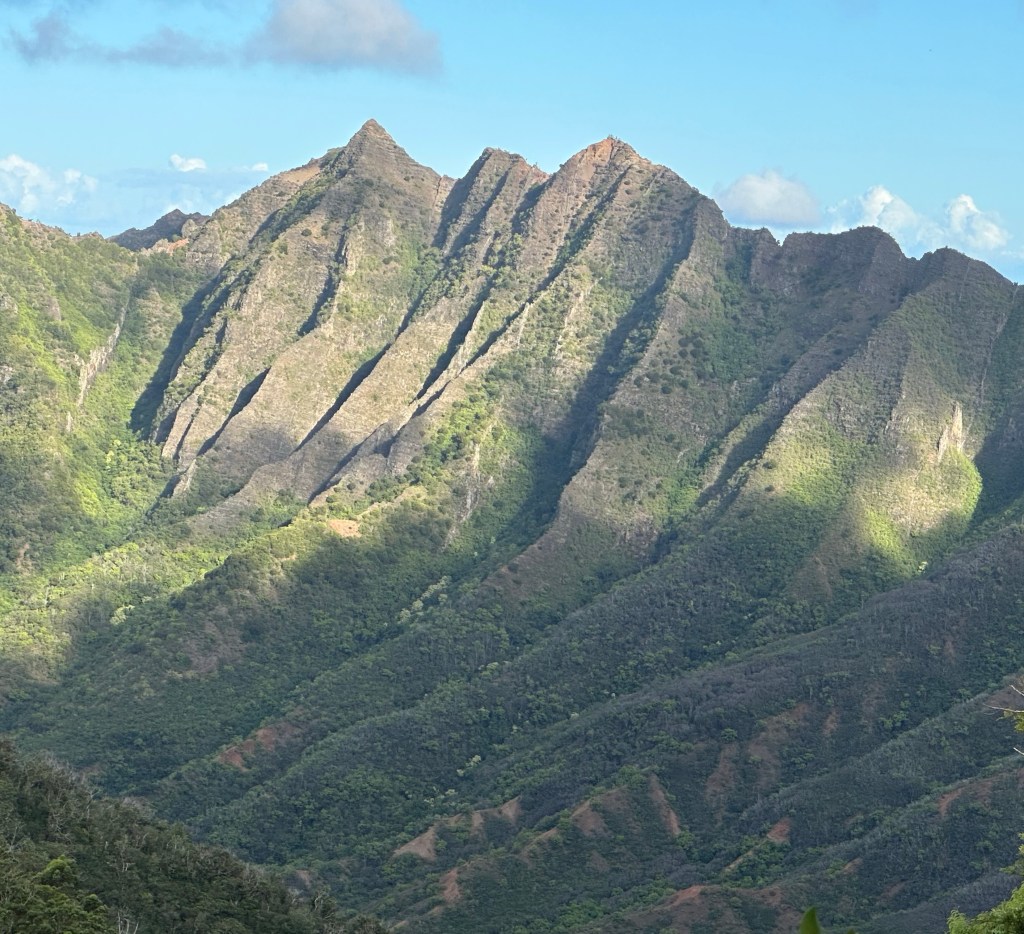
The ridge itself is quite steep – solid class 3 terrain – and quite exposed with huge drop offs on each side. I wondered to myself if the vegetation clinging to the sides of the ridge would be enough to stop a fall or if it just provided a visual false sense of security.
“Be careful,” I coached myself and spoke the words out loud. It’s kind of a joke in my family as I’m always telling my kids the same whenever minor peril lurks around a corner. At least I’m consistent.

And honestly, if not for the foursome who I could now see a couple of pitches ahead of me, I might have turned back. There’s either safety or shared stupidity in numbers. And so I continued on.
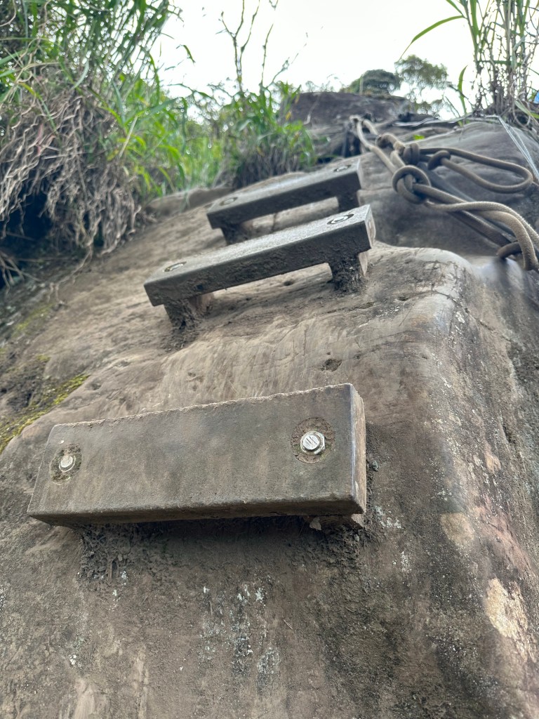
Every pitch was now roped with one section featuring steps bolted into a large vertical boulder. At least the day was dry and the footing remained good.
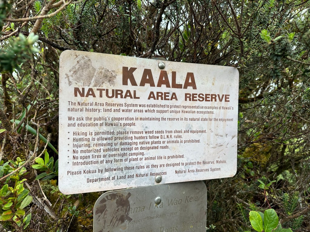
After about 1000 feet in elevation gain on the exposed ridge, the trail passed through a gate and completely flattened out. As in as flat as the highway with wooden planks to walk on. It provided a striking and unexpected contrast. There was also the first signage indicating that I was on Mount Ka’ala. I mean, I was pretty sure by now, but let’s just say it wouldn’t have been the first time I climbed the wrong mountain.
In another half of a mile or so, I reached the summit area, which features a fenced off US Air Force Facility that has a restricted road which approaches from the opposite side of the mountain.
After spending hours in what felt like remote wilderness, I think my mouth literally went agape as I now watched a small construction vehicle buzzing down the road.
I spied the foursome looking as befuddled as me.
“Can you actually tag the summit?” I inquired, thinking they might have some local knowledge.
“I think it might be around the side of the fence,” came the reply as another indicated that he hadn’t come all this way to not touch the top.
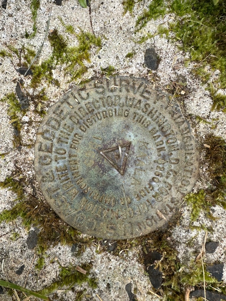
We all crossed the restricted road together and went off searching, soon locating a gate that led around the fence before we parted ways again. They continued all the way around the fence while I searched one specific area for the USGS marker. Bingo.
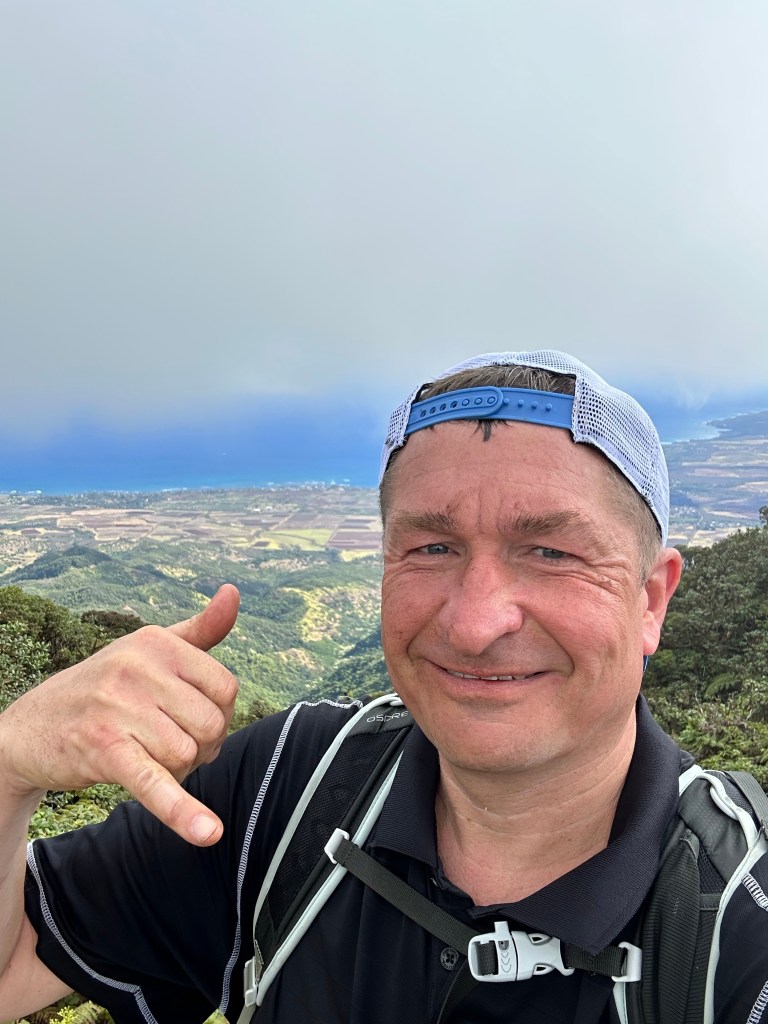
As I ate my lunch on the summit, the fog of just a few minutes earlier burned off and a spectacular vista all the way to the Pacific Ocean opened up.

I left the summit area before the foursome and was in the lead for the entire descent of the ridge, which could only be done by holding the ropes and walking backwards, facing the terrain.
But I could hear them behind me and so when I stopped for a break at the bottom of the ridge proper, they caught up to me and we chatted for a few minutes. They were all currently living in Hawaii but had come from all over the US. Maryland, Utah, California and Arizona, if I remember correctly. They had suggestions for other cool hikes on the island and I listened with interest even though I knew our time left in Hawaii was short. And then they were gone.
I was back at the Jeep a little after noon for a round trip time of just under 6 hours and still had plenty of time to enjoy some afternoon beach time with my wife after getting back to Waikiki.
It was a good day.