I’ll begin with a brief retrospective.
The year was 2004 and I was heavily into mountain biking at the time. I was also really starting to get rolling with my US State Highpointing project. So it seemed like a natural marriage.
The Highpointers Club has no requirement on how you reach a state highpoint and many, if not most, folks drive to the tops of North and South Carolina as well as Tennessee and Georgia. Given the closeness of these four state highpoints, it is not unusual for people to complete them all in a day.
My chosen method all of those years ago was to attempt to ride my mountain bike up the summit roads of these four state highpoints. Just around 7 AM on April 24, 2004, I arrived at the Newfound Gap parking area, marking the start of the Clingmans Dome summit road as well as a crossing point for the Appalachian Trail. I then completed a 15 mile round trip to the top of Tennessee on my mountain bike before driving to North Carolina (Mount Mitchell) and South Carolina (Sassafras Mountain) to do the same.
It was a memorable day and by the time it was over, nightfall was approaching, I was exhausted and I’d successfully completed a trifecta of state highpoints on my mountain bike in one awesome day. The following morning, I decided to leave the mountain bike in the back of my car and simply walked up the summit road of Brasstown Bald, Georgia, thus pushing my state highpointing total to 20.


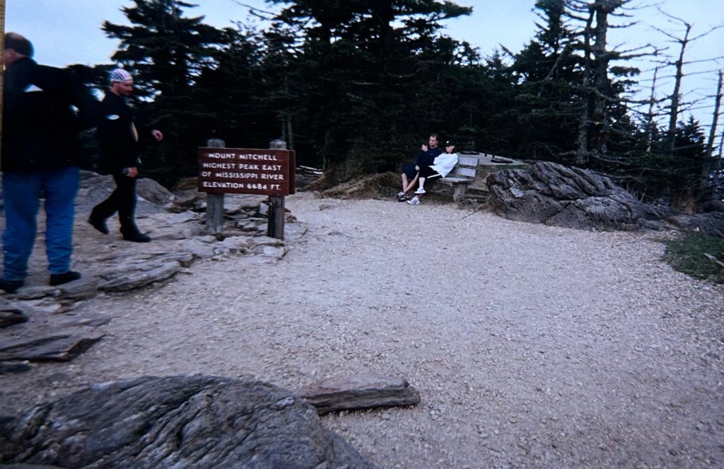
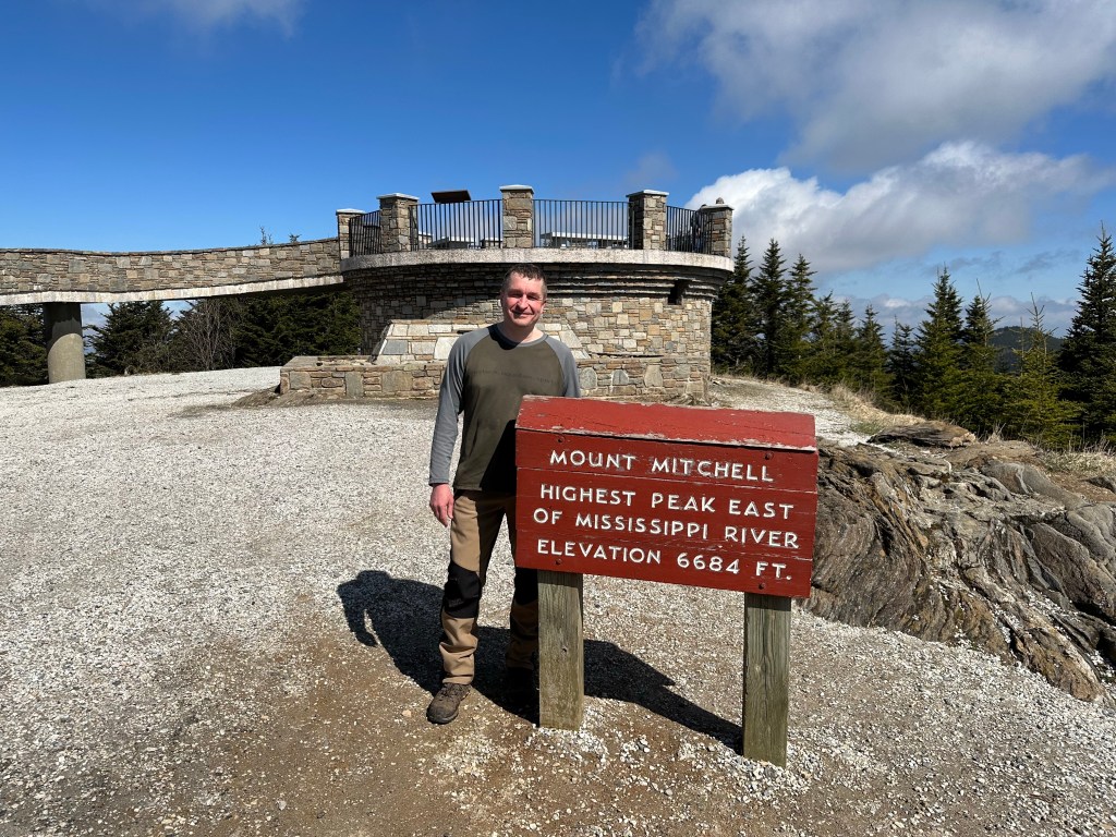
The years passed and I became a 50 state highpoint completer before I started to revisit various state highpoints when the spirit so moved me. It began to nag at me that I hadn’t properly hiked Mount Mitchell (NC), which at 6,684 feet is the highest point in the US east of the Mississippi River. Older me felt it deserved more attention than I’d given it during my one day blitz all of those years ago. Plus, the summit area had been given a substantial facelift in the intervening years and no longer looked anything like it had during my visit.
I had similar feelings about South Carolina. And if I was going to drive all the way down south for a hike of Mount Mitchell, I may as well properly hike to the summit of Sassafras and its new summit structure as well.

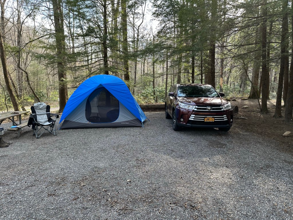
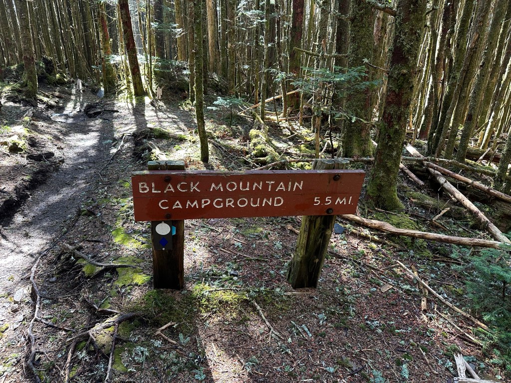
And it was decided. So when I found myself in a very brief “between jobs” situation at the end of March, I took full advantage of the unplanned week off. I pointed my Toyota Highlander in the direction of the Black Mountain Campground at the base of Mount Mitchell and arrived late in the afternoon of April 3rd, 2023.
By strange happenstance, the campground caretaker took note of my signature Talkeetna, Alaska jacket that I had acquired shortly after completing my 50 state highpoint journey on Denali in June 2015. She mentioned that she had been on an RV camping trip to Alaska with her husband and family some years ago when a 5.8 earthquake hit Talkeetna, shaking the town quite a bit but doing no serious harm.
“Interesting,” I said, “because a 5.8 earthquake hit Talkeetna a few days after I got off of Denali.”
We compared notes and, of course, it turned out to be the same event. Her husband also works at Black Mountain Campground and the three of us had fun exchanging stories. It created a great vibe on the front end of what turned out to be a fantastic although short mountain getaway.
From my chosen campsite, I could see the trailhead and trail, which were marked by blue diamonds. The following morning, the Mount Mitchell Trail would take me 6 miles (one way) and about 3,700 feet worth of elevation gain to the top of the Tar Heel state. Or so I hoped. A vigorous hike by nearly any standard.

I was up with the sun and wasted no time getting myself ready. I pre-hydrated by tossing back a couple of orange Gatorades and then hit the trail right around 7:20 AM. A beautiful early spring day was forecast and I anticipated that the trail would be free of ice and snow all the way to the summit.
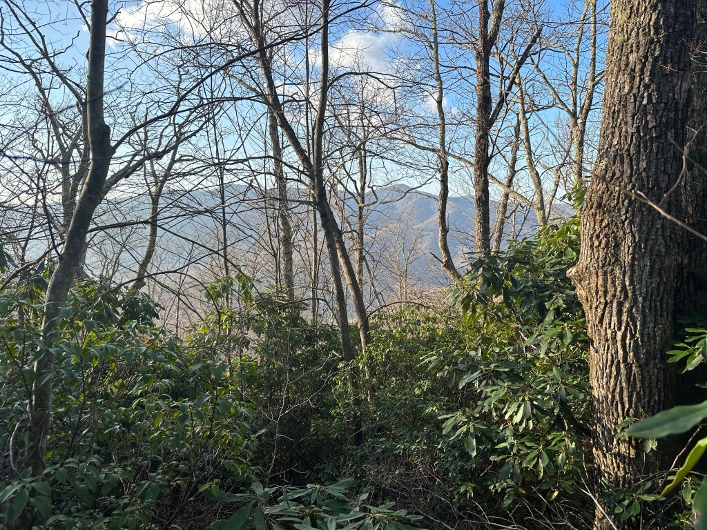
One of the first things I noticed was the complete lack of vegetation on the trees. It was, of course, early spring so not surprising even this far south of my home base in New York. I always enjoy the enhanced viewpoints that go along with foliage free hiking and soaked it all up on this fine morning.

The trail was well-marked with trailside markers every half of a mile giving you your exact distance from both the campground and summit as well as your elevation. At the two mile point, I stopped to snap a quick photo of the marker as well as a selfie.


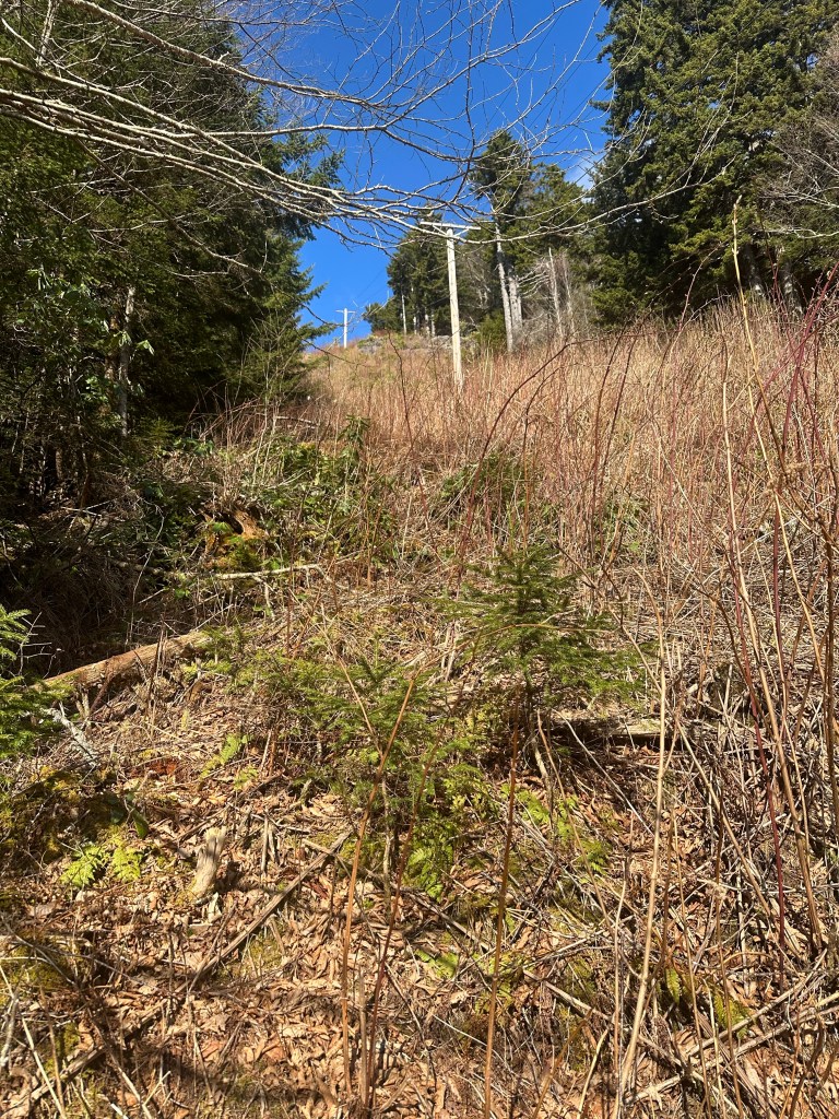
Other than one brief encounter, I had the trail all to myself for much of the ascent. Between the 3.5 and four mile mark, the trail began to climb aggressively in what was a highlight of the hike for me. There were numerous switchbacks zig-zagging across a power line cut where the views of the valley below were magnificent.
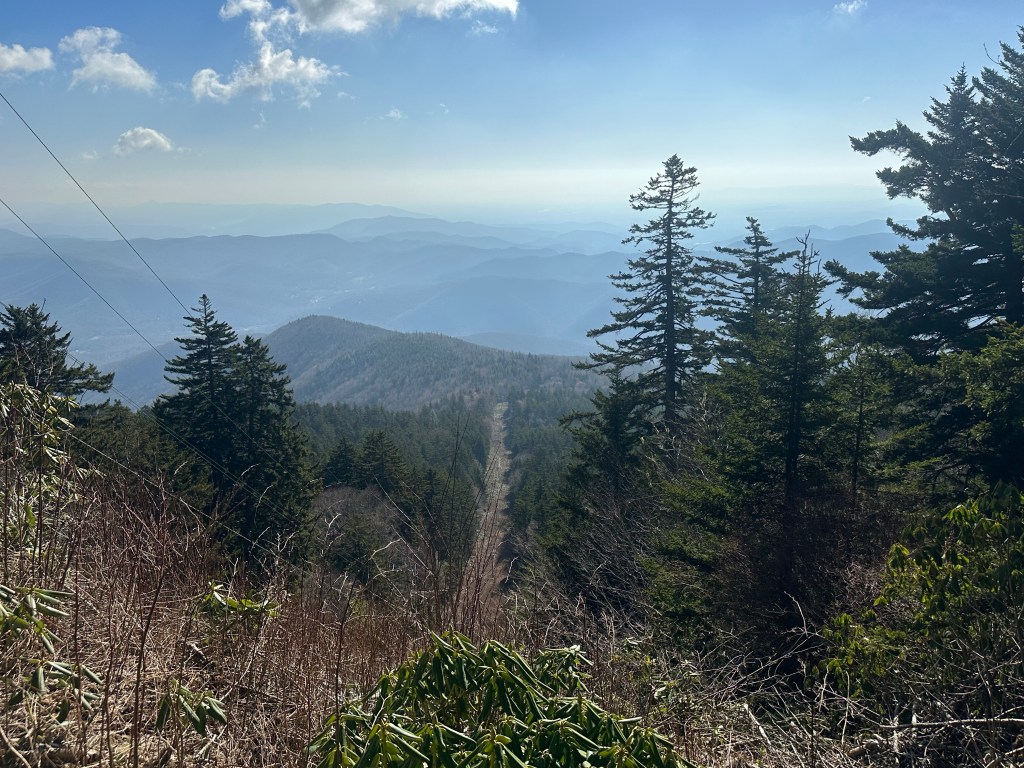
Upon reaching the top of the power lines, the grades eased up, the terrain opened up and I was presented with multiple trail options for continuing on to the summit. I chose to stay on the Mount Mitchell Trail (AKA the Mountains to Sea Trail) and followed it back into the thick woods.

I had been taking lots of photos and proceeding at a very leisurely pace with no plans for the day beyond this hike and relaxing back at the campground. It was just before 11 AM when I reached the 1/2 mile to go sign. At this point, I started to see people at regular intervals. Folks who had driven to the summit but then enjoyed nature hikes along the trails that depart from the top of North Carolina.
The views were stellar from the “new” Mount Mitchell summit tower (completed in 2009). A few couples asked me if I would be kind enough to snap photos of them in front of the “Highest Peak East of the Mississippi River” sign and one of the couples returned the favor.

The hike back was uneventful although warm. The sun beat down through the leafless trees and I strategically stopped for a bottle of Gatorade every 1.5 miles or so until swigging my last one about a mile from the campground. I arrived back at my tent at just about 2:20 PM, making for a seven hour round trip. Solid day. Everything I had hoped it would be.
Back at my campsite, I had the chance to relax following by the long drive of the previous day and the big Mount Mitchell hike. I showered and enjoyed some of the BBQ’d food I had cooked on our grill back home the night before I left. The campground caretaker stopped by to even up with me after my cash overpayment of the previous night and asked how my hike had been. I read a little and otherwise just enjoyed the solitude in an otherwise empty campground, which had just opened for the year a couple of days before my arrival.

I awoke early the next morning as well and got myself ready at the first hint of early morning light before leaving on a two hour car ride to the Foothills Trail access point that would take me 4.5 miles (one way) and about 2,100 feet in elevation gain to the summit of Sassafras Mountain.
I arrived just after 9 AM on April 5th but quickly lost an hour when I stupidly got on the trail heading in the wrong direction. I know exactly how and why I made the mistake but it still doesn’t excuse my foolishness. It was exactly 10:12 AM when I started up the trail to the top of South Carolina, this time heading the right way.

Compared to the previous day’s hike, the trail was not-so-steep and substantially less rocky. The forecast for the day was even warmer and I decided to wear sneakers, shorts and a T-shirt rather than my normal hiking attire.
Despite the lost hour as a result of my error, there was still no hurry. I had all day to complete a moderate hike and once again took my time and snapped plenty of photos as I followed the white blazed Foothills Trail.

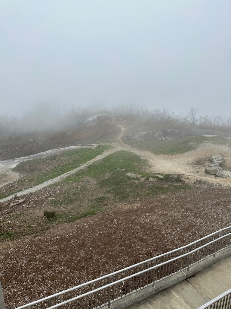
Pleasant is the best word that comes to mind for this hike on this day. The bright sunshine I’d expected never quite materialized, however, and I found myself hiking up into a summit fog. I had no objection to the slightly cooler temperatures as I was already experiencing a shirt-soaking sauna effect now that I was in the comparative warmth of the south at the very end of a long Northeast winter.


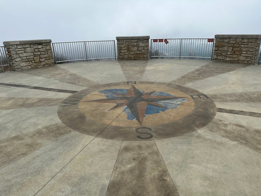
The trail meandered a bit and followed a ridge or two before finally intersecting the summit road in the upper reaches of the mountain. About 10 or 12 minutes after this, I ascended a wooden stairway built into the trail and the wild new Sassafras summit tower came into view. Completed in 2016, the elaborate viewing platform provided a striking contrast to the woodsy, secluded scene of 19 years earlier.


Back in 2004, Don Holmes’ “Highpoints of the United States” guidebook had instructed “the actual highpoint appears to be next to a tree that is in front of a Foothills Trail sign approximately 25 yards w of the benchmark.” That tree is now long gone.

It’s a different era in state highpointing now. The hobby has been popularized by the Highpointers Club, the internet and people like me who have broadcast our cross country travels on places like SummitPost and other mountain websites. I felt myself waxing sentimental for the quiet and woodsy Sassafras Mountain of yesteryear. One that existed before the entire summit area was clear cut and built up to improve summit views. I, of course, had nothing to do with this decision but felt partly to blame simply by having been a personality that helped publicize and advertise the hobby.
In any event, I can at least say I’ve now been to the old and the new summits of both Mount Mitchell and Sassafras Mountain and that I have now properly hiked each mountain. So to that end, it was a good trip.
I returned to the Black Mountain campground for one more relaxing evening before packing up and heading back north the following morning.