“These woods are lovely, dark and deep, but I have promises to keep, and miles to go before I sleep, and miles to go before I sleep.” – Robert Frost
It wasn’t supposed to take three trips.
Trip reports abounded all over the internet of skilled off-trail navigators completing Maine’s famed “six pack” over a long weekend. But I had no intention of hurrying (rushing through wilderness) and planned originally to complete my final six New England Hundred Highest peaks over a leisurely 5-6 day trip in late June 2017. After all, my first qualifying peak had been some 22 years earlier on New Hampshire’s Mount Eisenhower and I had left and come back to the NEHH multiple times following my “high volume” 4000-footer days of the mid-to-late 90s. I had approached this particular list with the urgency of a slow-moving turtle and had no plans to change tactics now.
What I didn’t anticipate was that this effort would evolve into a summer-long epic that would take me back and forth to the Pine Tree State no fewer than three times. In the end, what started out as something that had the feel of a chore-to-be-finished turned into a memorable season of Maine peakbagging.
Round 1 – June 19th to 22nd, 2017
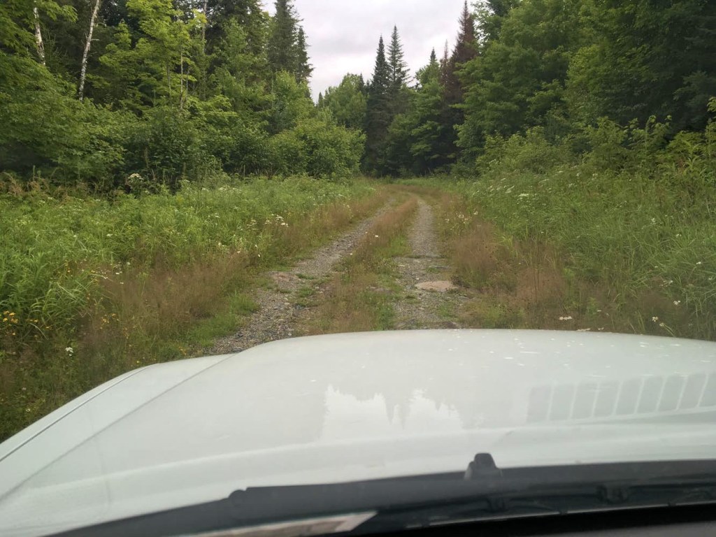
My late June trip proved enjoyable but I was continually vexed by Maine’s confusing maze of logging roads and ATV trails.
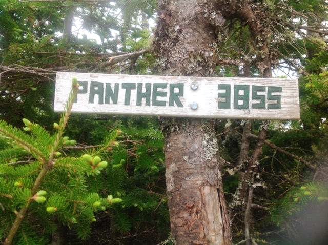
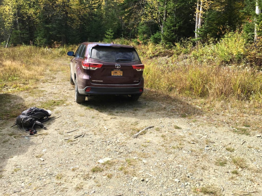
Day one started with a relaxing drive up through the Adirondacks into Canada and then east through Quebec back towards the US and Maine. Just before reaching the US border, I peeled off into the Mont Gosford park (ZEC Louise Gosford) and started down some rutted dirt roads to an ATV trail that I knew would lead uphill to the US-Canada border swath, which I could then follow to the summit of Boundary Peak. Also known as Panther, this peak literally sits on the Maine-Quebec border. Pretty cool and pretty easy although the weather grew gradually unsettled during my hike. I wound up hurrying back to my XTerra during the descent and the skies opened up with some ferocious thunderstorm activity shortly thereafter.
The ensuing thunderstorms were actually so severe and long-lasting (all night) that I cancelled my campground tent plans and sought shelter in a nearby motel. As it turned out, the Mountain View Motel would become my base of operations for all three trips to Maine. Room 7 to be exact.

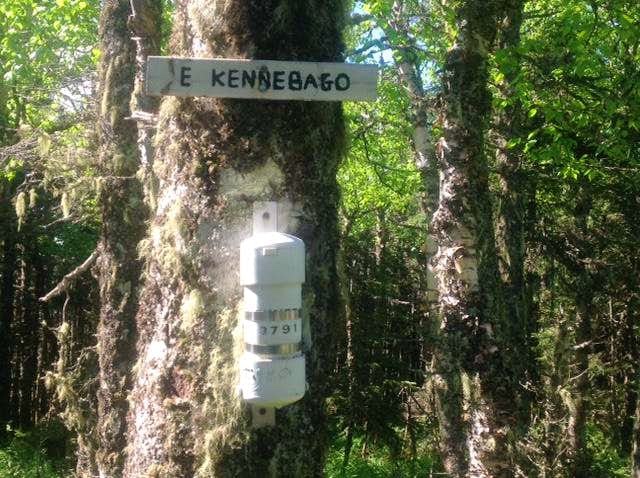
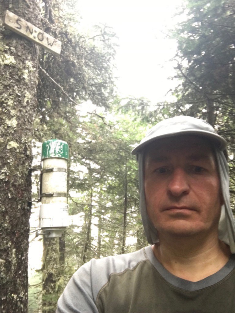
Although I got a super-early start each day and was out the door by sunrise, the next three days would prove far more frustrating in terms of route-finding and it soon became clear that I had no hopes of tagging all of my remaining New England Hundred Highest peaks on this trip. On Snow (Chain of Ponds), the key issue was the ATV trails and trying to figure out exactly where to break off and start working my way up the mountain. And on East Kennebago, I struggled with navigating the rock-covered old logging and camp roads to find the precise starting point of my off-trail hike. But as the saying goes, a bad day in the mountains is still better than a good day at work.

So instead of completing all six peaks, I was happy to return home with Boundary, Snow (Chain of Ponds) and East Kennebago … in addition to the slightly lower and nearby East Kennebago – West Peak which I climbed entirely by accident after being led astray by a misleading sign. An unexpected bonus peak.
My chosen route home, by the way, stayed within the boundaries of the US. This was partly to avoid multiple border crossings but also just for variety. After stopping in Rangeley to fix a flat tire that my XTerra had sustained during the last day on those rock-covered Maine camp and logging roads, I cruised down into New Hampshire and through Vermont before crossing back into New York.

Round 2 – August 12th and 13th, 2017
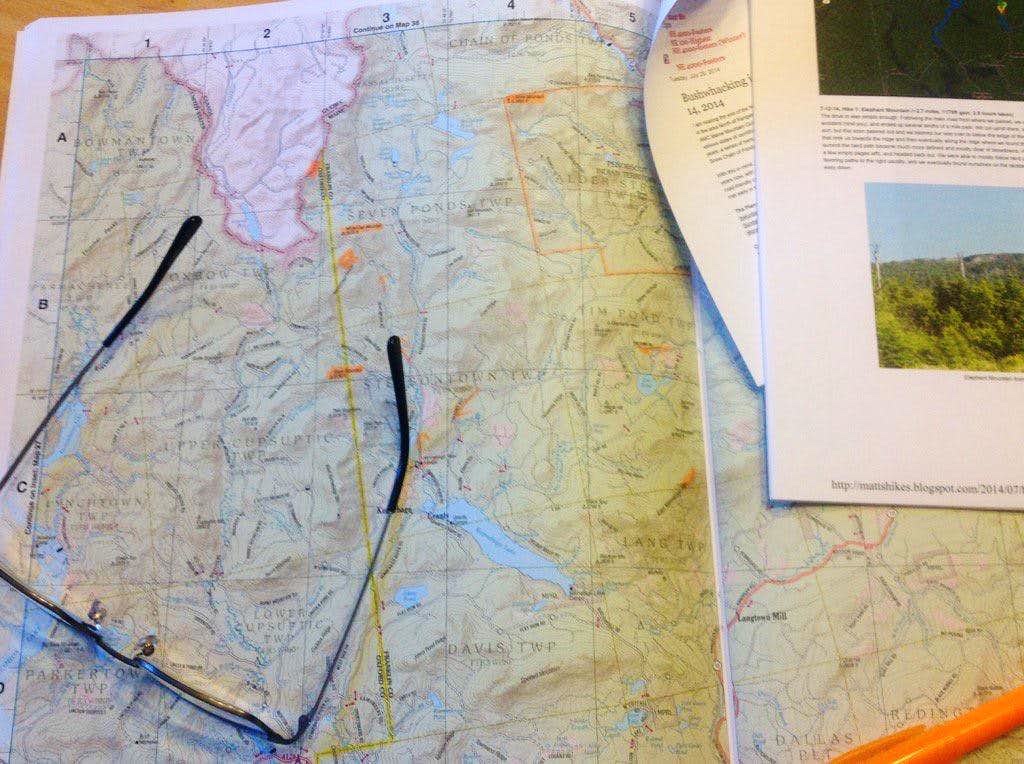
A little under two months later in mid-August, I returned to the Stratton area with the intent of “grabbing” those last three six-pack peaks, but was foiled once again. Again, this trip featured a lot of time driving on backwoods lumber country dirt roads, but while the distances travelled were even greater, the roads were significantly less deteriorated and the navigation was markedly easier.
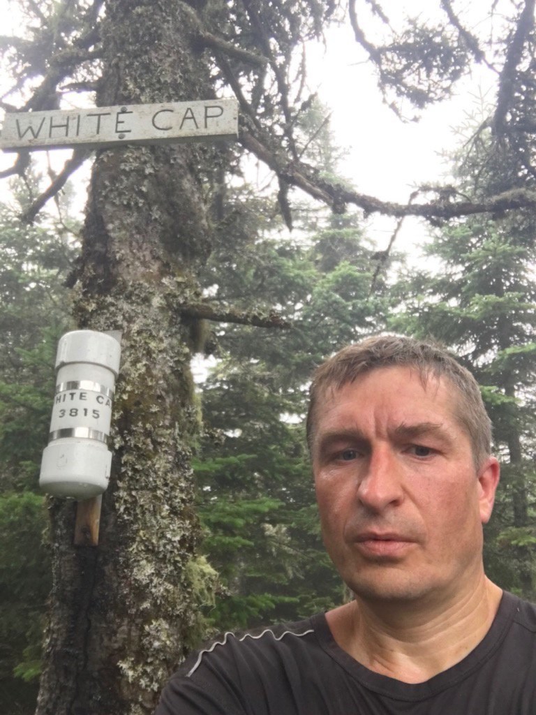
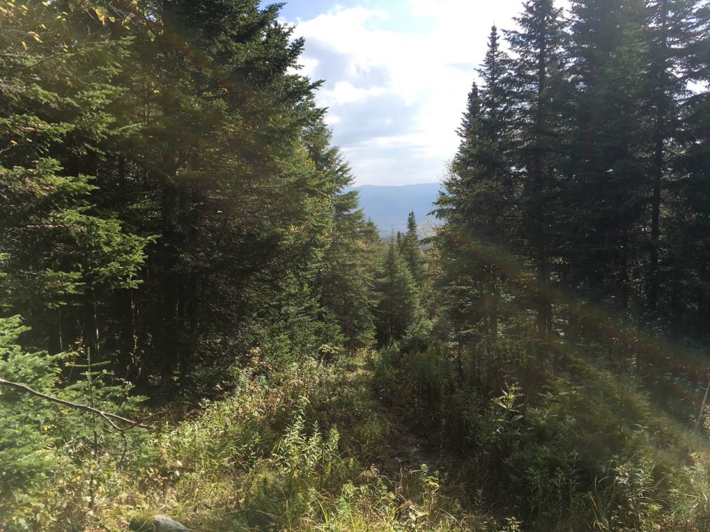
My first day of round two started with high hopes for a “two-fer” with the targets being White Cap and North Kennebago Divide, which are divided by a fairly shallow col. The kicker, of course, is that there are no trails whatsoever and the effort requires a combination of following primitive paths with a bit of map and compass work thrown in for good measure. My hopes stayed high after summiting White Cap in quick order, but upon returning to the col (and the well-documented “lower” cairn) with North Kennebago Divide, I repeatedly got myself turned around on a confusing network of herd paths and ultimately chose to mentally reset and leave it for another day. Bushwhacking would be required.
The following morning brought a super fun and navigationally-challenging hike of Cupsuptic Snow although rainy conditions during my descent dampened my enthusiasm for an afternoon second attempt of the very nearby North Kennebago Divide. Once again, the grand finale would have to wait for another trip.

NH Interlude – August 23rd, 2017
The unexpected “miss” on North Kennebago also gave me the chance to update my Owl’s Head, NH credentials. My previous summit of this peak in October 1997 had finished off the Northeast 111 for me (I later added Redington, Spaulding and Wildcat D when a new survey was released) but in the intervening years, the location of the accepted true summit of Owl’s Head had been relocated to just a short distance away along the same ridge. I had always meant to go back but an 18-mile round trip for a fairly insignificant difference seemed a long way to go. But now I had motivation since I really didn’t want to do a NEHH post-script hike. I wanted North Kennebago Divide to have a sense of finality. So on August 23rd, I banged out Owl’s Head V2.0 on a beautiful summer day.


Grand Finale – October 7, 2017
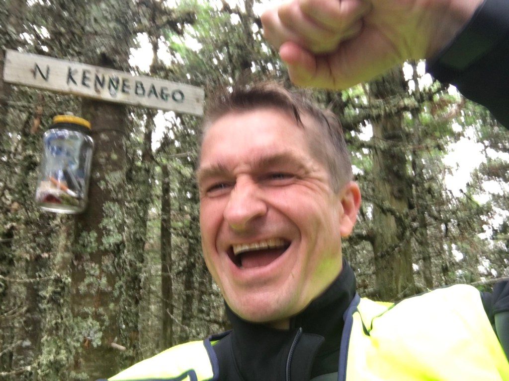
So here it was … Columbus Day weekend and I had actually developed my very own “Stratton routine,” staying now for the third time in Room 7 of the Mountain View Motel and having a pre-hike dinner at the White Wolf Inn. I awoke early and was there for the opening of the Flagstaff General Store for a coffee and breakfast sandwich before beginning the now familiar drive on Tim Pond Road and eventually to the old skidder landing where I would begin my hike. Originally, I considered and was leaning toward a full whack up the south facing slope of North Kennebago from the parking area. I felt it out briefly but I really wasn’t digging it so returned to the grassy path that leads towards the lower cairn and eventually the White Cap herd path. Once again, I scouted out the herd path at the lower cairn but decided to do a little more recon before committing to it. There is another little-talked-about grassy path with a cairn that lies between the lower NKD herd path and the upper White Cap herd path. I had been on this path during my failed August attempt and decided to check it out again. While heading west on this path, I kept looking to my left hoping to catch just a glimpse of the NKD summit ridge and finally spied it through the trees after 1500 feet or so. FINALLY, I had a target I could lock in on. My compass indicated a due south bearing to the summit area and the terrain looked like it would head downhill slightly, before levelling off and then going back uphill to the ridge. I really didn’t care how thick it was going to be. I knew if I just kept a true south bearing, I would be good to go.
As it turned out, the going wasn’t too thick and the many pine branches that had been cracked off suggested I was not the first to come through this way, whether it be man or moose. I stopped to consult my compass every 50 feet or so and within 20-30 minutes, I was heading back uphill towards what I believed to be the summit ridge. And as soon as I hit the ridge, a beautiful herd path leading to the promised land lay at my feet. My enthusiasm soared far more than I had expected it would. You really never how you are going to react to a list completion until you are in the final steps. When I finally spotted the N. Kennebago wooden summit sign another 20 minutes or so later, I let out a loud war whoop and then just started laughing. It was done.

As my wife had told me before I left, it was now time to get myself home for awhile, where I belong. Promises to keep.
Patchwork
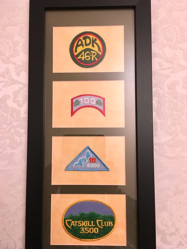
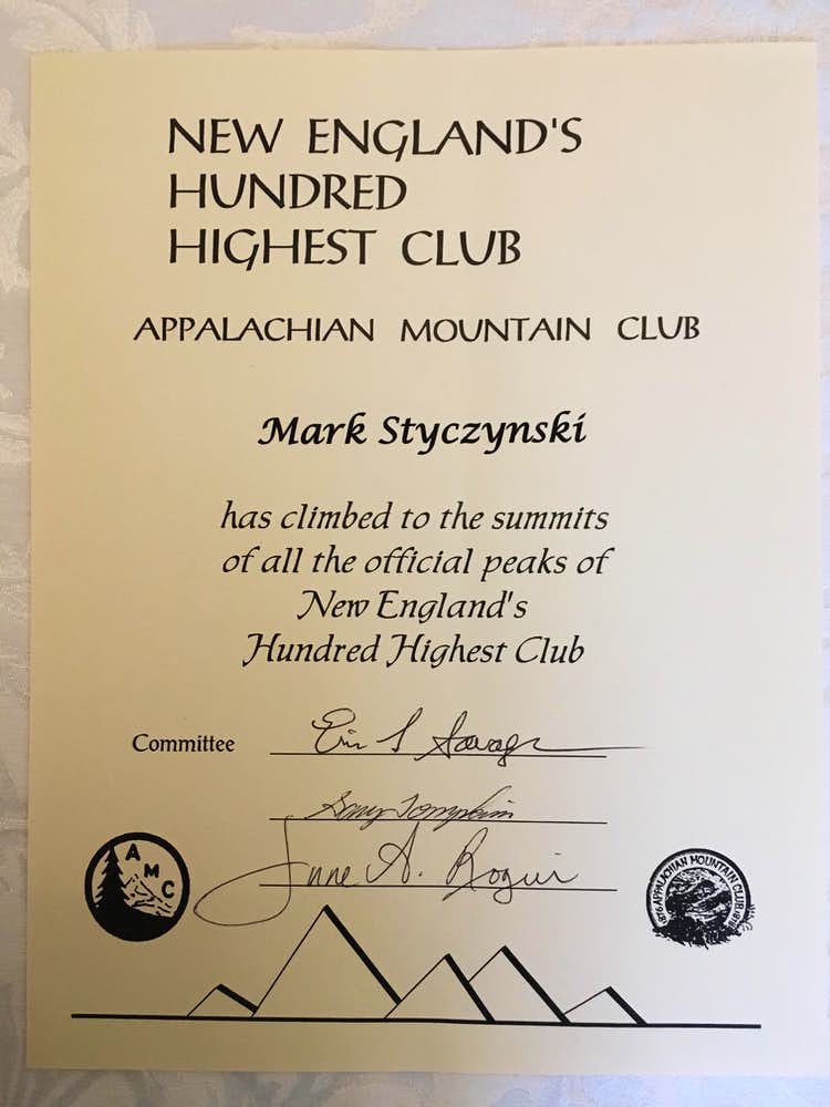
Postscript (01/16/18) – There’s all the hiking and then there’s the documentation. To each his/her own, but I’ve always enjoyed the process of filling out the required paperwork and receiving the “official” club patch, whatever that club may be. The New England Hundred Highest portion of the Appalachian Mountain Club Four Thousand Footer Committee (AMC FTFC) was very timely in processing my paperwork and I received the NEHH patch within about 6 weeks. The AMC FTFC also awards patches (not seen here) for completion of the New Hampshire 4000-footers (48) and the New England 4000-footers (67). The NEHH is essentially a superset of these other AMC FTFC lists.
The New England Hundred Highest patch is second from the top.