Introduction to the Prominence Game
Lists, lists, lists. It’s seemingly the story of my hiking and mountaineering existence. My peakbagging story goes back to the early 1990s when I was a young State Trooper stationed in New York’s beautiful Adirondack Mountains. It was then that I decided to hike that range’s 46 peaks which measure over 4,000 feet in elevation. Check. And from there, it just blossomed. It turned out that the White Mountains of New Hampshire also have a slew of 4,000-foot peaks, 48 to be exact. Check. Five 4,000-footers in Vermont and 14 more in Maine. Check, check. The Catskills, you say? Well, there are 35 peaks more than 3,500 feet in New York’s southern mountain range. Check. Adirondack and Catskill Park fire-towers. Check. The 50 US State Highpoints. MAJOR CHECK. The highest 100 peaks in New England. Check. Vermont County Highpoints. Seriously? Yup … check. You get the picture.
But what all of those lists – fire-tower peaks excluded – have in common is that the measure of the mountain is based primarily on elevation above sea level. The idea of prominence enters the picture only in determining what separates one mountain peak from another. In a nutshell, prominence is based on locating the key col, which is basically a fancy term for the highest low point between one mountain peak and its next higher neighbor. In the Adirondacks and most major US mountain ranges, the list-makers decided there must be 300 feet of prominence to qualify as a unique mountain summit. Over in New England though, it was decided that 200 feet of prominence would suffice. Interesting facts to the peakbagger’s mind, no doubt, but ultimately it is that 3,500-foot or 4,000-foot Holy Grail towards which Northeastern US hikers aspire. The whole prominence thing lives somewhere way in the back of your mind as you climb upwards, obsessively checking your altimeter.

Somewhere along the line, I started to become aware of a few lists that were based solely on prominence. In the United States, the Grand Daddy of them all is the group of Ultra Prominent Peaks. 57 summits in the lower 48 states with 5,000 or more feet of prominence. Meaning essentially that these mountains are super isolated from higher neighbors and stand out above the surrounding terrain like a Phoenix keeping watch over the land. Most are located in the western United States as elevations east of the Mississippi simply aren’t high enough for many peaks to meet that kind of prominence criteria. In 2015, after I finished my US State Highpoints project which included a small handful of Ultras, I toyed with the idea of going after this list next. But ultimately, I decided it was too big of a project for a guy juggling the responsibilities of work and family. So for awhile, I just kind of faded back into the regional hiking game, hiking and climbing what I wanted when I wanted.

Fast forward now to the pandemic where my hiking activity picked back up substantially in 2020 largely based on a complete lack of anything else to do. It was then that I decided to finish my remaining five Vermont County Highpoints and then traveled to Baxter State Park for a hike that had been on my bucket list for a number of years … the Traveler Loop. After I returned home from Maine, and was looking over my hikes for the year on the Lists of John mountain website, I realized that I had summited three 2,000-foot prominence peaks in 2020 – East and Signal Mountains in Vermont as well as the Traveler in Maine. Hmmmmm. And when a peakbagger says “hmmmmm” in that kind of tone (you know the one), the decision has already been made. In the Northeastern United States, there are two established prominence-based lists. First, you have the Northeastern United States 2000-foot prominence peaks, a list which contains 55 summits. And second is the New England Fifty Finest, which excludes New York State and contains the 50 most prominent peaks in the New England states. As I reviewed the list of Northeast 2,000 foot prominence peaks on peakbagger.com, I realized that I had already visited the summits of 42 of the 55 peaks during my decades of mountain rambling. So for me, this would be a list of 13. Totally manageable and just what the Doctor Fauci ordered.

So as the pandemic rolled on and 2020 began to fade indiscernibly into 2021, I found myself sneaking back and forth between New York and the COVID safe havens of Vermont and New Hampshire for solo hikes of 2,000-foot prominence peaks. So rebellious. There was Grass Mountain and then Mount Putnam in Vermont, Mount Kearsarge and Smarts Mountain in New Hampshire as winter now took hold with several ski outings thrown into the mix as well. Took two attempts in the snow to reach the summit of New Hampshire’s Mount Shaw before closing out the winter with a near perfect hike of a very difficult Cold Hollow Mountains Highpoint in northern Vermont. As I often tell myself when I’m traveling through mountainous terrain … “this is what doing it feels like.”
But the winter was coming to an end, Pfizer’s vaccine was getting pumped into my arm, the world was opening back up and my seven remaining Northeast 2,000-foot prominence peaks (P2Ks) all lay in faraway northern Maine.
Planning
Family fun, sporting events and regular summer vacation plans would dominate the coming months, but those seven Maine P2K peaks kept rattling around in my mind. Late at night and early in the morning, I would study topographical maps and scour the internet for any and all information on trail and route information for these mountains. By May 30th, I would write on twitter: “My peakbagging trip to Maine is starting to take shape. Four nights out of Greenville on the shores of Moosehead Lake during which I shall attempt Baker, Big Moose, White Cap and Coburn before heading north to BSP for Doubletop. Will leave Kibby/Boundary Bald for another trip.” Mountain plans tend to evolve and change somewhat as the weeks and months go by, but not this time. Ultimately, the only thing I would alter was the amount of time I would camp near Greenville, Maine when I realized I could “double up” on Big Moose and Coburn. I could hike one in the morning and then one in the afternoon as both were relatively short hikes and separated by an easy hour and 15 minute drive. So three nights instead of four before driving up to Millinocket for Doubletop in Baxter State Park. As I would later tell my wife during a text exchange: “Sticking with the plan. It’s a good plan. Gonna ride or die with it.”
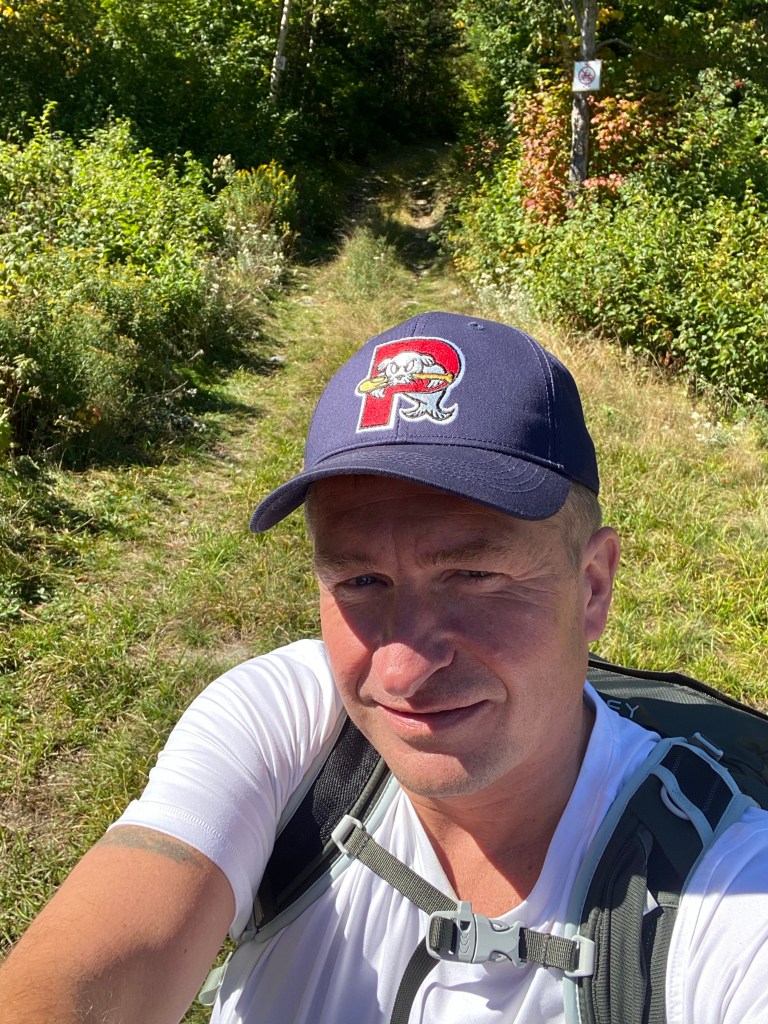
So with a car full of gear and a heart full of hope, I set off for the woods of northern Maine. Estimated driving time: 7 hours.
I rolled into Lily Bay State Park late in the afternoon of September 15th in the middle of a thunderstorm. The friendly Ranger told me to go ahead and pick any available tent site and settle up payment in the morning. So after checking out several soggy possibilities, I settled on one that was set up high with good drainage. Site 231T to be exact. The rain would not let up for many hours, however, and not wanting to start the trip with a wet tent interior, I would spend that first night in the back of my 2017 Toyota Highlander. No worries. This was one of the exact reasons I had picked this car in the first place … big enough to sleep in with the back seats folded down. Had already done this several times in the last few years.
Big Moose – September 16, 2021
There is always a certain amount of restlessness that goes along with sleeping in the back of your car, even if your set up is pretty good. So by the time the early morning light started to filter through the canopy of trees on the morning of September 16th, I was ready to get up and go. The first order of business was to set up my tent as it was really the only way I had of claiming this particular tent site. If I had left to drive to my hike and neither my car nor my tent were left behind, it would have been fair game for someone else to claim while I was away. In any event, I set up my brand spanking new LL Bean Adventure Dome tent in quick order and drove on down the road en route to my first mountain of the trip.


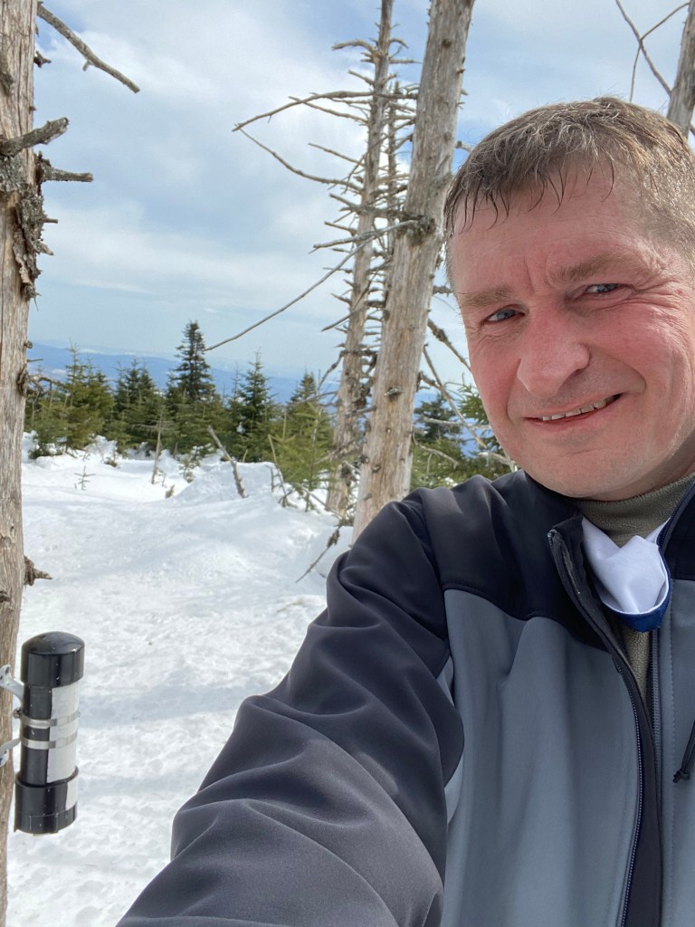
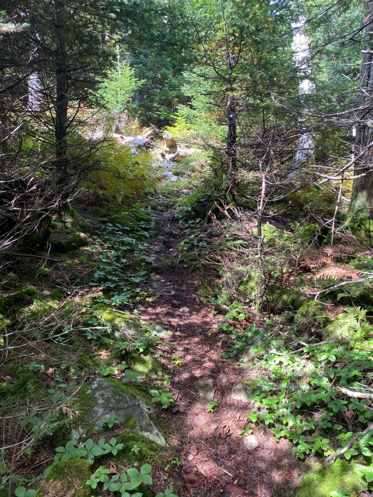
The trailhead to Big Moose is located a couple of miles down a dirt road just outside of Greenville. Of the five mountains I would be attempting, it was the easiest to find by far. I pulled into a lot large enough to easily accommodate 10-15 cars and was the first to hit the trail that day. The hike was pretty straightforward … a 4.4 mile round trip with a little over 1,800 feet in elevation gain en route to the 3,196 foot summit, which I reached a little before 9 AM. Views of Moosehead Lake (the largest lake in New England) were outstanding and I was happy to officially be in the groove of things after six months of planning and anticipation. One interesting tidbit about Big Moose Mountain is that it was apparently the site of the very first fire tower constructed atop a mountain peak in the United States. The tower was removed in 2011 after 108 years, although the footings for it remain. I’ll let the photos tell the rest of the story.


Coburn Mountain – September 16, 2021
Back at my car by 10:30 AM, I was easily in position for an afternoon attempt of Coburn Mountain. The 80 minute drive from the Big Moose trailhead through Jackman, Maine to the site of a long abandoned ski area on the slopes of Coburn Mountain was pleasant and uneventful. In hiking terms, this mountain has no true trail to the summit, but rather a route that is not at all difficult to follow. After pulling off the Route 201 14.3 miles south of main intersection in Jackman, I followed the rutted and bumpy Enchanted Mountain Road for a little over two miles before bearing to the right near the site of the no longer standing ski lodge and continuing another couple of tenths of a mile to an obvious path heading straight up hill.

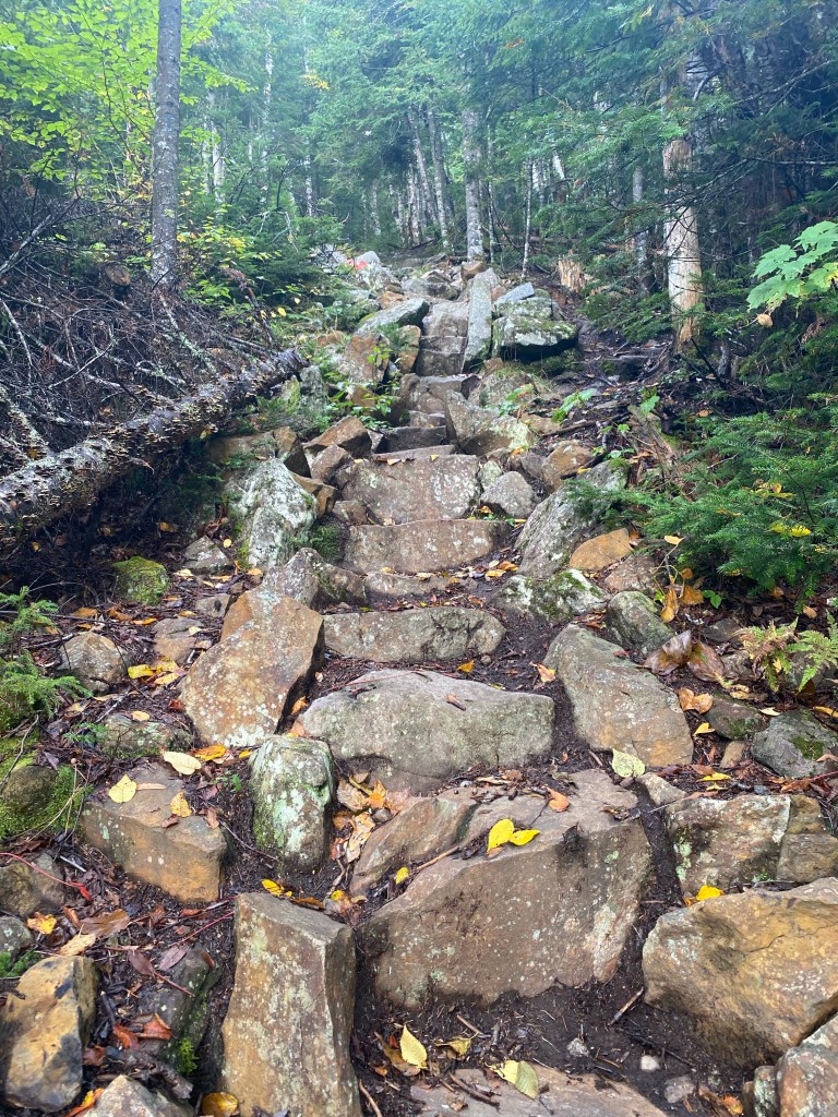
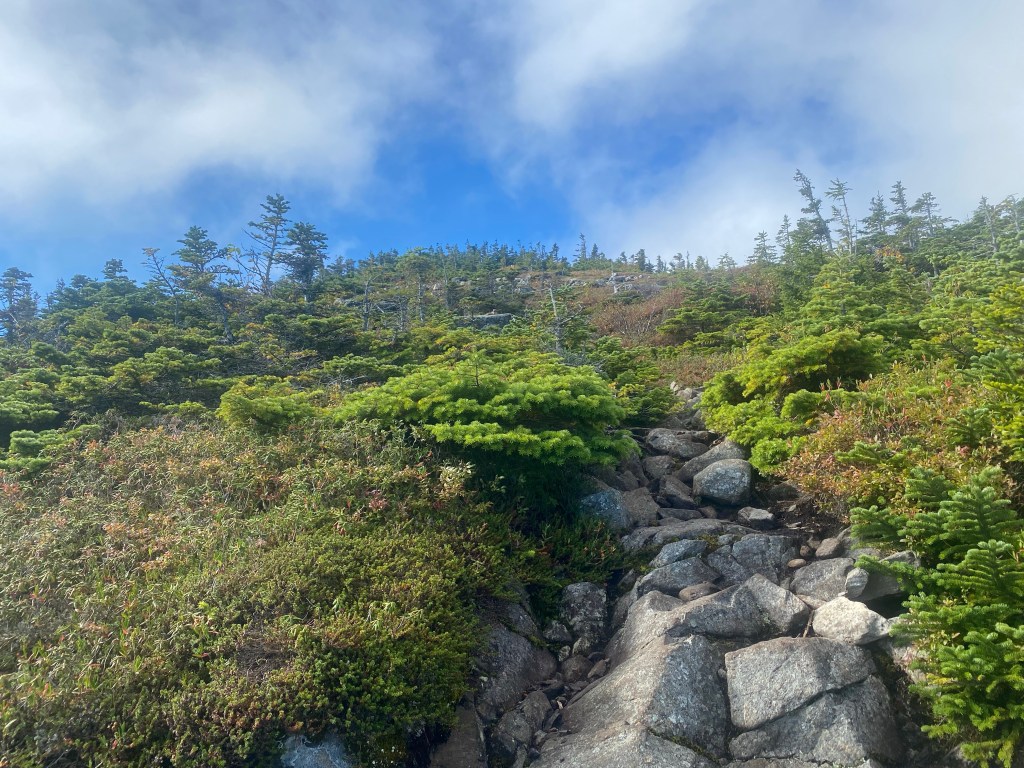
One of the things I sometimes enjoy about off trail hiking is that the routes tend to be no nonsense. No meandering switch backs to take an edge off the steepness … but rather straight up the gut. This was most certainly the case on Coburn, the Enchanted Mountain. I started up a wide rocky path that was almost certainly a downhill ski trail and appears to still be used by snowmobiles during the winter months. Today, however, I would have the mountain all to myself. I blasted straight up hill and reached the top end of the old ski run in only about a half an hour. From there, I located a cairn signifying the start of a narrow but easy to follow herd path and continued steeply to the 3,717-foot summit in another 30 minutes. The views were quite outstanding – much better than I anticipated – and I was thrilled to reach my second Northeast 2,000-foot prominence peak of the day. Enjoy the photos!


Campground Life
There are different kinds of camping and different kinds of campers. I am a hiker who camps as necessary, sometimes deep in the backcountry and sometimes on the edge of the front country. For this trip, the objective was to hike five mountains in relatively close proximity to one another but far enough from each other that large amounts of driving would also be required. The choice of Lily Bay State Park for my campsite, therefore, was the perfect choice for a base of operations. Having said that, my proximity to Greenville offered some pretty good dining options so after my hikes, I would make it a point to stop in town for food and coffee to stay ahead of the calorie deficit curve. After my first day’s double hike of Big Moose and Coburn and restaurant fuel up, I arrived back to Lily Bay Sate Park in the late afternoon around 4 PM. Having just erected the tent in the morning, I more completely set things up as my first order of business and then retired to my camp chair to read a chapter from “The Ice at the End of the World” by Jon Gertner.

White Cap Mountain – September 17, 2021
Of the five peaks on my to-do list for this trip, White Cap probably ranked second in terms of excitement factor. While I hoped some of the others would be fun hikes, I knew this was going to be a good one. Located on the Appalachian Trail, its 3,654-foot summit ranks as the highest point in Maine’s famous Hundred Mile Wilderness, named as such because it lies in an area of Maine where there are no civilization crossings for a 100 mile section of the Appalachian Trail (AT). To access the AT for this hike would require some of that adventurous travel on Maine dirt roads that I’ve come to know so well in my decades of travel to the Pine Tree State. After leaving the campground, the key was to head north for about 9 miles to the intersection with the dirt Frenchtown Road, which proved fairly easy to navigate at first. Eventually, all signs of camps and life disappeared … but the road went on and became a bumpy rock and pothole kind of affair. After about 14 miles, I came to a large iron gate blocking the road. Normally, this would cause a traveler some distress but no so in this case. This is where I was to start my hike and pulled into the tall grass on the side of the road.

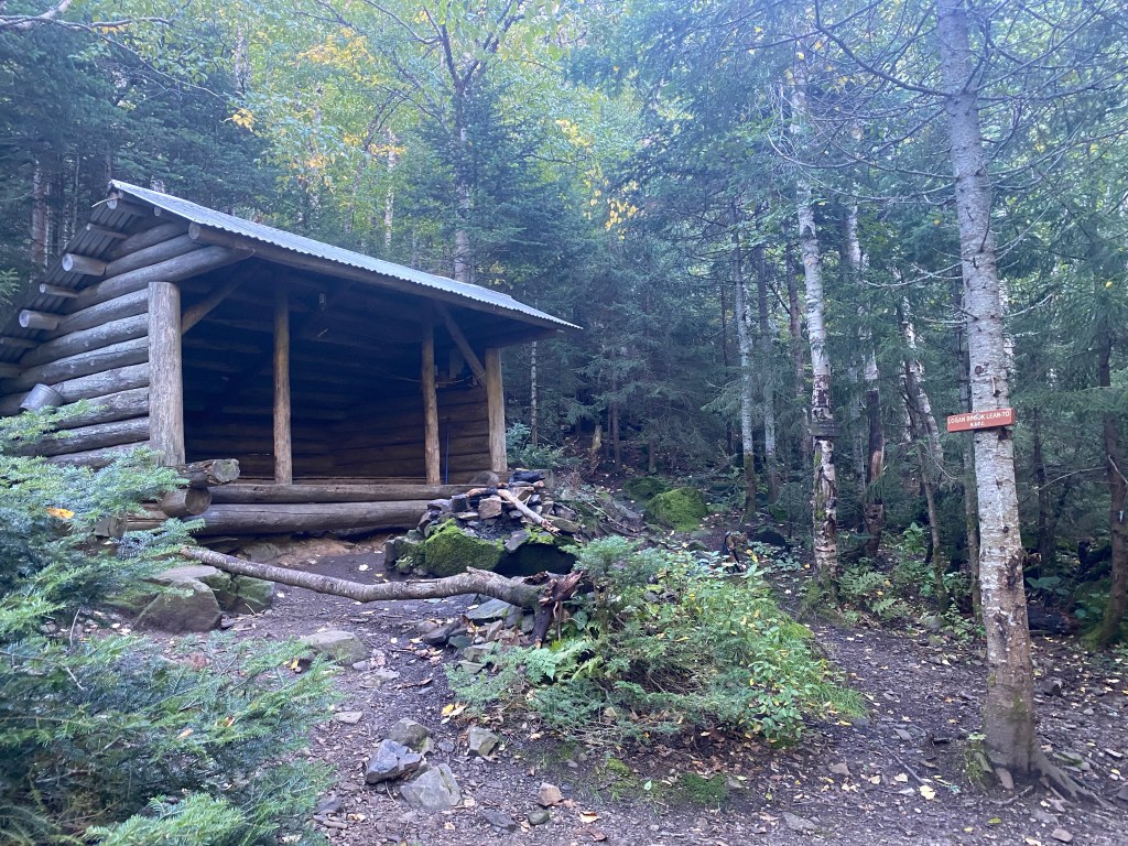
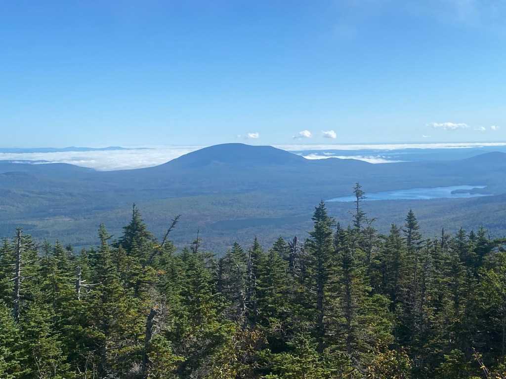
It was right around 8 AM as I walked around the side of the iron gate that looked sturdy enough to stop a tractor trailer. From here, different sources were telling me that it was somewhere between 1/4 of a mile and 4/10 of a mile to the Appalachian Trail crossing. Keep an eye out for it, my sources warned, because it’s easy to miss. So down the dirt road I bounded wildly swinging my head back and forth looking for the trail. I was pretty sure I was in the right place but have had enough misadventures in Maine over the years that I’m never more than 62 percent confident of anything. I started checking my iPhone for the mileage I’d covered as it ticked past .35 miles. I was definitely starting to get that feeling of “you’re in the wrong place” when I saw a lone figure emerge from the woods on the north side of the road. The hair was long and the backpack was huge. A southbound Appalachian Trail thru-hiker. Bingo. We exchanged pleasantries and had a brief conversation before I headed into the woods to start my 3.4 one way hike to the summit of White Cap looming more than 2,100 feet above as SOBO (AT lingo) continued his break. After having had the trail to myself for my first two hikes, today’s vibe was much different and I crossed paths with multiple northbound AT hikers (NOBOs) who had obviously spent the night at the Logan Brook shelter, which is located about two miles from the road crossing. After about a mile, I stopped briefly to check my notes and the SOBO I’d earlier encountered leap-frogged past me only for me to catch up to him again at the Logan Brook shelter. Over the years, I’ve learned AT shelters are renowned for one thing … and that’s confusing the heck out of you. Unless you spot the trail sign for continuing on the AT right away, you frequently find yourself testing out a plethora of herd paths … one that goes to the water source, one that goes to a tent site, one that goes to the privy and so on until you spot the actual Appalachian Trail again. This was one of those days. After my third time back to the shelter, SOBO just kind of gave me a “what the hell” look and I told him what I was up to. “Right there” he said and pointed to the trail sign that lead another 1.4 miles to the summit. And what a fantastic alpine summit it was! Expansive 360 views with the beauty of the Maine woods laid out below. I lingered on top for a bit as a handful of other hikers crossed the summit during my stay. There may have been a war whoop or two as others expressed the excitement they felt on this peak. I was about ready to head down when SOBO and I met once again. A bit of a longer talk this time and I asked him if he had a trail name yet. He responded he did not. “I know I don’t get to do this since I’m not a thru hiker myself but I kind of like Compass as a trail name for you. You kept me pointed in the right direction multiple times this morning.” “I like it,” he chuckled and soon left to continue southbound … destination Springer Mountain, Georgia … while I turned back the way I came. Three mountains down, two to go.


Baker Mountain – September 18, 2021
While basking in the glow of three fairly easily attained 2000-foot prominence peaks, I was also somewhat wary of the two mountains that lie ahead, albeit for different reasons. Baker Mountain was the one where I thought I was most likely to take a loss, which is part of the peakbagging game. I have a long list of peaks that ultimately took me more than one attempt to reach the summit. Quite frankly, that’s part of the appeal of it for me. If this game was a simple matter of one triumph after another, it would be pretty dull. Anyway, my concerns with Baker were twofold. First, it is a long wilderness hike (14 miles round trip) with a vague route. I had done my homework and had good intel on the route from a trip as recent as June 2021 … but still. Second, the weather forecast was very iffy for this Saturday. Over the first few days of my trip, the forecast for this day seemed to change every five minutes. Ultimately, I decided to just wait until the morning of the hike and make a sound decision based on what the weather was actually doing. Complicating things further, this was relocation day. After the hike, I would be driving up to Baxter State Park near Millinocket for my fifth and final hike. This, of course, meant breaking down camp at Lily Bay State Park and re-establishing it to the north. So it was going to be a big day full of uncertainty. This is what adventure is all about.

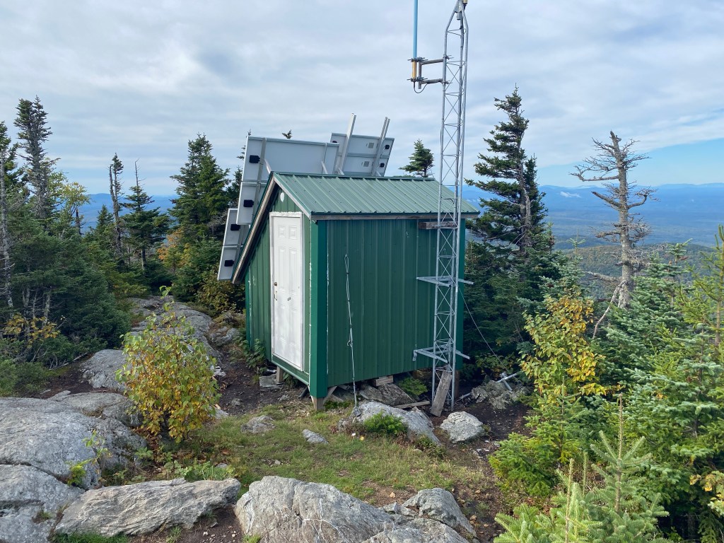
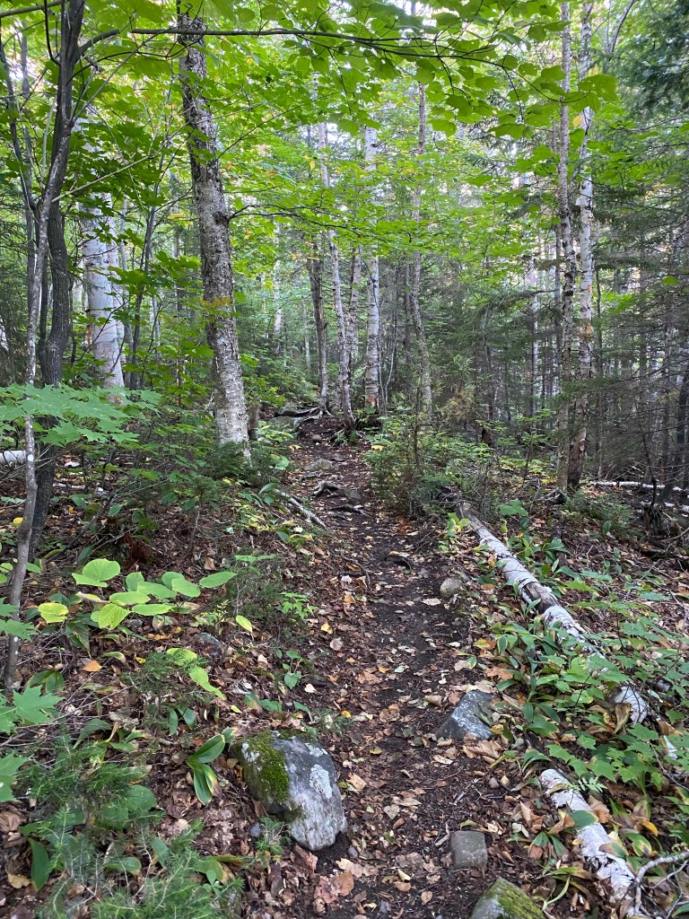
I was awake before the sun and broke down camp in the dark with the aid of my lantern and flashlight. I timed it all just about perfect and the first morning light started to filter through the trees just as I was about to get ready to leave. One of the things in my favor for this hike is that the trailhead was super close to the State Park where I’d been camping and I pulled to the side of the dirt road where I needed to be at 6:45 AM. Weather conditions were good for now, but the forecast was calling for showers after noon and thunderstorms in the late afternoon. So my plan was to hit the trail early and try to get it in before the weather hit. There was no way I was doing this hike in anything less than six hours so I figured if I’m on the trail at 7 AM and everything goes right, I can be out by 1 PM or so. The first 1.8 miles of the hike leads to the summit of the very popular Number Four Mountain, elevation 2,890 feet, featuring a fire tower and magnificent views towards both Lily Bay Mountain and my target for the day …Baker Mountain. My legs still felt good and I was in prime hiking condition to blast up the sometimes steep trail to the summit. My photo time stamp indicates I was on top of Number Four Mountain at 7:49 AM with the sweat already pouring off of me. From here, the one way mileage to Baker’s 3,520-foot summit would be 4.7 miles (one way) along an somewhat uncertain route. To be sure, I knew that Baker is much easier than it used to be. Prior to 2015, there was no established way to attain the summit. In hiking terminology, it was a true bushwhack. But in 2015, the State of Maine decided to construct a trail from Number Four Mountain to Baker. Except they didn’t entirely finish it. The intel I had from a June New England Trail Conditions report indicated that the trail leading from Number Four towards Baker was solid for the first 1.5 miles, after which point the blue paint blazes that mark the way simply stop as does any effort at trail maintenance. For the next mile or so, there would be a lot of blowdown and nothing to mark the way although the route followed a logical boundary swath of some variety. Eventually it would meet up with a snowmobile trail with a wooden sign pointing the way towards the summit of Baker along a herd path in another 2.1 miles. So I knew what I had to do, but between the questionable and very remote route, the looming weather and the big mileage, I’d be lying if I said I wasn’t feeling a little intimidated. So I put on my big game face and started down the trail towards Baker.


I cruised easily along for the first 1.5 miles as I knew I would. The trail was very well marked and well maintained during this section in addition to being either downhill or flat. But I knew that would soon be coming to an end. Or so I thought. Sometimes the mountain gods are cruel towards you and sometimes they smile on you. Today, they would smile. As I reached the area that was supposed to be unmaintained and unmarked, I soon noticed some sawdust on the ground as well as what appeared to be a fresh chainsaw cut. Then another area of sawdust and fresh cuts. “Well, doesn’t the blue paint blaze on that tree look fresh?” And so it went. Fresh cutting and paint that barely looked dry for as far as the eye could see. The State of Maine had been here and I would bet my last dollar that the right person had seen the very same trail conditions report that I had seen. “Hey Ed, I thought the trail to Baker was finished.” “Um yeah, Bob, about that …” Whatever the actual story, I was now benefiting from the very recent trail cutting activity and continued to make fantastic time all the way to the junction with the herd path that was marked by a large red diamond nailed to a tree at the junction. On top of that, the sun was shining, at least for now.


From here, the path led uphill and more resembled a lightly used trail than a herd path. The State of Maine had been through here as well with fresh cuts in several critical spots along the way. So the route that I was expecting to be a weak single at best turned out to be a home run. I took a summit selfie at 9:46 AM having covered the entire seven miles from the trailhead in two hours and 45 minutes. I was the first person to sign the register within the summit canister in a month so it’s entirely possible that I was the very first person to benefit from the substantial trail cutting activity that I observed. Upon arriving home a few days later, I would be more than happy to post the update on my favorite Northeast mountain website. From here, it was simply a matter of turning around and heading back the way I came. The weather remained good all the way back to Number Four Mountain before the rain rolled in. Got caught in a pretty good downpour in my final mile but it was all good. Four mountains down, one to go.


You Can’t Get There From Here
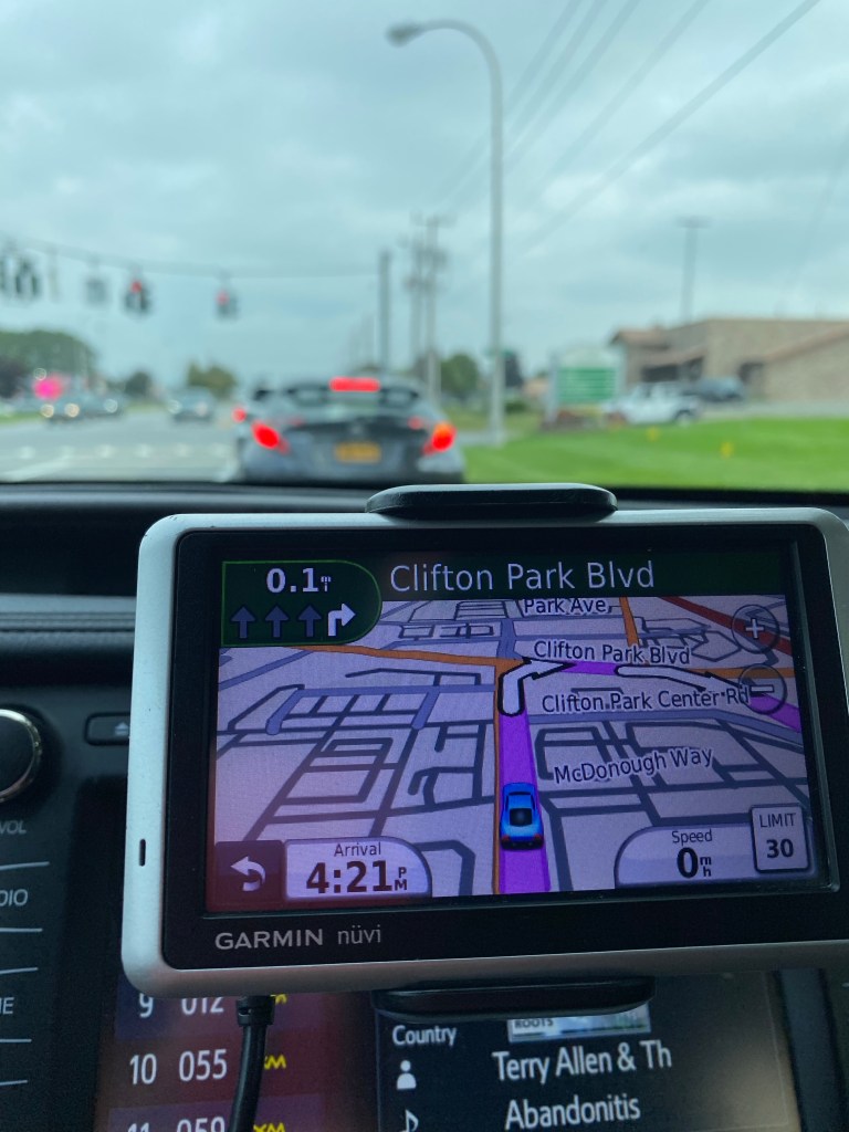
Anyone who is familiar with travel through interior sections of Maine has certainly heard the old New England expression often attributed to the Pine Tree State … “You can’t get there from here.” A funny little quip to be sure but also very applicable to my current situation. With all of my Greenville area hikes complete, I now wanted to get to Baxter State Park near Millinocket for my hike of Doubletop the next day. For all of the planning I did for this trip, this was the part of the trip I had planned the least. In fact I had done zero planning. A gap in the whole process that now had to be plugged. During a text exchange with my wife during my descent from Number Four Mountain, I asked her to find me a couple of candidates for campgrounds near Baxter State Park. And now the mission was to physically get myself there. I plugged an address for Millinocket into my GPS and it indicated that Baxter State Park headquarters lay just 38 miles as the crow flies from my current location. But the directions were clearly following all dirt roads and it was going to take close to two hours. Nah. So I drove back to Greenville from the trailhead (15 miles or so) and tried again. Still dirt roads. So out come the maps. Damn. There’s literally no easy way to do this. If I were to drive back to I-95 and go that way, it was going to take close to three hours. Or I could drive a convoluted route that stuck to the paved roads and was still going to take over two hours. The current dirt road route was giving me an ETA of about an hour and a half. Oh, what the heck. I had come to Maine for adventure so I was now about to have a driving adventure. As I followed the GPS route, minutes slowly but steadily got added to my arrival time as I stayed below the 35 MPH speed limit on the rutted back roads. The houses got fewer and further between until there were no more. But the roads stayed decent enough. Not like many of the one lane dirt roads I’ve taken to “trailheads” in Maine where grass grows between the tire tracks.

After 45 minutes or so, I spied a bend in the road with the first structure I’d seen in many miles. Two flags hung from the front porch area. “Is that a store? Why would there be a store way out here?” As I bore right to pass the structure and continue on my way, I then observed a string with multi-colored flags hung completely across the road and also saw a sign telling me to stop at the gatehouse and register. What the heck? Did I just step into a Stephen King novel? Well, as it turned out, I had stumbled upon the Ki Jo-Mary Multiple Use Forest, a place that I never knew existed before this very moment. But now here I was talking to a kindly older Maine woman. “Did your GPS tell you to come this way?” “Did your GPS also tell you there would be a toll you’d have to stop and pay? “We should pay Garmin for all the business they send our way.” Oh, she was a talker. “You save 65-70 miles by coming this way but I’m not sure you save any time.” And the process for registering me was not fast. She asked me enough questions about myself that she could have quite easily pulled off an identity theft if she was later inclined. “SUMMIT50,” she said after seeing my license plate. “Does that mean you want to climb 50 mountains or that you already have?” “I have actually been to the highest point in all 50 states,” I responded. “From Denali to Katahdin to the high point of Florida and everything in between.” Well, that interested her and talk about that we did. But, of course, the internet was down and when she clicked the submit button with all of my information, her computer did not respond. “Buffering.” “Well, I guess we’ll just have to start all over again by hand.” Honestly, the entire affair felt like a scene from a comedy with Will Ferrell cast as me. After about 20-25 minutes, she finally collected my $16 fee and I was back on my way. In another 15 miles or so, I reached the gatehouse on the opposite end of the Multiple Use Forest and quickly and quietly turned in my form as I’d been instructed to do.

My photo stream tells me that my tent was up at my new campsite eight miles from the southern entrance to Baxter State Park at 5:18 PM. It had been a big day. The kind of day that bumped this trip up from fun to epic. And it ended with an interesting encounter with a moose on the road adjacent to my tent site. I’ll simply say that when a young bull moose grunts and then makes a deliberate move straight in your direction, it’s probably best to get the heck out of the way.


Doubletop – September 19, 2021
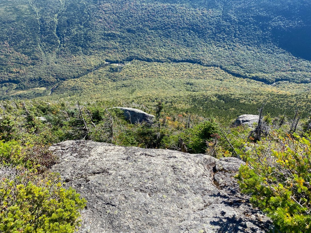
Up and out in the dark once again. For the second morning in a row, I broke down my campsite in the glow of my flashlight and lantern. This time not because I had a big hiking agenda but rather because the gate to Baxter State Park opens at 6 AM and I knew the cars would be lining up early on what was forecast to be a beautiful mid-September Sunday. I rolled up and took my place in line at 5:15 AM with about 20 cars waiting in front of me. Not bad. I figured I would be processed through within 30-45 minutes of the gate opening but it turned out to be quicker than that as many of the cars in front of me were sent to the waiting lane. They had come to hike Katahdin, no doubt, and did not have the requisite parking reservations so were sent to the side. No such problem for me. Doubletop is an outstanding and well-known feature within BSP but quite simply is not on much of anyone’s radar to climb. After getting through the gate and driving 10 miles on the park’s dirt tote road, I arrived at the trailhead just after 7 AM. Perfect. The agenda for the day was to complete the 9 mile round trip hike to the spectacular summit of Doubletop and then start the long drive home. I would have the mountain completely to myself for most of the morning. I crossed paths with one trail runner early on but then didn’t see anyone else until I was well into my descent. Doubletop by either the approach from the south or the north is difficult in spots because of its pyramidical peak that becomes quite steep – as in handholds required – in its upper reaches. I chose the southern approach mostly because although the round trip hiking mileage is a little longer, it is seven miles closer to the park entrance. I reasoned that I would rather spend extra time on the trail than in the car. I would not be disappointed with my decision. The first section of the trail is quite flat with an approach hike of about 1.5 miles that affords some spectacular glimpses of the mountain you are about to climb. I found myself staring at the impressive summit cone of Doubletop wondering just what exact route the trail would follow to get to the summit. Ultimately, I decided it would have to cut back across the southern face in an east to west fashion before ascending from a saddle on the west side of the peak. Any other way would simply be too steep for this to fall into the category of a “hike.” And this, in fact, is just what the trail did.


The trail was wetter than I expected and the grades gradually steepened until I reached the summit push. During the last half of a mile or so, the trail gained 900 feet in elevation and some acrobatics were required on the cold wet rock. Being on the west side of the mountain, none of this area had yet seen any sunlight for the day and the temperature difference was noticeable. I occasionally glanced back down on areas I had just scrambled up and had the thought that down climbing was going to be tricky. But summit fever had kicked in. “I’ll worry about the descent during the descent.” I pushed on and soon reached the summit of the south peak at about 9:30 AM. I then completed the airy traverse to the higher and true north summit of Doubletop 15 minutes later. A picture perfect morning it was and I raised my arms in triumph not just for reaching this peak but because I had nailed the entire trip. Five for five. Check. It was now time to get myself home. The first part of the descent was just as tricky as I’d suspected but I put on my gloves and worked my way through it. I was back at my car by 1 PM and enjoyed my lunch in the parking lot before heading south. I got back home somewhere around 11 PM, having decided to just push through. Another long day but well worth it all.


With the successful trip, I have now reached the summits of 53 of the 55 Northeast 2,000-foot prominence peaks. So there is still some work to do and I am hoping to get back to Maine early next summer to finish the job. The two peaks that remain – Kibby and Boundary Bald – are in close proximity to one another near the Maine/Quebec border. It is possible that they could both be done on the same day, one as a morning hike and the other in the afternoon. There is also the matter of nearby Caribou Mountain, whose 3,640-foot summit is measured by its highest contour … meaning that its actual summit elevation could be up to 19 feet higher. Kibby has a true summit elevation of 3,656 feet, meaning that Caribou COULD be higher and if-so would therefore steal the 2,000-foot prominence rights from Kibby. All intel I’ve seen supports Kibby as the higher peak … but still, I’m going to be right there, so why not? Anyway, back to the drawing board.


2 thoughts on “Maine 2021 – Solo P2K Peakbagging”