Some background first.
August of 2004.
I stood in the driveway of my childhood home that I had purchased just two years prior … now finding myself in the early stages of raising my own family in this familiar setting. My 12-year-old stepson was getting bigger and my wife and I had recently acquired a Chrysler Town and Country minivan that needed to be converted for wheelchair accessibility. We had located a company in Kalamazoo, Michigan for the job, but I would need to drive the van there for the conversion. Once complete, the van would be sent back to our area by train. For a fee.
I explained this all to my now-retired Dad as we chatted in the driveway. I also saw this as an opportunity to add to my state highpointing tally. At the time, I had reached 20 US State Highpoints and decided that once I dropped the van off in Kalamazoo, I would rent a car and attempt to reach the highest points in Michigan, Wisconsin and Minnesota. Mount Arvon, Timms Hill and Eagle Mountain to be exact, hopefully bumping my tally to 23.
“Want company?”
“Sure!”
And so began a whirlwind highpointing alliance that would see me and my Dad stand together atop 16 US States over the next two years. But that first trip was the most memorable and our first highpoint would be the Upper Peninsula’s Mount Arvon, elevation 1,979 feet and zenith of the Wolverine State.
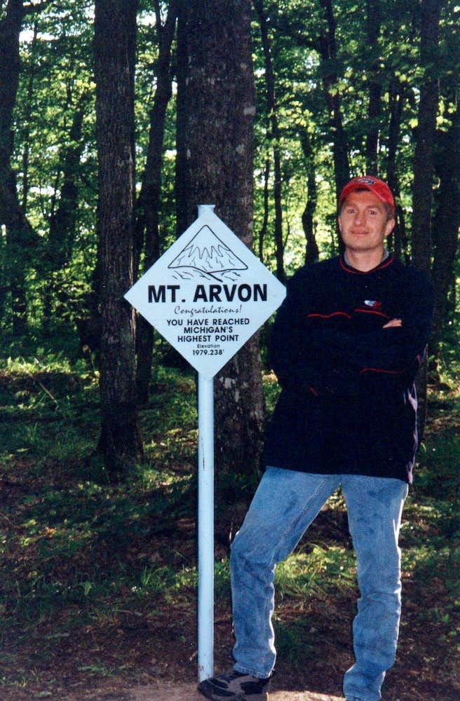
Until 1982, the summit of nearby Mount Curwood had for several decades been regarded as the top of Michigan. But a USGS survey that year determined Mount Arvon was 11 inches taller than Curwood. Not much of a difference but there can only be one highest point in Michigan. And that point – according to the best, latest and most official data – was on Mount Arvon. The smallest margin between the highest and second highest points in any state.
Now, in retrospect, I should have had the foresight to consider that “someday” in the future there could be yet another survey that might produce a slightly different result. Less than a foot is certainly within the margin of error. But I really wasn’t into going after second highest mountains at that point in my life, no matter how slim the margin.
And of course, sometimes “someday” never comes, as Alan Jackson once sang in a famous country song about lost love.
In this case, however, “someday” did come.
December 1st, 2025 to be exact.
I sat in my usual spot on the couch of my home of over 40 total years and sipped my morning coffee while making the rounds of my usual internet haunts. My own family is now mostly grown. My disabled stepson – now 33 – recently moved away to a nearby group home. We still own a converted wheelchair minivan all of these years later … just not the same one as I’d driven to Kalamazoo 21 short years ago.
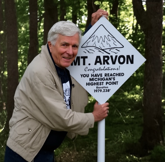
The news crossed my screen and would spread through the state highpointing community that day like a western wildfire. Noted surveyor Eric Gilbertson announced to the outdoors world via Facebook that he had conducted his own private survey of Mounts Arvon and Curwood and found some inaccuracies in the 1982 survey that had incorrectly promoted Arvon to state highpoint status. He waited more than a year for his findings to be scientifically peer-reviewed before he dropped the results of his findings.

Long story short, Mount Curwood once again reigns supreme as the highpoint of Michigan … by four measly inches over Mount Arvon. Wow!
Major mountain websites Lists of John (LOJ) and Peakbagger quickly updated their state highpoint lists as I watched my number of completed highpoints drop to 49/50 on my personal LOJ page. Meanwhile, the far more measured and cautious Highpointers Club and Highpointers Foundation essentially declared that they would wait for either official recognition of the survey from the state of Michigan or for a government-run resurvey of the two mountains.
Controversy.
Despite the hubbub, I knew I was “grandfathered in” as the saying goes. At the time of my 2004 ascent of Mount Arvon, it was believed to be the highpoint of Michigan and I remained well-aware that the so-called official scorekeepers would always recognize my status as a 50 completer. It’s just how this peak-bagging game works.

But still.
I wasted no time in planning a trip to Mount Curwood. Winter was young (technically still late fall) and it was a good time to go for it. As in now. Wait another four or six weeks and the snowpack would potentially become too deep. And then would come the sloppy spring melt followed by mud season. And bugs. Realistically, it came down to either embracing the December dark and cold or waiting until mid-summer. I decided that six to eight months of this all spinning around in my head was too much to bear.
I consulted with my wife, looked at my work and family schedule and penciled in a trip to Michigan’s Upper Peninsula beginning on the afternoon of December 17th. I reserved a rental car for the 1,150 mile one-way drive to L’Anse, Michigan and booked hotel/motel rooms for my first two nights away from home.
And then I watched the weather and waited, ready to cancel in the event of a major trip-ruining winter storm. In the meantime, I read every Mount Curwood trip report I could find and studied the maze of dirt and logging roads north of L’Anse where both Mounts Arvon and Curwood are situated.
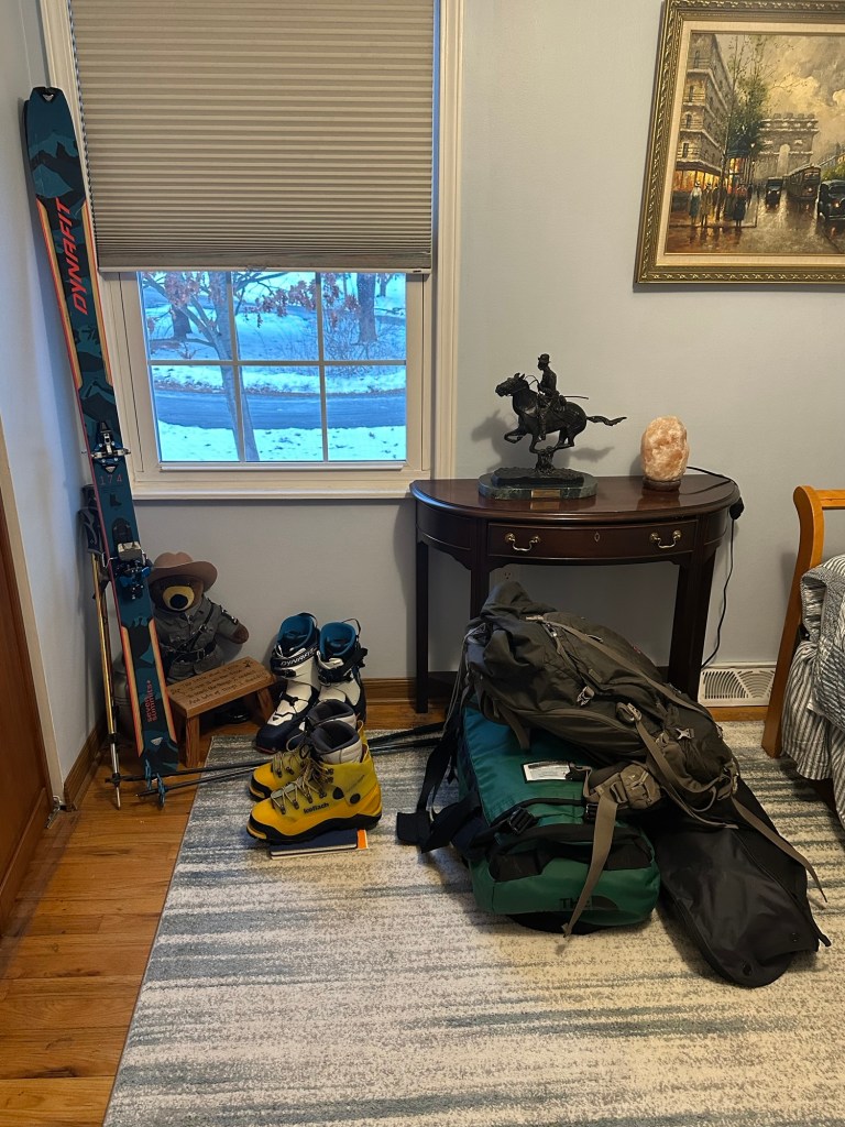
Nobody seems to hike Mount Curwood in the winter but I made a reasonable determination that I would be able to get within 4.7 miles of the summit by car. I busted out my Koflach Arctic Expe double boots that I’d worn on mountains like Denali and Rainier and packed for hardcore cold. I also decided to bring both snowshoes and touring skis and then make a game-time decision based on the conditions I encountered on the ground. Although my Dad passed away in 2022, his sage advice to “keep your options open” still resounds within me.
December 19th became the target date for my hike and the weather forecast remained mostly favorable. It would be cold with some expected wind and snow but nothing out of the norm for the U.P. of Michigan in December.
I awoke at noon on the 17th after having worked an overnight shift and was on the road by 2 PM. I was extremely relaxed as I love the open highway and knew that my only job for the next two days would be to cover the 17-18 hour drive to L’Anse. I arrived at a Hilton Garden Inn in downtown Cleveland (directly adjacent to Progressive Field) a little after 9 PM and enjoyed a healthy dose of Chianti before calling it a night.
The long and leisurely drive continued the following morning beginning right around 7:30 AM. I texted my sister birthday wishes somewhere around Ann Arbor after crossing into Michigan for the biggest stretch of the drive that brought me all the way north to the Mackinac Bridge before crossing onto the Upper Peninsula for another 230 or so miles of travel before reaching L’Anse. 550 miles of Michigan. Thankfully, the weather was very agreeable with slightly above average temperatures and occasional rain.

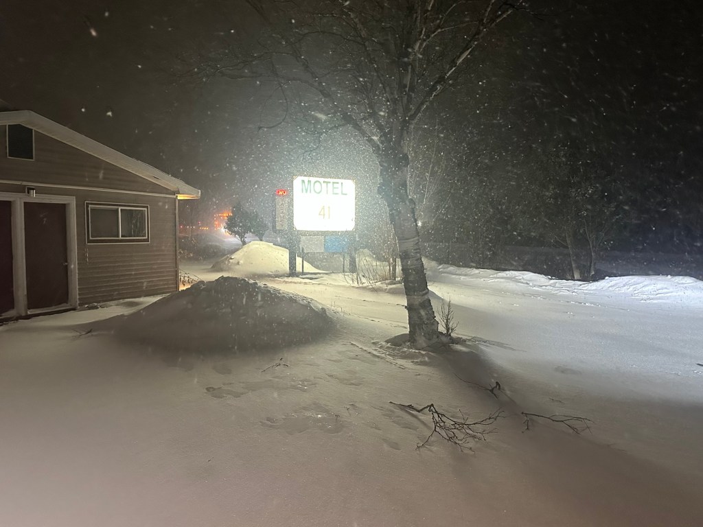
I arrived the Motel 41 in L’Anse at about 5:30 PM. The room was small but had a comfortable bed. This would be all I’d need. I grabbed dinner from a nearby Subway, had text exchanges with both my sister and wife and then called it a night.
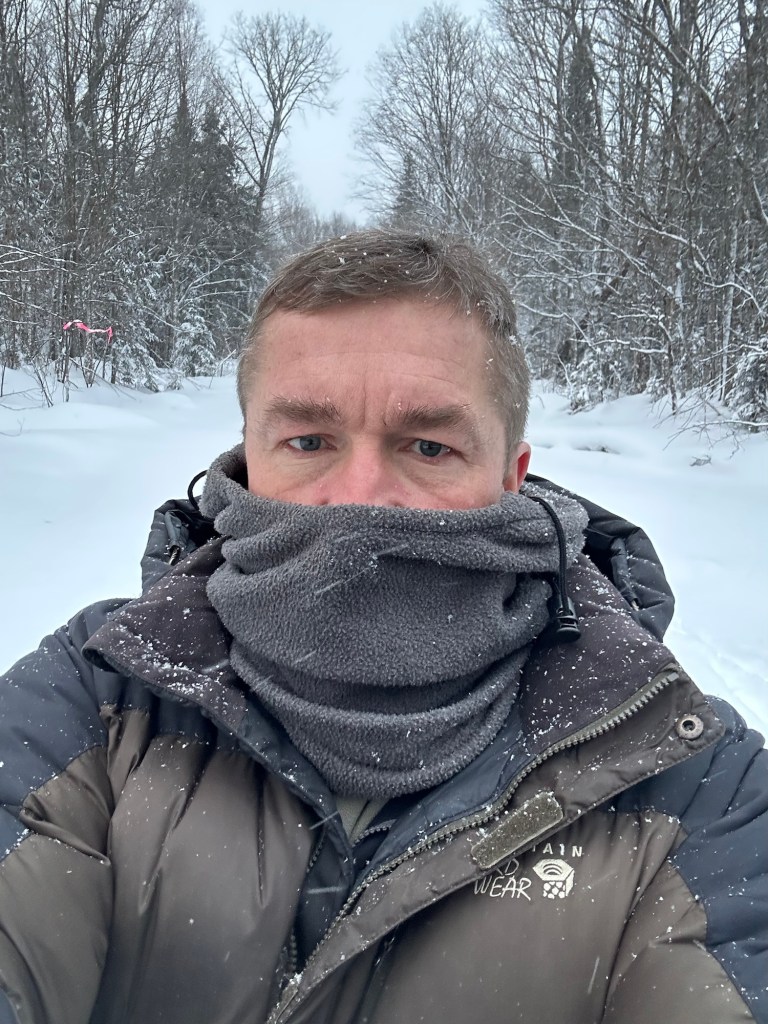
Bone-chilling cold and snow moved in overnight and I had to clear several inches of powder off my rental car before heading to the Burger King in town for my breakfast of champions. I was back at the Motel 41 by 7:30 AM with still an hour to go before sunrise. Although far west of my home in New York, all but four counties on the Upper Peninsula remain in the Eastern time zone, meaning that the sun rises and sets far later than in New York’s Capital District.
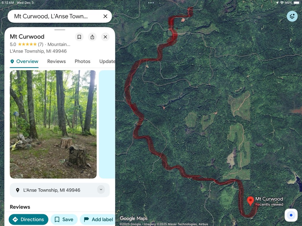
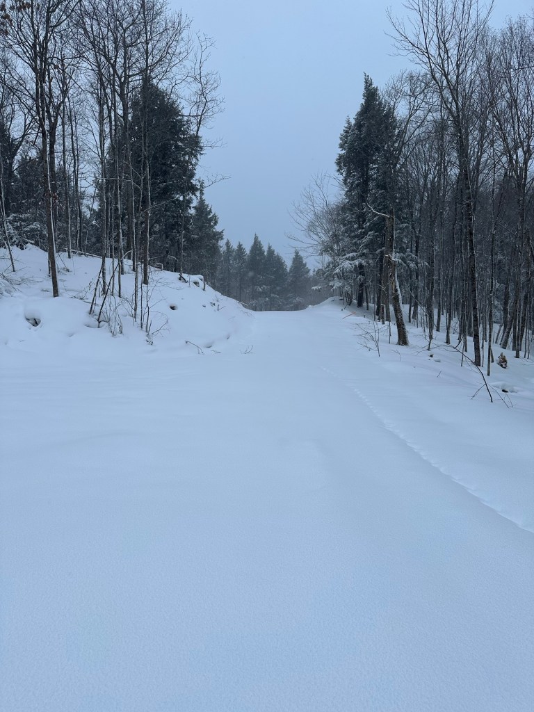
I waited until about 8:10 AM to begin my drive towards Mount Curwood. I was heading into the unknown and wanted to be sure I could see what I was driving through. The first 3.6 miles along Dynamite Hill Road were no issue. The road was wide and plowed with light traffic flowing in each direction. I bore right onto Indian Road at a Y-intersection and then stayed left onto Silver Road, again with no difficulties. At some point, the roadway turned from pavement to dirt but it didn’t really make a difference to me as the main surface was covered with a thin coat of snow. Clearly, these roads were regularly maintained and dotted with periodic residences.
The total mileage I wanted to cover between Route 41 and where I hoped to park came in at 11 miles. I anxiously watched the number tick down on my Apple map. Silver Road narrowed to the width of a single vehicle but signs of very recent “one pass” plowing activity with snow banks on each side of the road left me feeling encouraged. I was essentially on a logging road right-of-way and logic dictated that the minimal maintenance would continue until the intersection I hoped to reach.
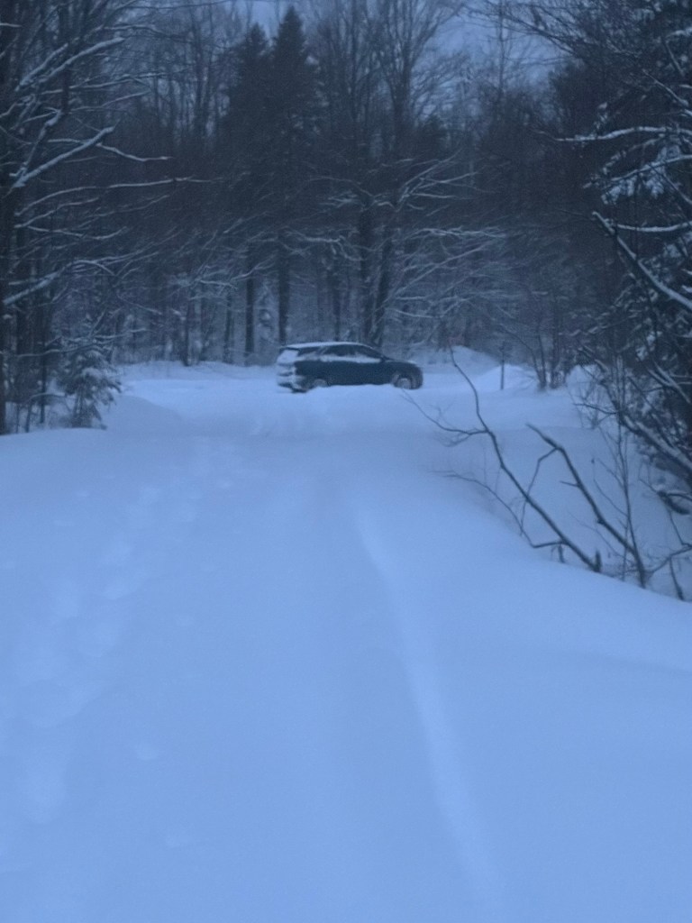
Finally, pay-dirt! Or maybe pay-snow. The day’s first major victory. I snapped a photo of my parked rental car at the key intersection at 8:58 AM. The plowed right-of-way continued straight ahead but the route to Mount Curwood led to my right along a dead end out-of-season network of logging roads that offered no chance for vehicular travel.

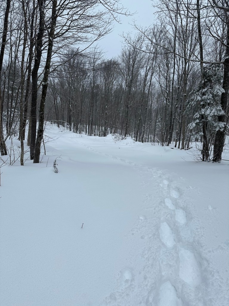
I quickly judged the terrain and snow conditions were not ideal for my touring skis. Atlas 1230 snowshoes it would be. I geared up and set off down the road into vigorous adventure. Just 4.7 miles remaining to the top of Michigan.
Full of morning energy, I happily bounded down the road at first, getting a feel for the snow conditions. Oof. A layer of several inches of fresh powder lay atop a thin crust with thicker, older snow lying underneath. This had in part been caused by the previous day’s rain and warmer temperatures followed by the overnight hard freeze and snow. It felt awkward as my snowshoes sank through the new fluff and then continuously broke through the crust at strange angles, both slowing my progress and methodically sapping my energy.
The other issue I faced was navigation. I had a variety of options but chose to stick with the Apple map on my iPhone. To my surprise, I found while still at home that I could simply enter “Mount Curwood” and it would lead me to the top. In warmer months, I would have been able to drive all the way to the summit barring any felled trees or other obstacles. Perhaps, this is how surveyor Eric Gilbertson was able to get all of his surveying equipment up there. I kept the Map App open and consulted my iPhone anytime I reached a junction … and there were plenty. I also carried a portable charger in my backpack should battery life become an issue.
Progress was painstakingly slow but steady. Temperatures remained in the 10-15 Fahrenheit range with intermittent light snow and moderate to strong wind in the more open and exposed areas. I took my first real break after having covered about 2.5 miles and was already feeling sluggish. One 32 ounce bottle of orange gatorade later, I was back on my way.
With the moderate gain in elevation, the depth of the snow had increased and trail-breaking became increasingly laborious. My one big mistake came with about 1.4 miles left to the summit. I was in full “embrace the suck” mode with my head down and completely missed a junction, thus taking the wrong fork. The route I was on now steepened with the deepest snow of the day. I plodded on, determined not to look at my remaining mileage until it felt like I had no more than a mile left. And when I finally consulted my Apple map, I saw that I was off course, way too far to the right of where I wanted to be. Damn. Adrenaline flowed and a little bit of mild panic set it. Time and daylight were going to be an issue.
I backtracked to the obvious intersection I had missed at the 1.4 miles-to-go mark, having wasted about 30 minutes due to the error. More importantly, the wasted physical effort concerned me.
“You can still do this, Mark.” My focus intensified but forward progress slowed to a crawl. Several more confusing intersections needed to be assessed but my Apple map remained true. I had set 1 PM as a loose turn around time, but 1 PM came and went. I was closing in and defeat at this point was not an acceptable option.

I neared the top and began to glance through the trees for any indication of the summit area but saw nothing even as the route began to flatten out. I finally reached the end of the road and caught a glimpse of the white summit sign and blue register box. I had to loop back somewhat to reach the summit area and snapped a victory selfie at 1:52 PM, nearly five full hours after parking the rental car and 48 hours since leaving my New York residence.
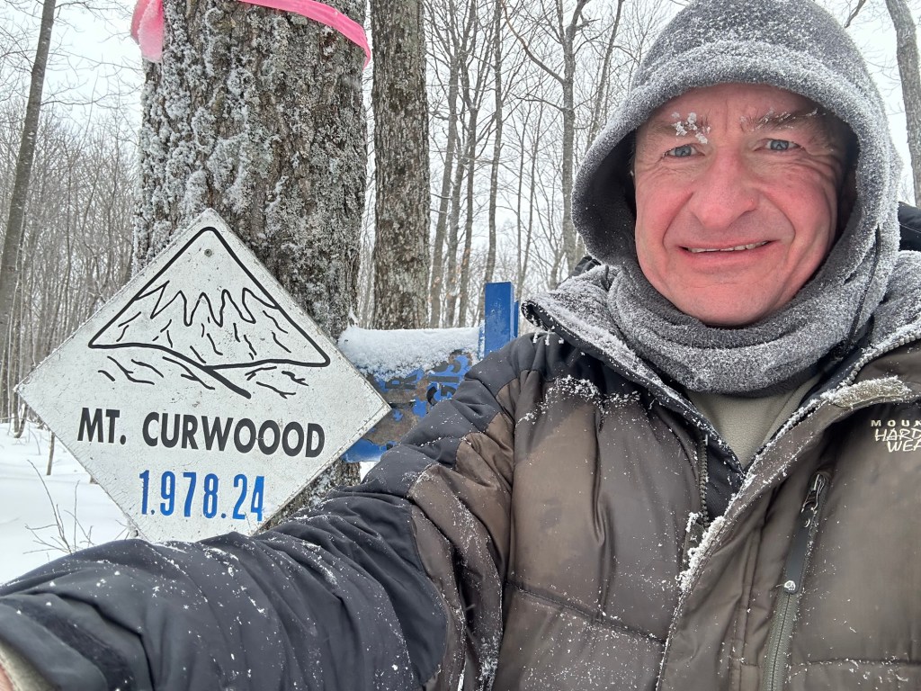
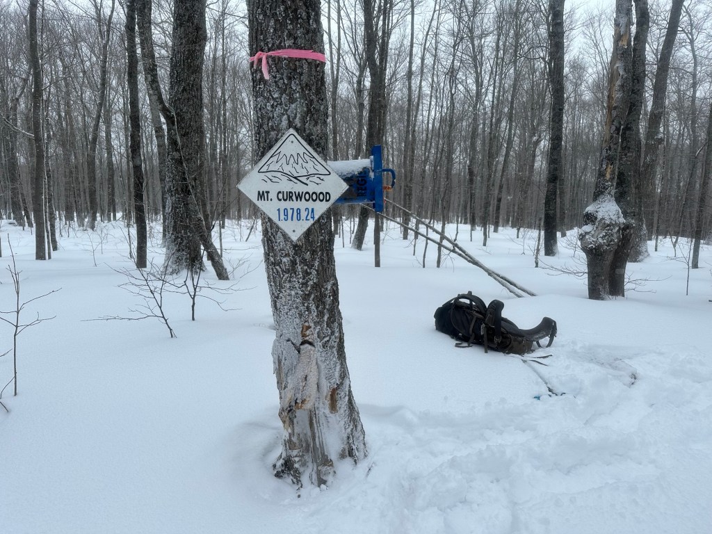
The snowshoe hike to Michigan’s newly-crowned zenith had not been dramatic in any way. It was just a far slower and much more physically-draining plod than I had envisioned while sitting on the couch in the warmth of my home. I spent about 15 minutes atop Mount Curwood, signing the summit register and sucking down another partially frozen bottle of gatorade for energy.

Sunset was scheduled for about 5:30 PM. I knew I’d move faster downhill and had my own tracks to follow … but still, it was going to be tight. Fortunately, I had packed a high-end headlamp with extra batteries so I was comfortable with potentially completing the last bit of the hike in the dark if it came to it.
It was about 3 PM when I texted my wife my first progress report since parking the car that morning: “Just checking in. Made the summit and am maybe a mile into the descent. May finish in the dark. Hard work, slow-going. Tired but otherwise OK.”
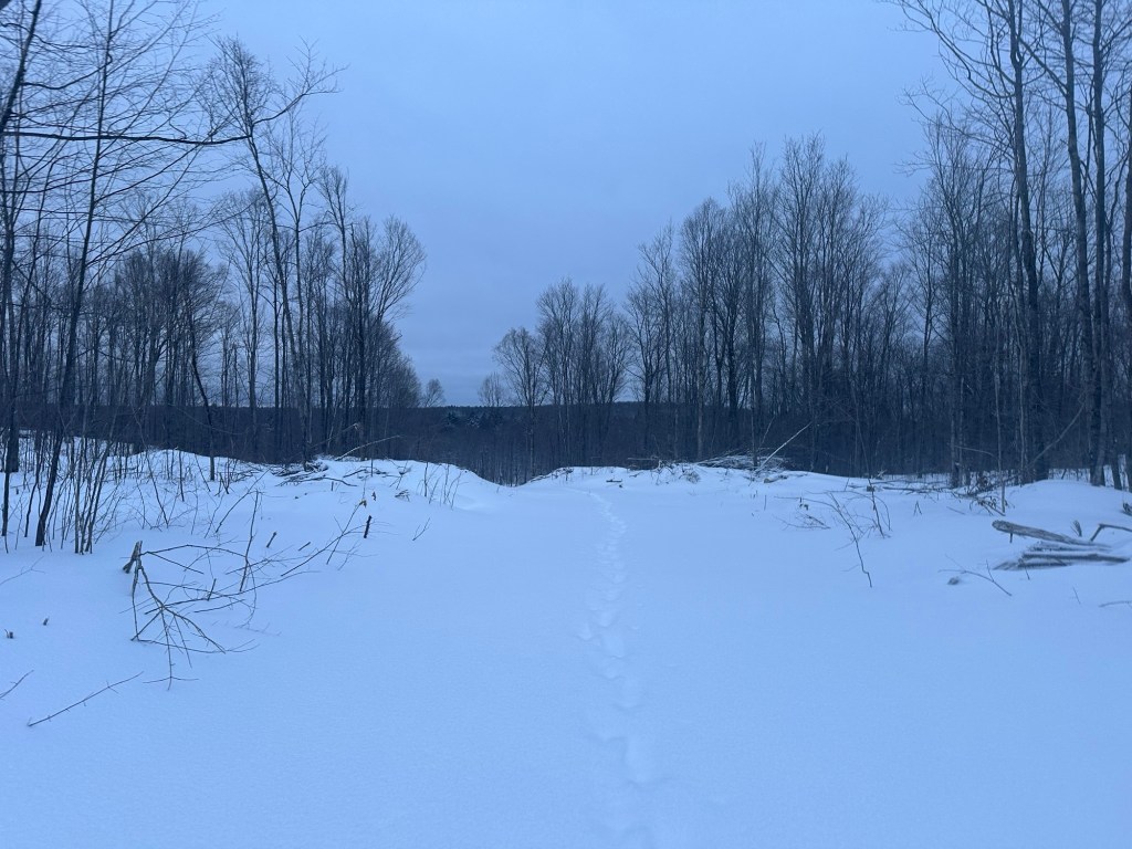
The wind and snow had cleared my ascent tracks in some spots, but I was always able to see far enough ahead to where they could be followed again. Not only that, but the route-finding choices going downhill were far more obvious than during the ascent.
I decided I wanted to beat the dark and my pace picked up in the final two miles back to the car. This was, after all, the easiest part of the day with snow depth steadily decreasing during the downhill trek. Finally, at 5:29 PM, I rounded a corner and eyeballed my rental car as the last bit of daylight faded. By the time I removed my snowshoes and cleaned the day’s fresh snow off the car, it was pitch black.
I enjoyed a victory meal at that same Burger King in town and made arrangements to stay a second night at the Motel 41. At 6 AM the following morning, in moderate to heavy snow conditions, I left L’Anse behind for the last time and began the long drive home, completing it in one continuous 18 hour push.
It had proven to be an excellent adventure.
*Author’s Note – Reliable information indicates that the final few miles of my driving route on Silver Road are not continuously maintained throughout the winter.*
