The name first crossed my radar in late 1997 as I found myself completing an application for membership into the 111ers of the Northeastern USA. At 28 years old, I had just finished climbing all of the required 4,000-foot peaks in New York, Vermont, New Hampshire and Maine and excitedly looked forward to receiving my 111 patch and scroll.
“Have you climbed Mount Jacques Cartier?” the question read. “Well no, I haven’t,” I thought to myself. “What is and where is Mount Jacques Cartier?”
It took a bit of research as I was not yet connected to the World Wide Web, but I eventually discovered that Mount/Mont Jacques Cartier – at 4,160 feet – is the highest mountain in the Chic-Choc mountain range of the Gaspe Peninsula region of Quebec. The Chic-Chocs, as I would also learn, are the true northern geographic terminus of the Appalachian mountain chain. After that, the terrain quickly drops and descends into the Atlantic Ocean from this part of Quebec, north of the Canadian provinces of New Brunswick, Nova Scotia and Prince Edward Island.
A long way from home and certainly not a requirement for recognition as a Northeast 111er. But instead, it was kind of a badge of honor, feather-in-the-cap sort of peak.
Someday, I thought. Someday.

Weeks turned into months and months to years. At one point in the early 2000s, I hastily planned a trip to the Chic-Chocs for Mont Jacques Cartier and Mont Albert, the lower sub-4000-foot but equally well-renowned mountain in the region. But alas, I became very ill the day before I was to leave and cancelled the journey.
And then years turned to decades. I raised a whole family and hiked/climbed hundreds of more mountains all around the US. Mont Jacques Cartier always remained in the back of my mind but other mountain lists and goals repeatedly took precedent.
In 2024, I completed the New England Fifty Finest peaks and vowed that would be my final list. By that point, I had already started to look for other hobbies. I tried yoga for a while beginning in 2023 and kind of dug it. Joked with my wife about golf. But the mountains are who I am and before long I found myself thinking seriously about finally getting up to Gaspesie and setting foot on top of Mont Jacques Cartier.

And so on July 16th, 2025 – with a rental car packed with hiking and camping gear – I headed north. To Quebec! Let’s do this.
I had gotten off work at 6 AM that Wednesday morning and slept afterwards as I always do when working the graveyard shift. So it was about 3 PM by the time I finally hit the road at the start of my four day pass. A Hampton Inn & Suites on the outskirts of Quebec City would be my stopping point for the night before completing the second 5 1/2-hour leg of the journey the following day.

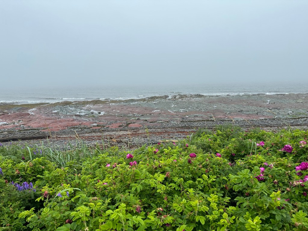
It proved to be a very relaxing and restful hotel stay and I woke up excited on Thursday morning. This was finally happening after all of these years. I took it all in as I worked my way north and east with the St. Lawrence Seaway just to my left as I-20 and then Route 132 followed the shoreline. For the summertime, the air had a chill, a nice break from an oppressive heat wave back home. A low maritime fog dominated this day.
It was approaching mid-afternoon by the time I tuned south onto Route 299 and headed towards Parc National de la Gaspesie, where I had a reservation at the Mont Jacques Cartier campground. The plan was to camp there for two nights, hiking Mont Jacques Cartier directly from my tent site on the first day and then breaking camp and heading back towards Park Headquarters for a hike of Mont Albert the following day.
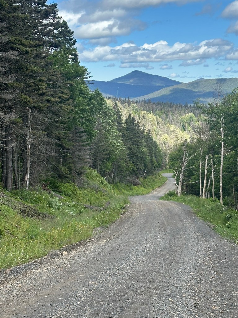
I drove through a fairly heavy downpour that ended just before I reached the main Visitor Center and had a few questions very politely answered by a friendly bilingual woman working the desk. I then began a 41.5 kilometer drive along the gravel Route 16 and arrived at the Mont Jacques Cartier campground around 4 PM. Campsite 18 to be exact.
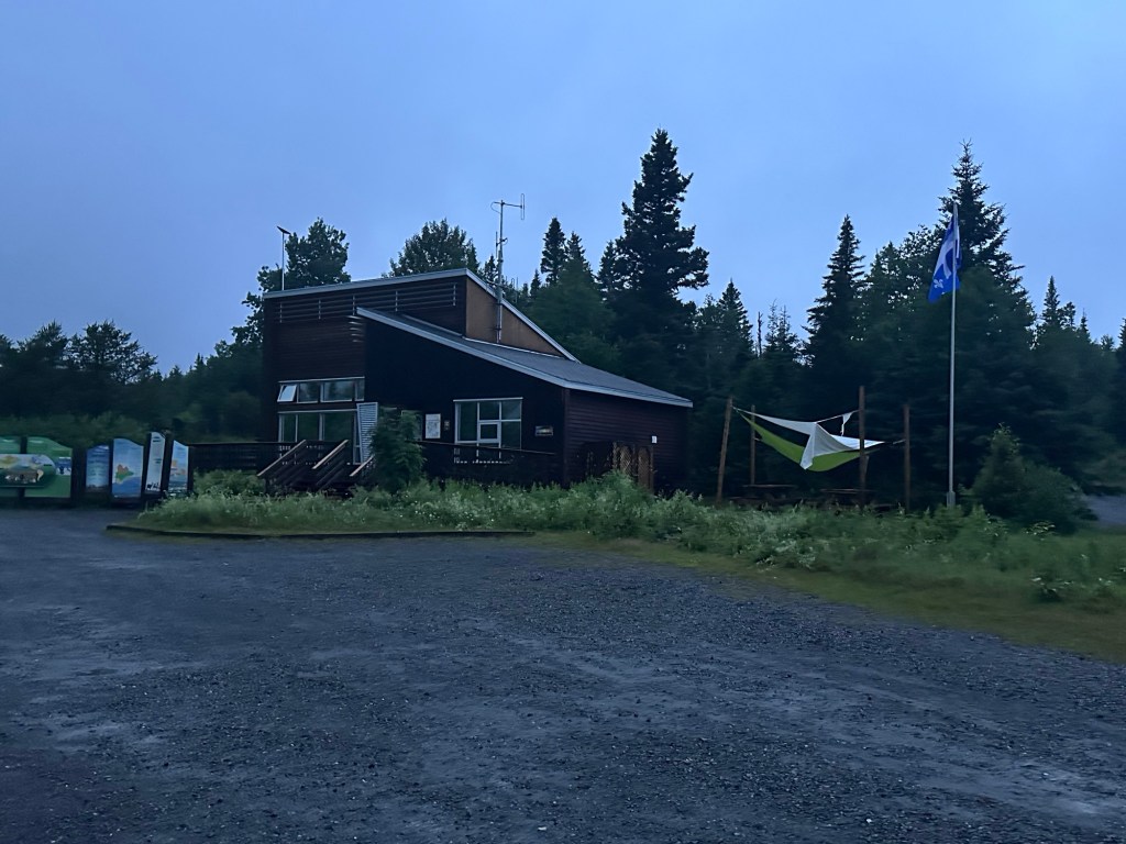
I had expected a primitive campsite being so deep into a National Park that restricts the hours that you can hike on Mont Jacques Cartier to between 10 AM and 4 PM to protect the caribou herd that lives high on the mountain. Instead, I was happy to find a full service campground with its own visitor center (including wifi) as well as running water and a shower. Cool.

I set up my large LL Bean dome tent about 10-15 feet from my rental car on a perfectly-sized flat site that included a picnic table and fire ring. I then went out exploring to find the access road I would be walking the following morning for my Mont Jacques Cartier hike and checked in with home from the porch of the visitor center, which had wifi Instructions conspicuously posted. I was also able to confirm breaking news that a potential workers strike by Sépaq employees – which would have shut down the campground the following night – had been averted with ratification of a new contract.
I was up with the early sun on Friday, July 18th. Being so far east in the time zone, sunrise came before 4:30 AM. Which would have been great for an early starter like myself except that I couldn’t start the trail part of this day’s hike until 10 AM because of the caribou thing.
It had rained heavily overnight and by morning, extreme wind had moved in. Not only did the wind manage to displace all six of my tent pegs but one gust got under the tent and flipped my large and heavyish North Face bag containing clothes and gear up onto the sleeping bag I was in. A harbinger of things to come.
I realized that my tent would be gone by the time I returned later that afternoon so broke it down and tossed it in the back of the car before setting off a little before 9 AM. I quickly reached the gated gravel access road to the Mont Jacques Cartier trailhead. Only Sépaq vehicles – including large hiker shuttle passenger vans that run in 20 minute intervals between 10 AM and 4 PM – are allowed to drive on the road. Meaning I would be walking an extra 4.1 kilometers each way bringing my total distance for the day to 16.8 kilometers. A solid outing.
I side-stepped the wire gate and started down the lane. The wind continued and blew straight into my face but by now it was accompanied by a pesky maritime drizzle. Fortunately, I had anticipated the possibility of unpleasant conditions and was dressed accordingly in my sturdy winter hiking pants (with UnderArmour leggings underneath) as well as three layers for my upper body. I wore a single rain jacket for now but also had a second North Face insulated shell stored in my backpack. Little did I know that I would need every bit of it.


Much to my surprise, the lonely gravel lane road walk to the trailhead featured more than marginal elevation gain. My campsite sat at exactly 1,856 feet in elevation as per my brand new Garmin GPSMAP 67i I was testing out. By the time I reached the trailhead proper, I was at about 2,600 feet according to my saved data. I had been the only pedestrian on this day and two fast-moving Sépaq shuttle vans zoomed by me within just a few hundred feet of the trailhead.
I reached the end of the road at exactly 9:52 AM as the two vans were unloading the first hikers of the day. A Ranger approached me and started to speak to me in French but quickly switched to English when he realized I couldn’t understand him.

“So you like to get wet?” he inquired, clearly puzzled by my choice to have not paid to ride the van.
“Well, I’m staying at the campground and it’s not that far of a walk. Is it OK to go on the trail yet?” I responded.
The young, friendly Ranger instructed me to wait 10 more minutes. I then went into the large hut at the trailhead along with 15 or 20 other hikers and listened to the Ranger’s speech, given in French.

After we all wandered back outside, the Ranger pulled me aside and gave me the salient points in English. He was most emphatic about a 2:30 turn around time so as to be off the mountain by 4 PM.
And down the trail we all went, quickly spacing out. I let everyone else go ahead of me as I wanted to hang out at the back so that I could stop for lots of photos without worrying about having other hikers in the shots. Also, at 56 years old, I’m not quite as speedy as I was a half of a lifetime ago when I finished the Northeast 111.


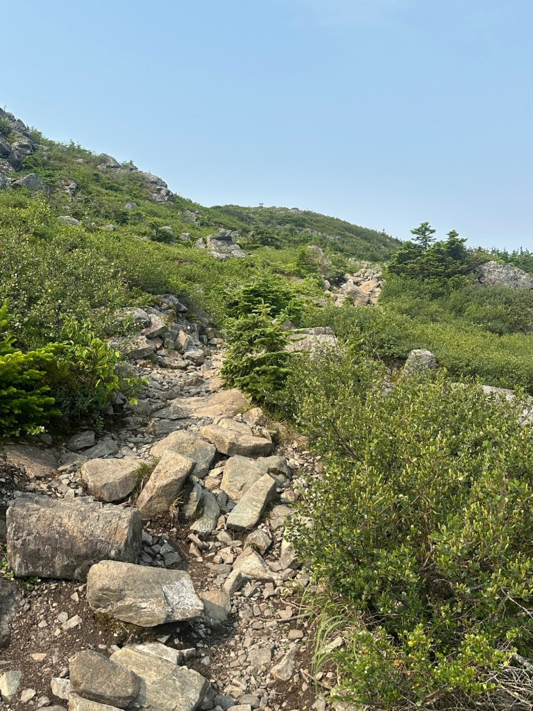
For now, I was protected from the wind by the mass of the mountain. In some some spots, rainwater flowed down the rocky trail with many areas of exposed bedrock. The grades remained mellow to moderate as things go with much of the 1,500-plus feet in total elevation gain being achieved in the first 2.8 kilometers of the 4.3 kilometer one way ascent.
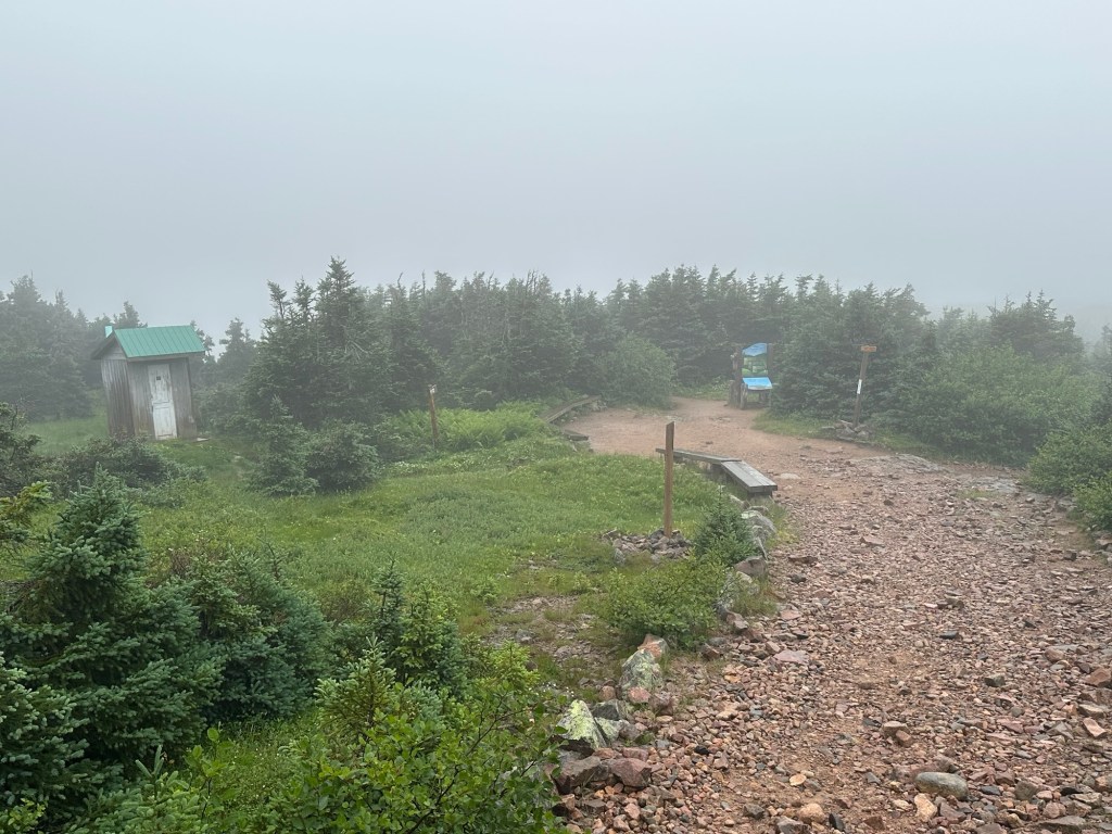
And then the nature of the hike changed. I passed a designated break area featuring a bench and outhouse and stopped only briefly to put on my insulated North Face jacket atop my rain jacket.
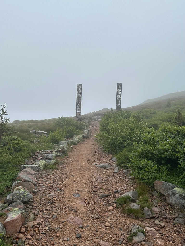
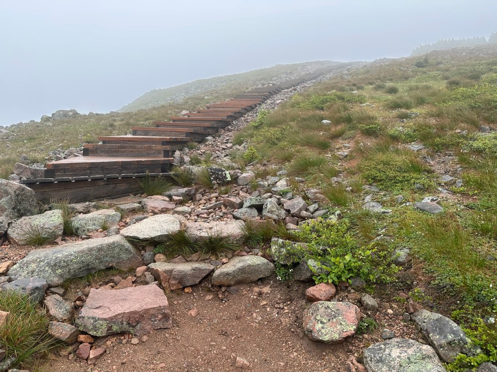
Beyond this point, I would see no mores trees all the way to the summit. Two magnificently-constructed wooden stairways led upwards. The wind increased to gale force.
The trail remained very wide and obvious, with signage directing hikers not to stray off the stone-lined pathway. I tried to stay on the right side as much as possible as gusts from the west regularly blew me to the left on the south-leading trail. My hands recessed inside my sleeves for warmth as I had not thought to bring gloves for my mid-July hike.

I was in it. Forward progress slowed to a crawl as the wind absolutely raked across the barren landscape. I grasped at my wildly flapping hood to keep it in place. I squinted as my eyes watered. Two skinny and faster-moving hikers hurried past me somewhere in the final kilometer to the summit, similarly grasping at their hoods with hands also recessed inside their sleeves. Wind chill was an issue.
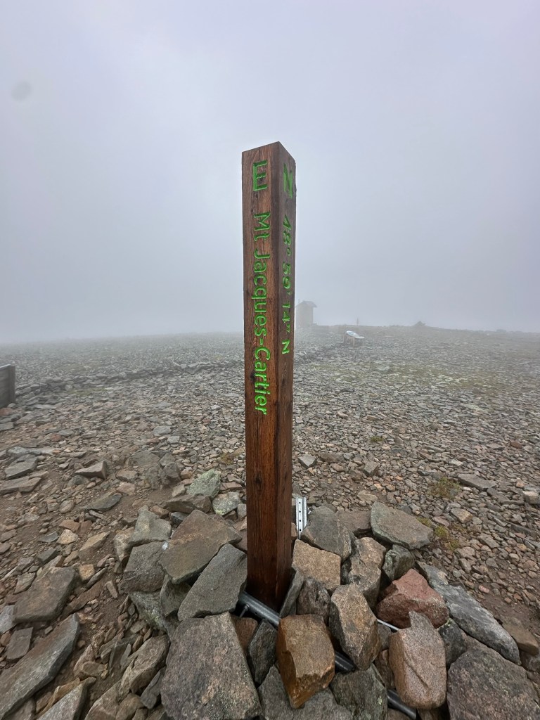
Finally, the summit shelter came into view. There was no one outside. I stopped to take a few summit photos and a quick selfie video. I tagged the true summit and then also went into the building which was packed with other hikers seeking protection from the elements. I went up the stairs to the second level, which was slightly less crowded but also slightly less warm. I sat on the bench and texted my wife via satellite about the ridiculousness of this current predicament.


Nearby, a few English-speaking teens took turns hugging the pipe of the wood stove, only half-jokingly muttering “warmth.” I assumed they were long-distance hikers as they had not been in the bus group at the trailhead. One offered me a slice of salami, which I accepted out of politeness.
After maybe 30 minutes, I rose from my perch and went back down the stairs to the jam-packed first level. I could see two other hikers getting ready to leave so waited to fall in behind them so the door would only need to be opened once.
And just like that I was back in it. I triple checked in the limited visibility to make sure I was headed back in the right direction. I didn’t want to be in this wind any longer than necessary. Two hikers in biker-style shorts passed me, their legs lobster red from the relentless battering from the wind.
Unbelievably, it seemed the wind speed had somehow increased. At times, the higher gusts made a low guttural sound unlike anything I’d heard in my life. When it first happened, I looked upwards for the airplane that sounded as if it were about to crash into the mountain. Eventually, I realized it was “just” the wind. I stopped for another quick video, this one narrated but all you can hear is the wind even though I was speaking quite loudly.
I noted to myself that there seemed to be almost no uphill traffic. Perhaps the Ranger I had spoken to earlier had shut down the mountain to further hiking for the day once he reached the summit plateau. The summit shelter was already at near capacity and I can’t imagine he would have wanted to start evicting folks to make room for new arrivers. The last hikers of the day I would pass were an elderly couple being badly blown all around. Upon making eye contact with each other, we all just started laughing. No words were necessary.
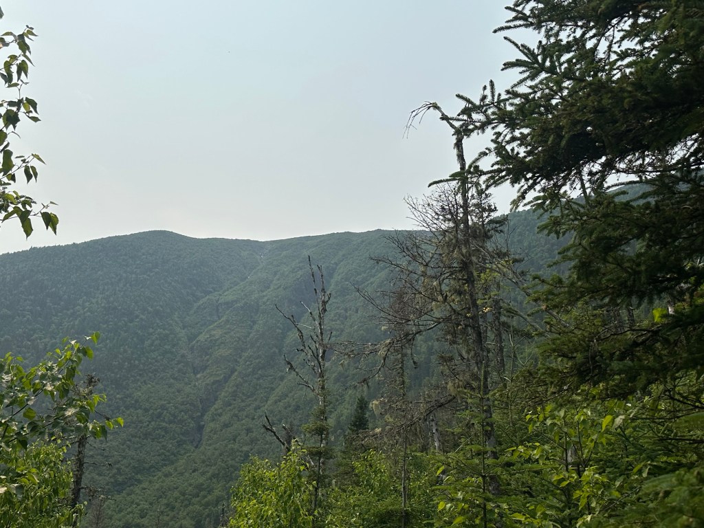
After what felt like an eternity, I dipped back below tree-line. The rain had completely stopped by this point and a few views could be picked out through the remaining clouds. One nearby slope appeared to still be holding a small patch of snow.
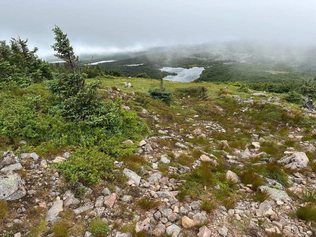

I arrived back at the trailhead just before 1:30 PM, making for about a 3.5 hour round trip on the 8.6 KM (5.3 miles) trail portion of the hike. About another 45 to 60 minutes of road walking still awaited. Conditions continued to clear and the wind began to die down as I made my way down the lane. Magnificent vistas opened up and I made back to my campsite uneventfully.

One down, one to go.
After re-erecting my tent, the evening passed uneventfully as I relaxed with some wine before going to sleep early. I was up once again with the early sun on Saturday morning and had my campsite completely broken down by 5:30 AM.
The ride back towards the National Park Visitor’s Center directly across the road from the Mont Albert trail was pleasant. It was a clear morning and I was able to fully appreciate the scenery along the 41.5 kilometer drive on the gravel Route 16. The evergreen growth on the sides of the road at time resembled a Christmas tree farm with one perfect specimen after another lining the way.


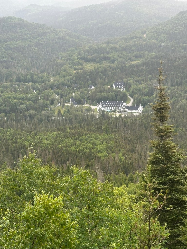
By 6:30 AM, I was back at the main Visitor Center and parked in the extremely large hiker parking lot. Mont Albert is not the only peak that can be hiked from here but is undoubtedly the main attraction. Between the easier accessibility and the far more pleasant weather conditions, I anticipated much more hiker traffic today than I had witnessed on Mont Jacques Cartier. Also, it was now the weekend.
But I was on the very early side, so enjoyed a good bit of solitude during the ascent. After fiddling around with my new GPS for a few minutes, I was on the trail by 6:40 AM. The trail construction was absolutely marvelous over the first couple of kilometers with easy grades and a deep erosion-resistant gravel bed. Unlike the previous day, I quickly found myself shedding layers and spent the rest of the day in just a wick-away T-shirt although I wore the same sturdy hiking pants as on Mont Jacques Cartier.
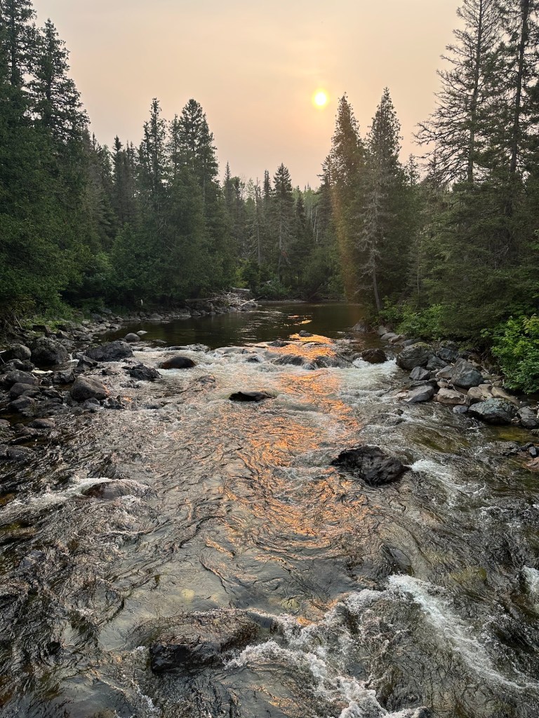
Some magnificent panoramas opened up but were partially softened by a Canadian wildfire smoke haze that apparently had been ushered in on the back side of the storm system from the day before.

The one-way distance for the Mont Albert hike is 5.8 KM and the hard-packed gravel trail continued for about the first half of it. Just a few minutes after passing the 3 KM to go sign, however, the trail crossed a wet rock slide area and took on a much more rugged nature. The grades of the trail steepened substantially. Although Mont Albert North rises to just 3,510 feet in elevation (the nearby true summit is off-limits due to ongoing restoration efforts), the trailhead sits about 2,000 feet lower than the Mont Jacques Cartier trailhead, making it pound-for-pound a more physically-rigorous hike requiring more than 2,800 feet in elevation gain.


I made my way through the contours at a relaxed pace and a few hikers caught up with me as I approached the summit. I noticed I had a good cell signal just a couple hundred of feet below the summit so stopped for 5-10 minutes to catch up with my wife. By the time it was all said and done, I was maybe the fourth person to summit that morning, reaching the top at 9:38 AM in clear and calm conditions. I had the top all to myself.


Similar to Mont Jacques Cartier, Mont Albert also has a substantial mountain-top plateau, but unlike Mont Jacques Cartier, I didn’t need to cross it to reach the summit. But I did decide to explore it a bit just for the added adventure. I took my time checking out the shore Lac Quiscale (a rare mountain top lake), snapped some photos of the true summit of Mont Albert and walked across a boardwalk leading to a fine vista. This time I was sure of it as I spied a lingering snowfield. Wow.


I made my way back to the summit and began my descent. As expected, even by the time I re-reached the north summit around 10:15 AM, a crowd was starting to form. During my hike down, I would estimate I passed no less than 150 upward-bound folks. I yielded each time, stepping to the side to allow passage where the trail was narrow and am quite sure that I have never said “bonjour” quite so many times in my life. By the end, I was even getting into it … “bonjouuuuur!”

Soon enough, I found myself back in my rented Mitsubishi Outlander Sport en route to the same Hampton Inn & Suites on the outskirts of Quebec City for the final night of my mini-adventure. The day’s great weather continued and I enjoyed the splendid ocean vistas to my right as I worked my way back west and south.
My first attempt at using the Garmin GPSMAP 67i was mostly successful save for some “learning curve” issues. First, I had failed to give Garmin proper permission to share tracking data with my wife and second I failed to save my track between hikes so that my total came out as if it were one big hike. So now I know. In any event, I logged 6,686 feet in elevation gain over 23.95 miles in 12 hours and 20 minutes on the move. Seems just a bit high on all accounts so it’s likely I had the tracking feature engaged during some of my walks around the campground. My primary purpose in purchasing the GPS is for use while attempting US Pacific Ocean territorial highpoints over the next few years. My journey to the Chic-Chocs of Quebec provided the perfect opportunity for a first experimental use.

