I’ll be honest. I didn’t know quite what to expect. My only previous visit to the Commonwealth of Puerto Rico had been in 2007 when it was a Port of Call on a cruise I took with my wife and kids. Old San Juan – certainly unique but only one small part of an island that is 100 miles long and 35 miles wide. I was also intrigued by its identity as a US Territory with a strong independent spirit. My goals for this short visit were simple: a) relax; b) ascend Cerro de Punta, the highpoint of the island; and c) break out of the tourist lane and get a feel for the flavor of Puerto Rico.

My travel partner for this trip was to be my father, a regular on my easier highpointing travels, but unfortunately he took ill the night before we were to leave and had to cancel. That meant I’d be going solo – a routine thing for me – so although I felt bad for my father, it was simply a matter of shifting into a different mindset as far as I was concerned.
My plane departed Newburgh airport just after noon on St. Patrick’s Day (March 17th, 2008). Everything in terms of the nuts and bolts of the travel went off very smoothly and I was thrilled just to have some down time after a very stressful week at work.
I had a switch of planes in Atlanta and started to get a feel for a bit of the culture of Puerto Rico before even arriving in San Juan. From the silent US servicemen boarding the plane to go home for some R&R to the quiet father of three who made a quick sign of the cross as we pulled away from the gate, the passengers on this flight gave an aura of humility. “Welcome to San Juan. It is now 8:25 PM,” announced the flight attendant and spontaneous applause broke out among the passengers. I had just arrived in Puerto Rico and was liking this place already.

I woke up early the next day (March 18th) with the attitude that I was going to just let the day happen rather than trying to force an agenda. I had considered a visit to El Yunque in the afternoon if the weather cooperated. But my primary goal was simple and easily accomplishable given that I had the entire day to play with – reach the top of the 4,389-foot Cerro de Punta in the Cordillera Central. If you were to draw a bullseye in the middle of the island, you would come awfully close to the highpoint, which is entirely logical given the volcanic origins of Puerto Rico.

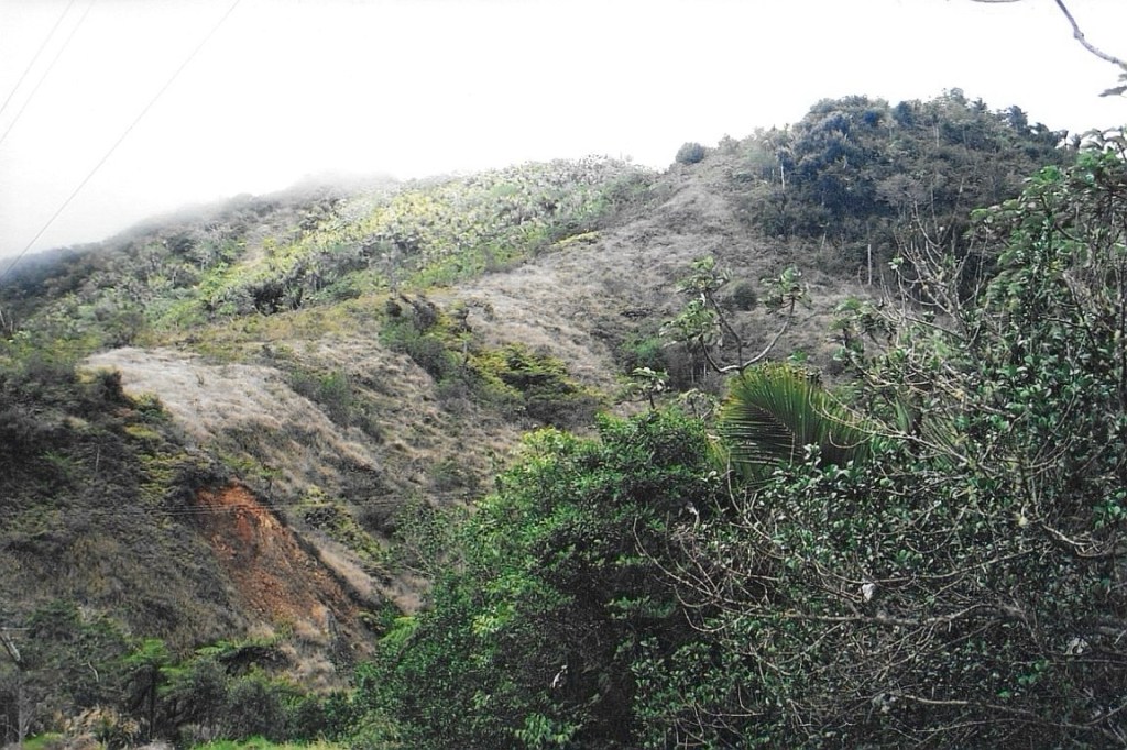
I set off from my hotel just after 7 AM. Rush hour traffic was pretty congested around San Juan but once I got outside if the city, things opened up nicely and I made my way onto Highway 52 and headed south and west across the island. I was happy to see lots of sun as I moved away from San Juan toward Ponce and had high hopes for the day. Just before reaching the fairly large city of Ponce, I headed north on Route 10 into the heart of the mountains. The lushness of the area was impressive – as I hoped it would be – and many roadside vendors were selling a variety of food and goods. Soon I reached Ruta Panoramica (Route 143), a narrow, winding road that runs along the Cordillera ridge and provides impressive views in many areas (although there are not many places to safely pull off the road). Clouds and wind became more persistent as I inched closer to the area where I would begin my walk.
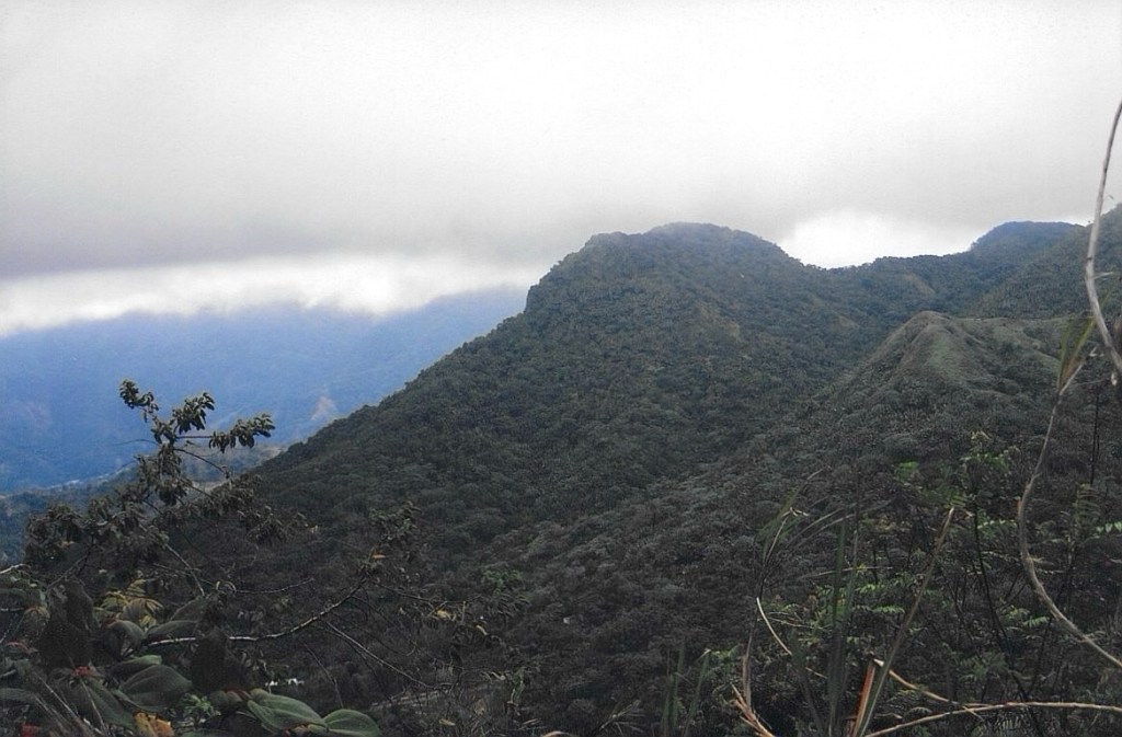

After 10.4 miles along Route 143, I pulled into a large unmistakeable gravel area on the left side of the road. I entertained no delusions about what I was doing – this was essentially a very easy walk-up along a cement one lane road that probably could have been driven. In some respects, it reminded me of Black Mountain, Kentucky except the final push to the summit is far steeper on Cerro de Punta. Though less than a mile from my rental car to the summit, my lungs and legs were awakened from the slumber of the last couple of days as the route climbed steeply. The variety of the rain forest vegetation was a refreshing sight given that it was the end of a long and snowy winter back in New York. The route wound around the upper reaches of “Pointed Peak” (the English translation) and there were many outstanding vistas to be absorbed as I approached the summit. Finally, I passed the US Navy installation and radio towers that clutter the summit area and made my way up the stairs that lead the final bit to the top. The clouds were thick at one moment and passed by the next, offering brief panoramas and views to the sea.

After summiting, I lingered for quite awhile and then spent some time looking without success for a path that is supposed to lead from the summit to the base of the north side of the mountain in the area of Hacienda Gripinas. It was to no avail as the only hint of a route that lead in the proper direction was marked “Privado,” “Keep Out,” and “Do Not Enter.” Pretty clear if you ask me and I had no interest in testing my luck with the Puerto Rican authorities or some unfriendly locals.

After getting back to my car, I decided to head west on Route 143 and check out some other peaks that similarly boasted antenna farms. The rains soon came, however, and within a half an hour, I found myself in a steady rain that would last the rest of the day. So I left El Yunque for another day (perhaps) and headed back to San Juan. An outstanding trip despite the rain and a fun “extra credit” highpoint to add to my tally.