No sooner had I completed my decades long project of climbing the Northeast 2,000 foot prominence peaks than did I start thinking about getting after the New England Fifty Finest.
If one considers the Northeast P2Ks to be somehow analogous to the Northeast 4,000 foot peaks, then it stands to reason that the New England Fifty Finest are therefore the prominence-based answer to the elevation driven New England Hundred Highest. The cool part of this comparison is that the two Northeast lists mentioned have a cut off based on a hard number (4,000 or 2,000) whereas the two New England lists instead have a predefined number of peaks on each list (100 or 50). Remember that the definition of “Northeast” includes New York whereas the definition of “New England” excludes the Empire State.
And if you followed that whole line of thought, well, congratulations, you’re as much of a peakbagging-obsessed geek as am I.

So the next thing that one needs to know is that the top 42 most prominent New England peaks also appear on the Northeast P2K list. Meaning that if you have completed the Northeast 2000 foot prominence peaks, then you’re looking at a list of just eight additional mountains. If you’ve also summited Vermont’s Camel’s Hump (#46 on the NEFF list as well as both a Northeast 4K peak and a New England Hundred Highest peak), then the list drops to seven.
Specifically, I was looking at Gore Mountain (Vermont), Mount Cardigan (New Hampshire), Big Spencer Mountain (Maine), Belknap Mountain (New Hampshire), Saddleback Mountain (Maine), Mount Blue (Maine) and Moxie Mountain (Maine). I additionally wanted to complete Caribou Mountain in Maine for reasons to be explained later, bringing my target back to eight peaks.

Some of these peaks are very popular while some others are utterly obscure and seldom visited. As it would turn out, it would take me another two years to finish – or 30 months if you include a second ascent of Big Spencer. More on that later as well.
After completing the Northeast P2K list on November 14, 2021 on Maine’s Boundary Bald, I wasted little time in transitioning to the New England Fifty Finest. The two remaining New Hampshire peaks – Mount Cardigan and Belknap Mountain – would be my first targets.
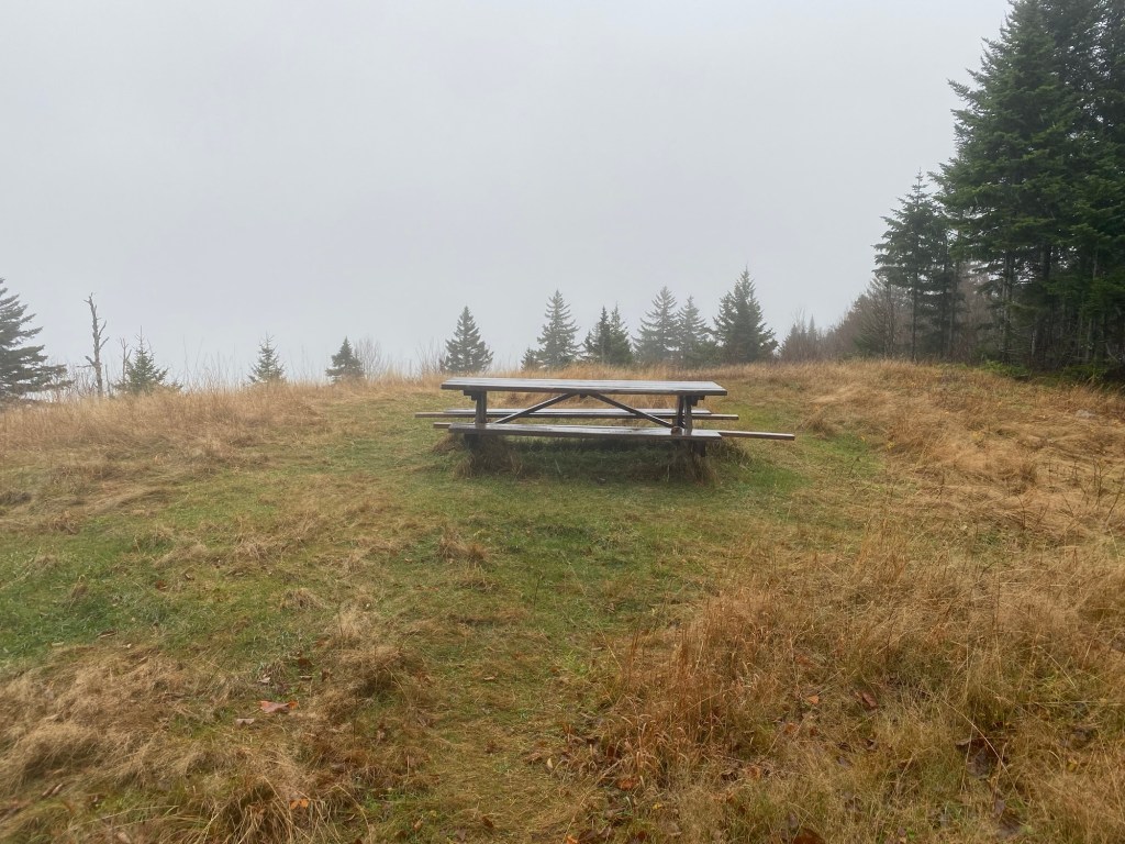
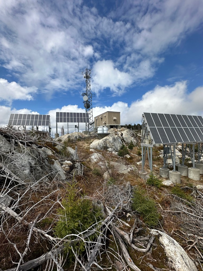
On December 12, 2021, I made the very reasonable 3 hour and 15 minute drive to the Mount Cardigan trailhead near Orange, NH. Just a 3.1 mile loop featuring about 1,200 feet in elevation gain, I made quick work of this mountain. My first photo at the trailhead shows a timestamp of 9:26 AM while my summit selfie was taken at 10:48 AM. Though a very popular hike in the summertime, very few folks were out on this brisk December morning as I ticked off my 44th NEFF peak. Windy and cold conditions on the summit made it that much more fun. I was back at the picnic area at the trailhead enjoying my lunch by noon.

On to Belknap Mountain! Even a shorter turn around time on this one as I found myself on the road once again just two days after Christmas 2021. This hike would be a 4.7 mile out and back with nearly 1,500 feet in elevation gain. And this time I would have the snow-covered mountain all to myself. After completing the four hour drive to near Gilford, NH, I was on the trail right around 9:15 AM. Not a particularly easy hike on this day as I broke trail in about six inch deep snow for much of the way. In the upper reaches of the mountain, some navigational care had to be taken as the snow-covered route became uncertain in a few spots after breaking out of the trees for a portion of the hike. I emerged at the summit featuring a fire tower once again just before 11 AM. 45 down.


With most of my remaining peaks in way up yonder Maine, that would end my season of hiking for now as I shifted my focus to skiing for the rest of the winter.
2022 hit hard. After seeing COVID restrictions open up a bit, I was able to take my family on our first real vacation since 2019 and we embarked on a cruise in April of 2022. But shortly thereafter, the health of my aging parents became my biggest concern as thoughts of hiking on a regular basis began to melt into the background …although I did manage to squeeze in some outdoors fun just to maintain some level of sanity.
As it turned out, I did not return to my New England Fifty Finest project until September 11th, 2022 when I traveled to far northeastern Vermont just south of the Canadian border for a hike of Gore Mountain. This 7.8 mile hike with over 2,000 feet in elevation gain hit all the right spots for me on this day. The trail was in excellent condition but I would encounter only two other people all day on a near-perfect late summer day. Factoring in a 4.5 hour drive each way, this adventure proved to be an all day affair as I secured my 46th NEFF peak.

My Dad – now living with us – was somewhat amused that the hike of Gore was near Norton, Vermont as he had spent the bulk of his professional career at Norton Company in Watervliet, New York. No relation whatsoever between the two Nortons but an interesting curiosity nonetheless.
As it turned out, this would be my last hike before my Dad passed away with COVID on October 8th. While not the primary cause of his demise, COVID proved to be the knockout blow. It was more than his ailing body could handle. My biggest fan across multiple decades of hiking was gone. I knew it would never be – could never be – the same again. This would be my final list, I told myself.

I sought out the woods for peace and solace multiple times in the weeks that followed and soon found myself on the road to the mountainous interior of Maine for what I hoped would be my 47th, 48th and 49th New England Fifty Finest summits.
It was Veteran’s Day of 2022 (11/11/22) as I rousted myself from bed in the wee hours of the morning and pointed my car towards the north woods of Maine for what I hoped a much needed weekend of fun and adventure. Temperatures were unusually warm and hovered in the low 70s in advance of a late season tropical system. Having seen snow and ice during my Maine November getaway just one year earlier, this time I knew I would be enjoying at least one day of warmth and humid air.
I arrived at a remote and deserted trailhead near Bingham, Maine after 10 miles of dirt road driving. It was exactly 11 AM as I began my hike of Moxie Mountain, which comes in at #50 on the New England Fifty Finest list with 1,827 feet of prominence.

The route to Moxie was easy to follow and I took advantage of the opportunity to make the most of the day. My chosen approach to Moxie came in at just a 3.2 mile round trip and I was in no hurry. I took time to fully enjoy the scenery and warm weather after the long drive from New York. An unexpected gem!
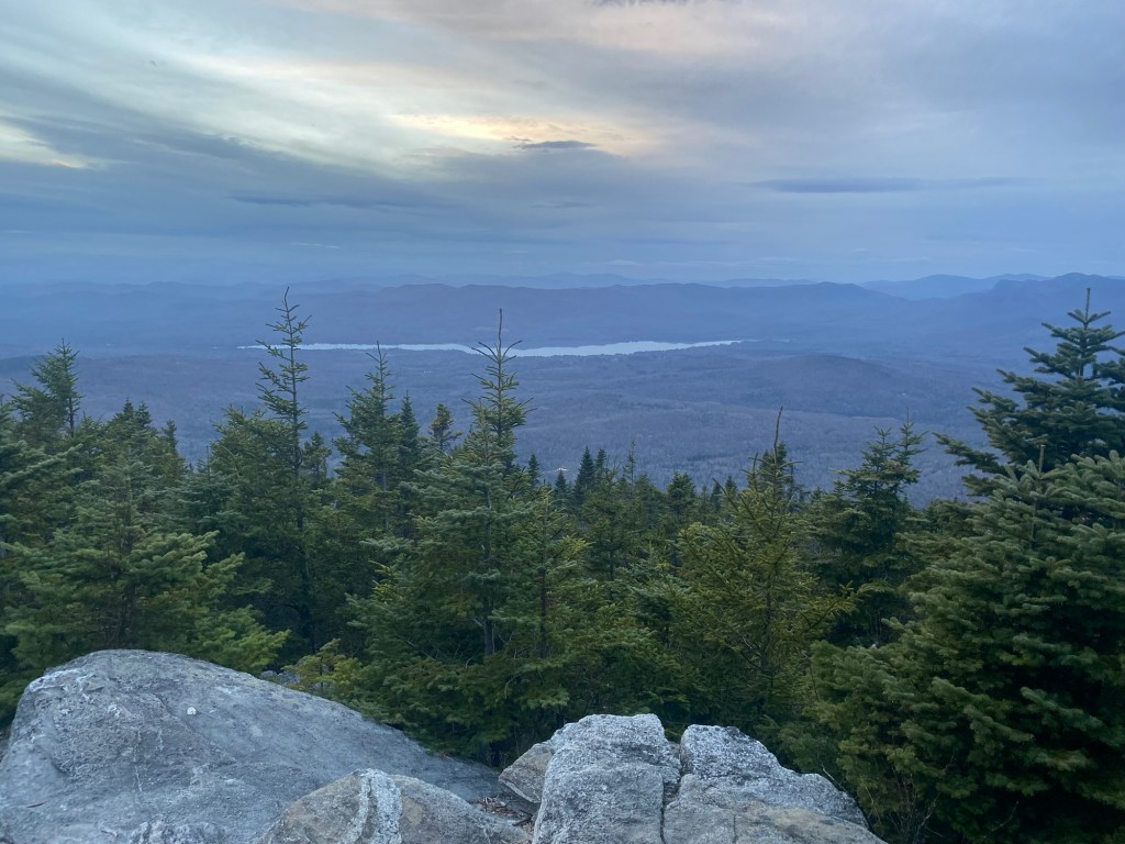
At first, the trail followed an old logging road before veering off to the right and climbing steeply and aggressively. It continued to gain nearly 1,500 feet in elevation as I closed in of the 2,933 foot summit of Moxie. The terrain was very rocky and provided some magnificent vistas over the Heald Pond area from which I had approached.


Even at my relaxed pace, I had completed the Moxie hike in less than two hours and decided I had a chance to at least take a stab at Mount Blue as a late afternoon hike in an attempt to beat the tropical system. With 1,856 feet of prominence, Mount Blue is also a short but steep hike via its normal route, gaining nearly 1,800 feet during the 1.6 mile one-way trip to the top.
Ultimately, I was shocked to be able to find enough time to hike both Moxie and Blue that first day after the long drive from New York, considering that there is also a two hour drive between the two peaks. But I pushed it to the brink of my comfort zone, knowing the remnants of Hurricane Nicole were on my doorstep. As it turned out, I finished the last mile of the Mount Blue hike in complete darkness and then set up my sleeping bag in the back of my Toyota Highlander where I spent the night resting comfortably in the parking lot as the rain and wind moved in.

It was a lazy start the next day as the storm continued. I stopped in Greenville Maine and enjoyed a hearty late-morning breakfast before continuing along the remainder of the drive to the Big Spencer trailhead. A powerful cold front moved in on the backside of the storm and I bundled up for what I knew would be a wet and cold hike.
As it turned out, Big Spencer was a “near miss.” After returning home and comparing notes with some other online reports of ascents of Big Spencer, it became clear that I had not quite achieved the true summit of the 3,205-foot peak.
While I reached my objective on that day in the immediate aftermath of Hurricane Nicole, it would turn out that the true summit of Big Spencer lies about 1/4 of a mile beyond the commonly accepted stopping point where a whole bunch of summit junk tries to stake claim to man’s alleged dominance over nature.
So long story short, I was going to have to go back.
Dang!

With 48.9 New England Fifty Finest Peaks now to my credit, I focused my hiking elsewhere during most of 2023, focusing on revisits of southern Appalachian US state highpoints. In fact, it would be a full year before I would return to the interior of Maine to attempt to complete the New England Fifty Finest project. I started to only half-jokingly make reference to “my annual November Maine hiking trip.”
In the year that had lapsed since I’d last visited the Longfellow Mountains, both my brother and mother had joined my father in the great beyond. Also, I had changed jobs during a year that redefined large parts of my life. Fortunately, my own house was still in order and my wife and kids wished me luck as I headed east and north once again.

Besides the tiny section of Big Spencer that I still needed to complete, the final NEFF peak on my list was Saddleback, a truly trail-less mountain requiring a fair amount of bushwhacking. Not to be confused with the more popular 4,122-foot ski mountain near Rangeley, Maine (also a New England Fifty Finest peak), this particular Saddleback rises to just 2,995 feet and is located near Brownville, Maine. Despite the lowish elevation, it boasts 1,836 feet in topographical prominence due to its isolation from higher mountain summits.
Additionally, I decided I wanted to hike Caribou Mountain on the Maine/Quebec border in the Stratton area of Maine. For many years, peakbaggers such as myself were unsure whether Kibby or Caribou (located very near to one another) has a higher mountain summit and is therefore the more prominent of the two. Being pragmatic types, most would ultimately hike both just to be sure. Although it has now been fairly definitively determined that Kibby is higher, I wanted to also ascend Caribou as a “shared experience” kind of thing.

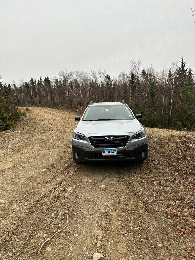
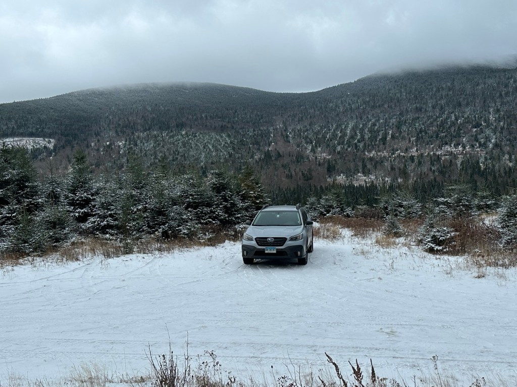
So another three-peak trip to northern Maine began with that now all so familiar drive up I-95 on November 8th, 2023. Not wanting to put big miles or rough logging road miles on my new Toyota Highlander, I instead rented a Subaru Outback with Connecticut plates from the local Enterprise dealership. It would turn out to be just the right vehicle for the job.
I arrived at Lovely’s Motel just off of I-95 in Newport Maine well after dark and settled in for a restful night. I was on the road the next morning before sunrise with a goal of getting in my hike of Saddleback done as early as possible before continuing on to the Spillover Motel in Stratton Maine.
The weather was cloudy and cool as I directed my car first onto Katahdin Iron Works Road and then some very questionable logging roads. I finally called it good after passing through an area of fresh “slash” in an active logging area. The gentleman who had written the trip report I was following had made it a couple of miles further but I felt I had pushed it far enough and pulled to the side of the road when I eyed a spot just large enough for one car to park.
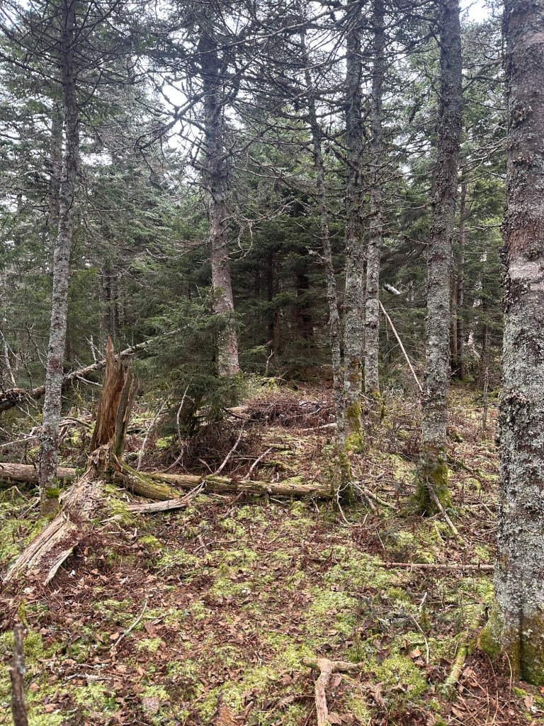
In hiking and mountain climbing in general, there are substantial differences between following a trail and following a route. To be clear, I was following a route on this day and paid close attention to all the vague landmarks as well as the surrounding terrain. There was a logging road T-Junction with wide open ridge views, a two track logging road and finally the remnants of an uphill logging road that eventually ended in a wall of pine trees. With my large pack, the bushwhack was difficult for a while as I was forced to throw all of my weight into the branches and then pull the backpack through behind me. Eventually, the woods started to open up a bit and I was then able to follow a sporadic animal path up through the contours. Some mountains are frequently climbed, others are only climbed by crazies like me trying to finish a list that hardly anyone outside of hardcore hiking communities has ever heard of. I was wearing blaze orange as it was hunting season in Maine, but not even hunters sought out places this deep in the woods. Just too difficult to get a prospective kill back to your vehicle.

After a couple hours of hard work, I spied the summit canister just after 9:40 AM and signed through with this being my 50th New England Fifty Finest peak. I was taking credit for my initial hike Big Spencer even though I still planned to finish that last 1/4 of a mile bushwhack … which again is only completed by crazies like me.

On to Caribou Mountain, elevation 3,650 feet.
I had booked a room at the Spillover Motel just outside of Stratton Maine for two nights. The idea was to be able to spend as much time as I needed ascending Caribou – for which I had what I felt were good route instructions – and then be able to enjoy a solid amount of PM down-time followed by a good night’s sleep before starting a two hour drive to the Big Spencer trailhead the next day.
The first night brought with it a few inches of snow so the next morning’s drive proved challenging once I reached the 13 mile long portion along the rough and hilly Beaudry/Gold Brook Road. This would be followed by another three miles on West Branch Road. Fortunately, it was hunting season so I encountered some other traffic giving me perhaps a false sense of security as I tried to keep the rental Outback from sliding into a ditch. I parked at a Y-intersection and then began a 2.5 to three mile walk along an old woods road turned protected wilderness area. I reached a confusing dead end, where I then attempted to locate the start of what I hoped would be the remnants of an uphill path to the summit.

I chose wrong, taking the bait of a new cut that at first seemed to be heading in the right direction but instead took me to the Maine/ Quebec border swath. I searched along both sides of the border for a solid hour before accepting the fact that I was not in the correct location.

After re-reaching the dead end area where I had chosen poorly some 90-120 minutes earlier, I decided I still had enough time to try to figure it out. I walked just a little further to the very end of the road to a wall of pine and then scanned and searched for anything resembling an old path. Finally a nibble. Could this be it? I was unsure but there was definitely a feint path distinct from the surrounding dense woods … so I continued with the reassurance that I’d be able to follow my own tracks out. The path eventually became true, at first leading slightly uphill and then a bit steeper as it now became obvious that I was onto something. The snow got deeper and thick branches spread across the track but the tiny break in the woods could still be seen by looking at the ground. I pushed through with snow and pine needles now finding their way down my clothes and onto my backpack. And then the uphill stopped. My altimeter watch was telling me I was at about the correct summit elevation. But where was the canister? I investigated a knoll off to the right and squeezed between several trees to no avail. At last ready to give up on this particular rise, I turned back around only to see the summit canister staring me right in the face. Sweet success!
I signed the small barely used six-year-old log book and happily headed back to Stratton for a victory meal at the White Wolf Inn.


The night turned cold and the wind howled outside my hotel. I lay in bed envisioning what it would be like along the summit ridge of Big Spencer the next day. I had already been to the traditional summit in very unpleasant conditions a year prior and knew the bushwhack to the true summit was going to be hell … even in good weather. It felt wrong. My gear was still wet from sweat and snow and it was simply too cold for this kind of hike. The margin for error was non-existent.
I drove home the next morning, confident in my decision as I watched flags alongside the road whip in a stiff 30 mile per hour wind.
By this point, the pandemic was essentially a thing of the past. Yes, COVID still remained (I’ve had it twice to go along with my six shots) but all of the restrictions associated with it have faded into history and the full impact may never be known. During 2023, I had traveled by air for the first time since 2019 and did so on multiple occasions. It felt good to be back.
But I still had a list to finish. Basically an asterisk to remove as I’d already been to the normal summit of Big Spencer … just not the obscure and unmarked “tippy top.”
During the winter and early spring, I jokingly referred to it as “Big Johnson” and decided that if I was going to go all the way back to Greenville Maine (a seven hour drive) that I might as well hike “Little Johnson” as well. Little Spencer (the actual name) is reportedly a great scramble in its own right and nearly makes the New England Fifty Finest list with 1,779 feet of clean prominence. And so it was decided. Once spring arrived, I watched the snow melt situation in the Greenville area on a daily basis both through Facebook and NOAA and finally scheduled a two night stay at the Kineo View Lodge beginning on May 15th.
My only concern for this trip was the situation on the dirt roads that begin where the pavement ends in Kokadjo, about 19 miles north of Greenville. I made some online inquires about the status of those roads and received some encouraging reports. Nonetheless, I rented a vehicle once again, this time a Toyota Tacoma pickup truck.


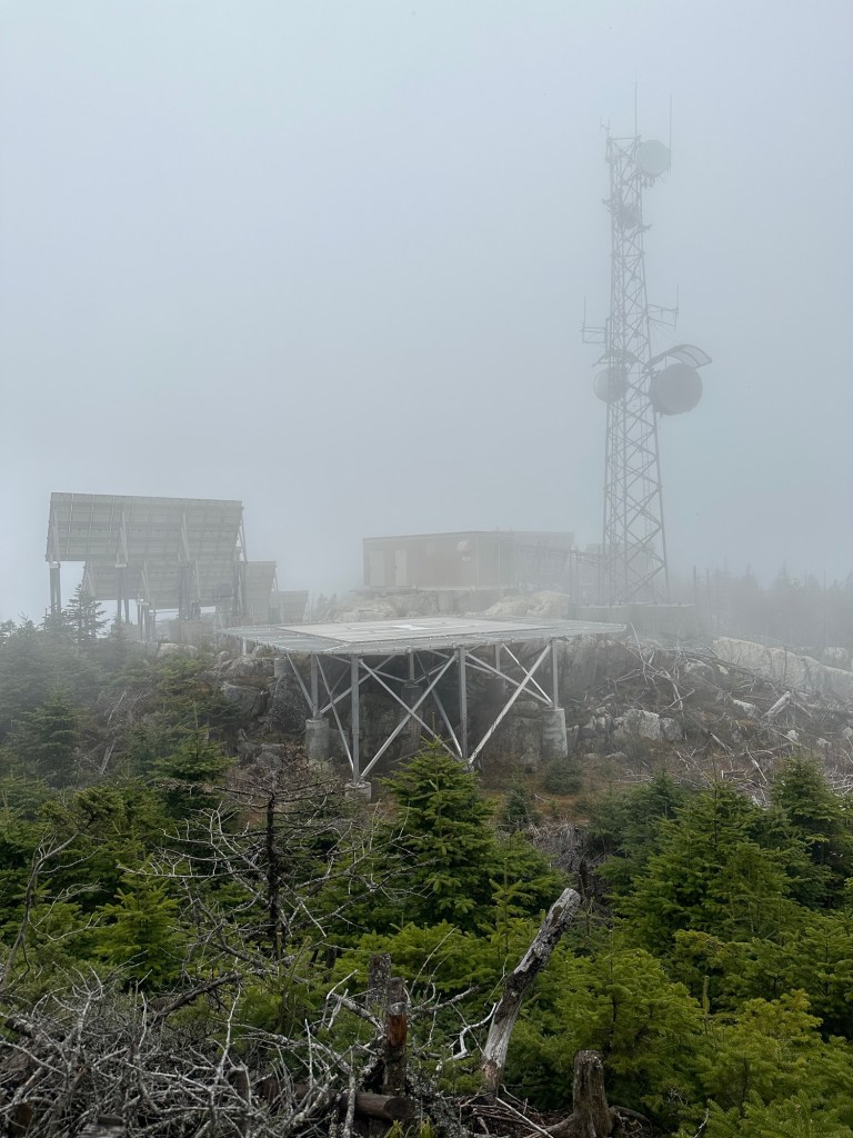
I arrived at the Big Spencer trailhead without incident at 10:30 AM on May 16th with a major list completion now firmly within my grasp. One hour and 40 minutes later, I was once again atop the traditional summit of Big Spencer with summit junk in every direction. Radio towers, the remnants of an old fire tower, a helipad. You name it and it was there. Once again I tagged the USGS marker before beginning the real work … that 1/4 of a mile bushwhack to the tippy top. I crashed into the woods right around 12:30 PM.

The woods were both thick and pathless so the going was slow. I set a compass bearing in a southwesterly direction and repeatedly checked on it to be sure that I was heading the right way. The ridge is narrow with steep drop-offs on both sides so, from that perspective, it was not difficult to keep myself on the correct route.

There were several ups and downs and I made sure to tag the top of each knoll even though I knew the one that counted would be the second to last bump before a substantial drop in elevation. There were some rocky notches and finding a route through the trees and scrambles required care. At one point, I looked down to find that I’d lost the bottom half of one of my hiking poles. No worries, I thought, I’ll just grab it on the way back if I’m able to spot it.

I took a summit selfie on the true summit at 1:25 PM, just under an hour after my bushwhack had begun. I decided to go one bump further just for good measure, knowing that I had now covered the entire summit ridge of Big Spencer.

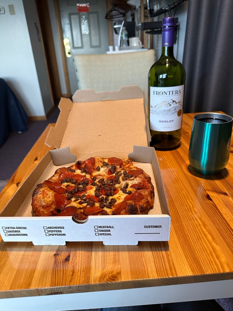
For the trip back, I simply turned around and reversed course, going back over the bump marking the true summit and soon found the bottom half of my broken hiking pole. With the job now done, I lost a bit of focus thinking instead about a celebratory pizza and accompanying bottle of wine. I also stopped consulting with my compass … always a bad move. And, of course, I somehow unwittingly managed to get turned around on the ridge in the dense brush while also trying to find a path through the rocks.
After about 45 minutes, I started looking for the summit junk from the regular summit area and saw nothing. Before much longer I reached an outcrop and recognized the view (in the wrong direction) from the initial bushwhack to the tippy top. Damn.
Paying better attention this time, I locked in on the task at hand and finally reached the towers and helipad at 3 PM, making for a 2.5 hour round trip for that 1/4 of a mile one-way bushwhack. In actuality, I’d probably hiked for close to a mile when one accounts for the accidental turn around. Still slow going no matter how you slice it.

Once off the mountain entirely, I pointed my rental Tacoma back towards Kokadjo and discovered the road I would need to travel to reach the Little Spencer trailhead was blocked off by a locked gate. Still closed for the season. I made a couple of inquiries back in Greenville about renting a mountain bike to no avail. Oh well, no biggie, I thought. I’d done what I truly come to do.
Mission accomplished. New England Fifty Finest = ✅.